

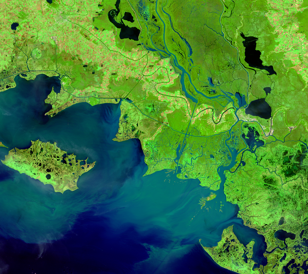
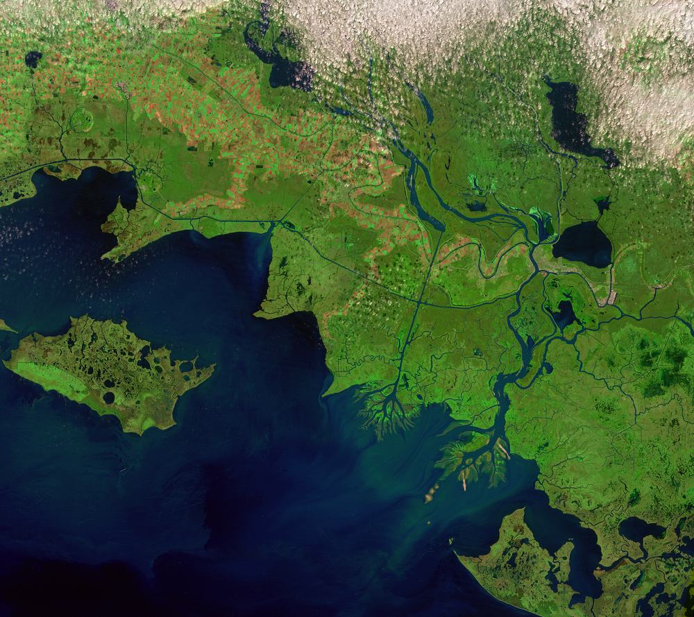
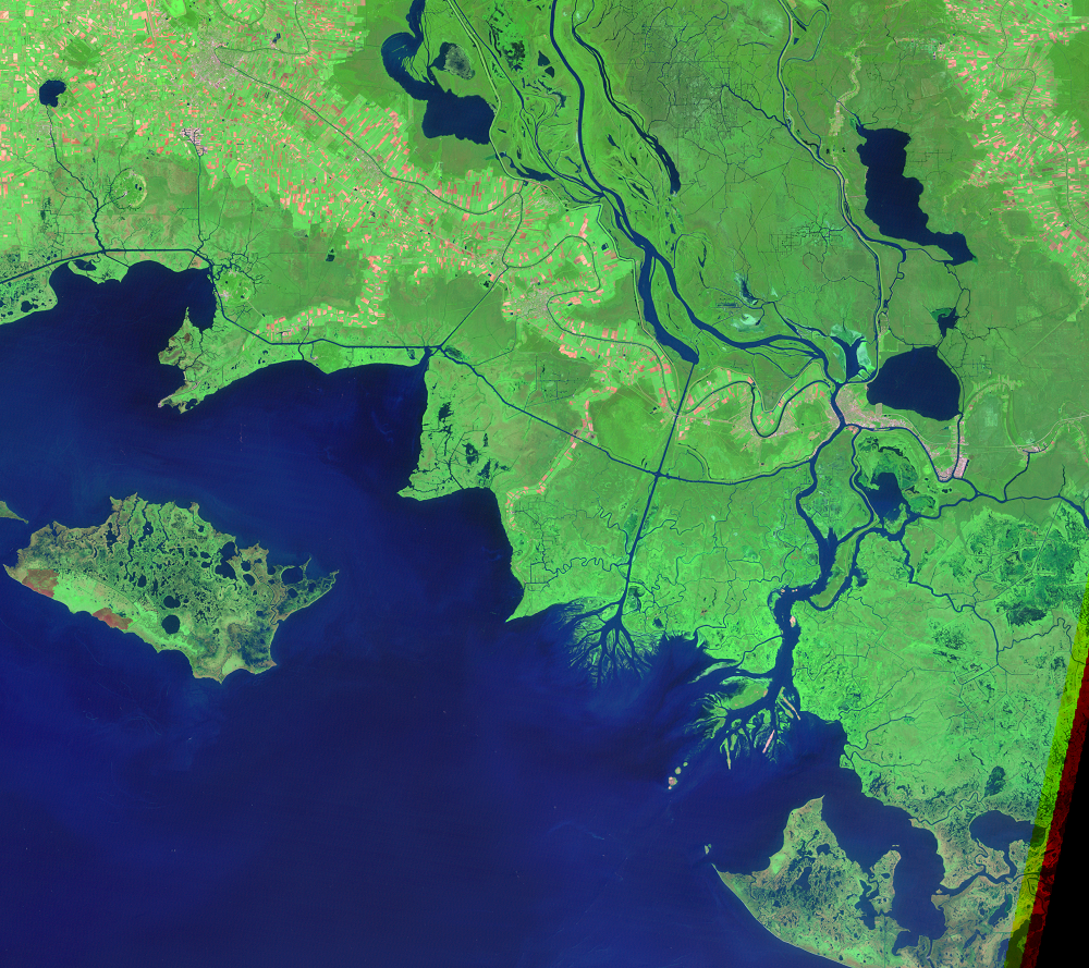
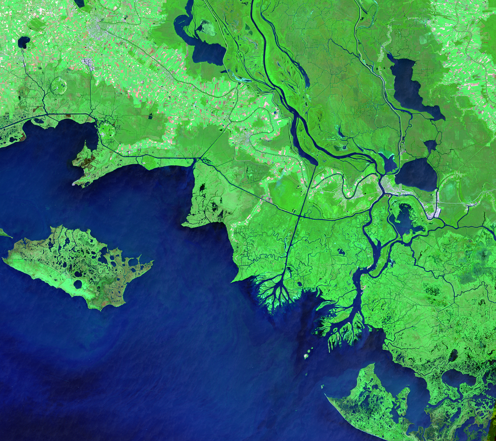
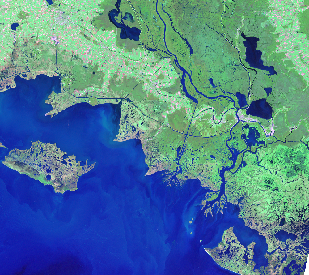
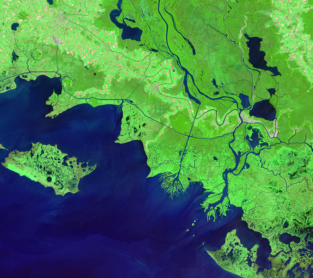
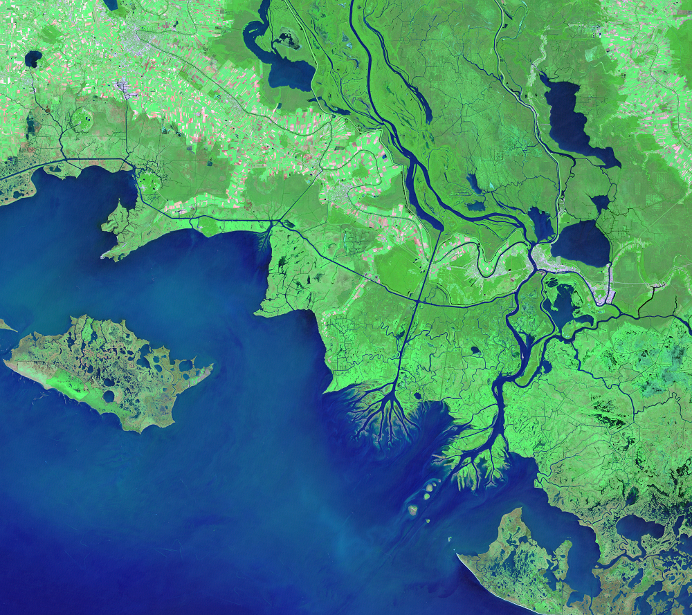
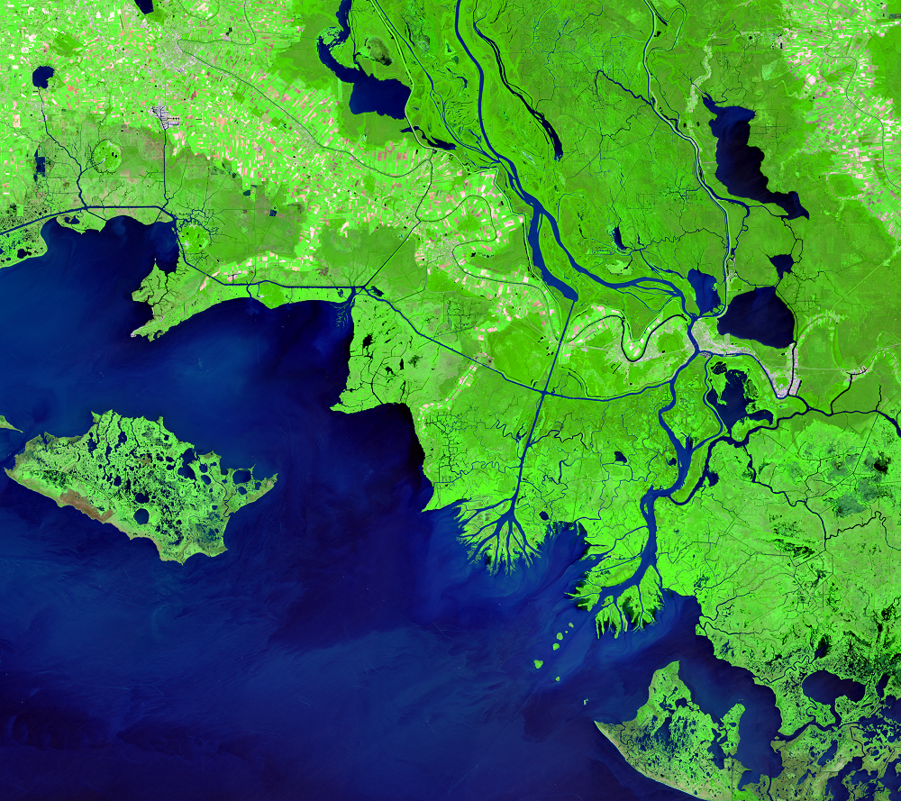
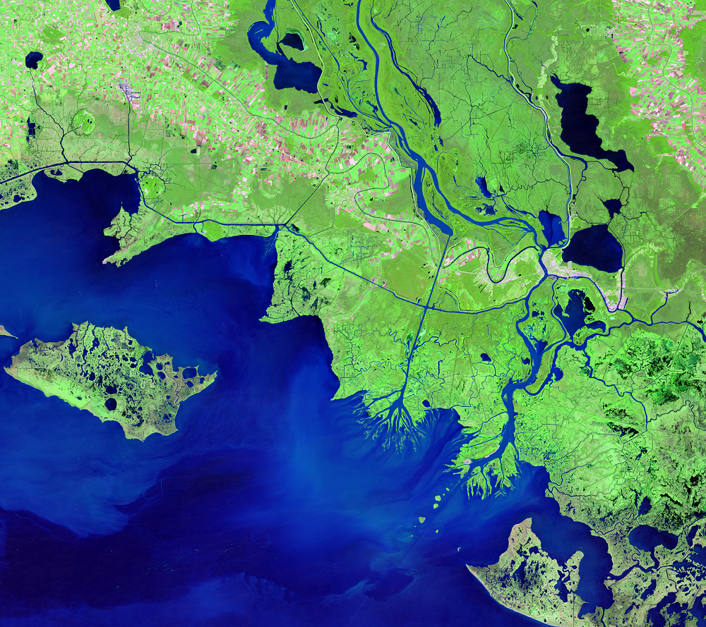
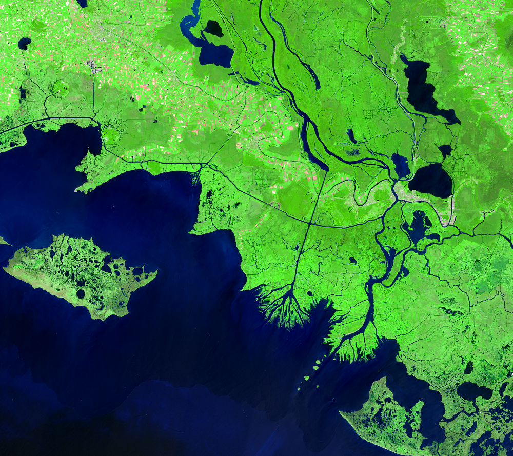
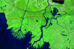
Atchafalaya Delta, Louisiana, USA
Earth Resources Observation and Science (EROS) Center - Earthshots
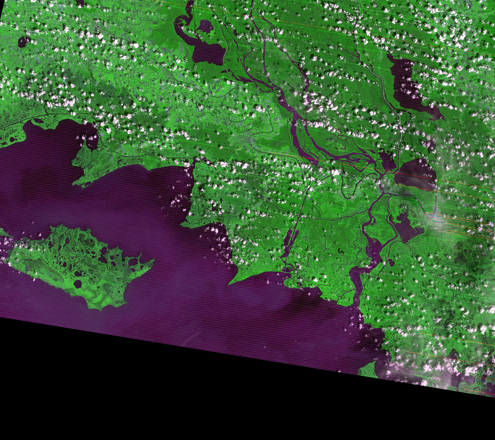
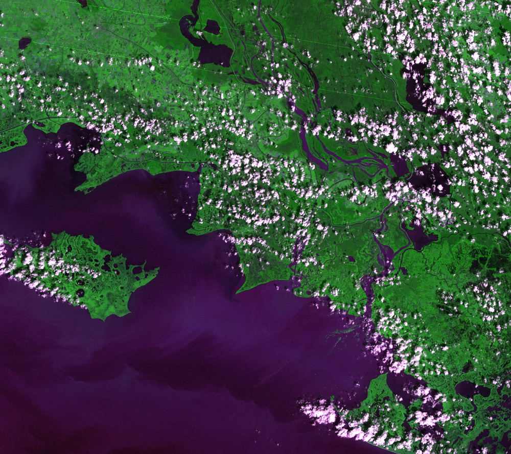
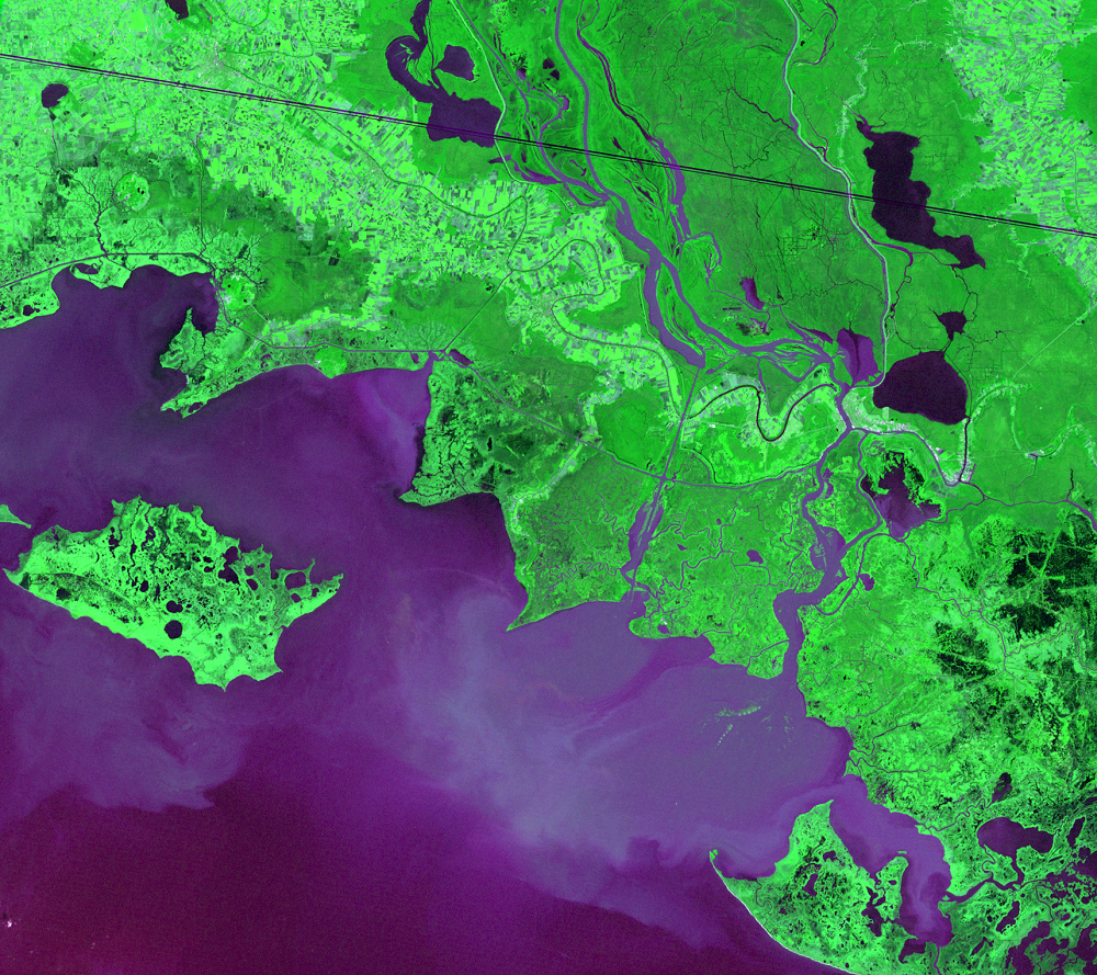
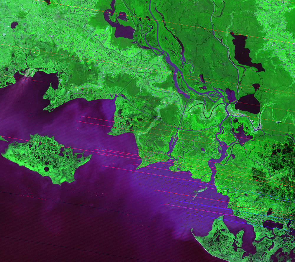
The Mississippi River Delta region in southern Louisiana is losing land to sea level rise, subsidence, and hurricane damage. The mouth of the Atchafalaya River, a distributary of the Mississippi River, is an exception. It has been building two deltas for the past several decades. The Atchafalaya Delta exemplifies the importance of freshwater and sediment to maintaining and even building land in the delta region.
The Atchafalaya River branches away from the Mississippi River where the Red River joins it. The Atchafalaya takes about 30% of the combined flow of both rivers and carries the water and sediment south.
Just east of the Atchafalaya basin, land is rapidly disappearing from the Louisiana coast. Besides subsidence, sea level rise, and hurricanes, a lack of sediment input from the Mississippi River is also causing land loss, making the region more vulnerable to storms.
Besides the risk to wildlife habitats, coastal Louisiana supports more than 30% of the commercial fisheries in the United States, and five of the country’s top 20 ports are located there. Furthermore, in 2017, the USGS reported that a fifth of the country’s oil and gas is transported through the southern Louisiana wetlands.
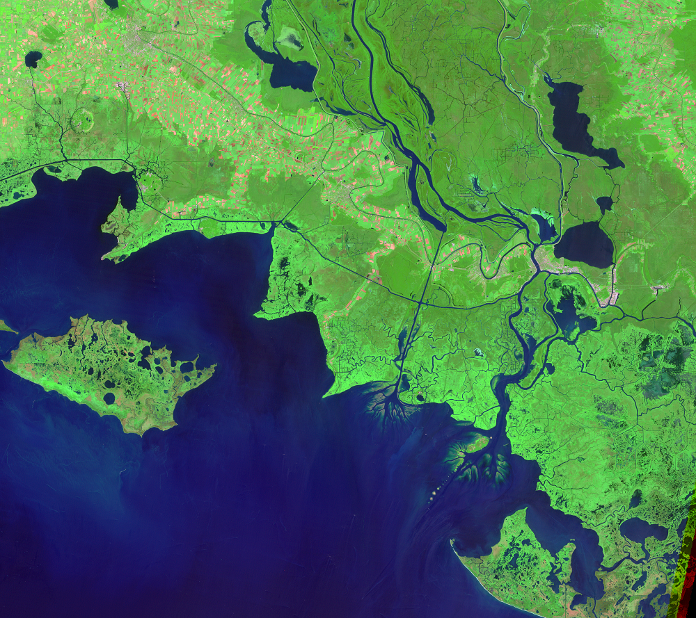
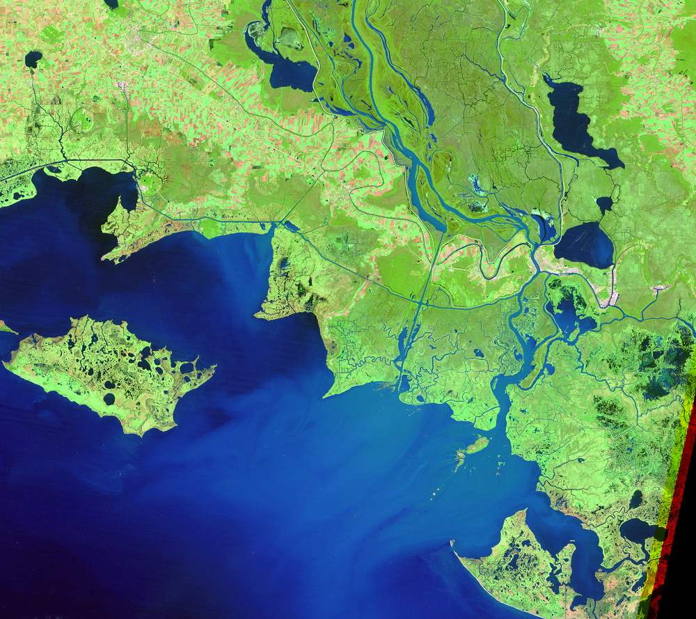
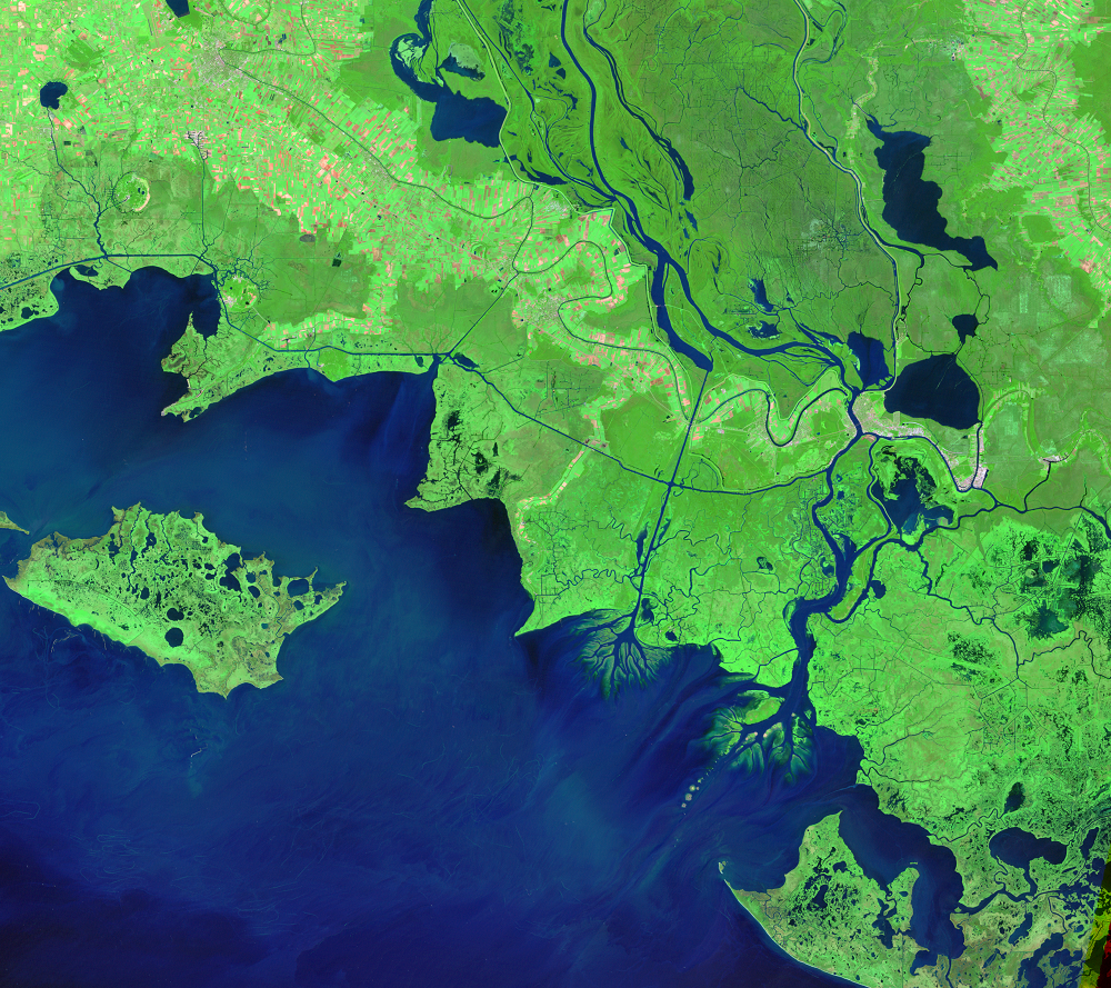
The time series of Landsat imagery shows that the deltas do not progressively extend into the Gulf. They are affected by local conditions like tides and the timing of hurricanes and floods. So while the overall trend is extension and delta building, the deltas seem to temporarily contract at times. In the Landsat images, water is dark blue, and vegetation is green.
Imagery
Downloads
Carlowicz, M., 2011, Lay of the Land Between Old River and the Mississippi: NASA Earth Observatory, accessed April 13, 2023, at https://earthobservatory.nasa.gov/images/50824/lay-of-the-land-between-old-river-and-the-mississippi.
Couvillion, B.R., Beck, H., Schoolmaster, D., and Fischer, M., 2017, Land area change in coastal Louisiana 1932 to 2016: U.S. Geological Survey Scientific Investigations Map 3381, 16 p. pamphlet, https://doi.org/10.3133/sim3381.
CWPPRA, [n.d.], The Atchafalaya Basin: Louisiana Coastal Wetlands Planning Protection and Restoration Act Program web site, accessed April 13, 2023, at https://lacoast.gov/new/about/basin_data/at/default.aspx.
Lewis, J.W., and others, 2022, Technical Assessment of the Old, Mississippi, Atchafalaya, and Red (OMAR) Rivers: Mississippi River Geomorphology and Potamology Program, accessed April 13, 2023, at https://erdc-library.erdc.dren.mil/jspui/bitstream/11681/45080/3/MRG%26P%20Report%20No%2041-Vol%201.pdf.
Louisiana Department of Wildlife and Fisheries, [n.d.], Atchafalaya Delta: Louisiana Wildlife & Fisheries, accessed April 13, 2023, at https://www.wlf.louisiana.gov/page/atchafalaya-delta.
Louisiana Sea Grant, [n.d.], Watch the Delta Grow: Watch the Delta Grow, accessed April 13, 2023, at http://www.watchthedeltagrow.com/home-waxlakedelta.
McLindon Geosciences, 2020, Changing Course—Historical Avulsions and the Old River Control Structure: McLindon Geosciences, accessed April 13, 2023, at https://www.mcgeo.me/blog/changing-course-historical-avulsions-and-the-old-river-control-structure.
NASA, 2017, World of Change—Growing Deltas in Atchafalaya Bay: NASA Earth Observatory, accessed April 13, 2023, https://earthobservatory.nasa.gov/world-of-change/WaxLake.
The Nature Conservancy, 2023, The Atchafalaya River Basin: The Nature Conservancy, accessed April 13, 2023, at https://www.nature.org/en-us/about-us/where-we-work/united-states/louisiana/stories-in-louisiana/the-atchafalaya-river-basin/.
PBS Learning Media, 2023, Delta Formation—Atchafalaya Bay Deltas: Bringing the Universe to America’s Classrooms, accessed April 13, 2023, at https://thinktv.pbslearningmedia.org/resource/buac35-sci-deltas/deltas-atchafalaya-bay-atchafalaya-bay-deltas/.
Piazza, B.P., 2014, The Atchafalaya River Basin—History and Ecology of an American Wetland: Texas A&M University Press, 320 p.
Renfro, M., 2018, A Tale of Two Basins—Why One is Thriving While the Other is Dying: Restore the Mississippi River Delta, accessed April 13, 2023, at https://mississippiriverdelta.org/a-tale-of-two-basins-why-one-is-thriving-while-the-other-is-dying/.
Smith, B., 2020, The Ecogeomorphic Evolution of Louisiana’s Wax Lake Delta: Princeton Hydro, accessed April 13, 2023, at https://princetonhydro.com/wax-lake-delta/.
USACE, [n.d.], Old River Control: US Army Corps of Engineers New Orleans District, accessed April 13, 2023, at https://www.mvn.usace.army.mil/Missions/Recreation/Old-River-Control/.
Related Content
Deltas
The Wax Lake Outlet is a prominent north-south waterway. This artifici...
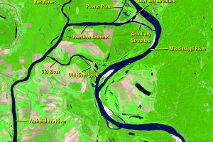
Old River Control Structure
The Mississippi River Delta has naturally meandered and migrated over ...