

Old River Control Structure
Earth Resources Observation and Science (EROS) Center - Earthshots
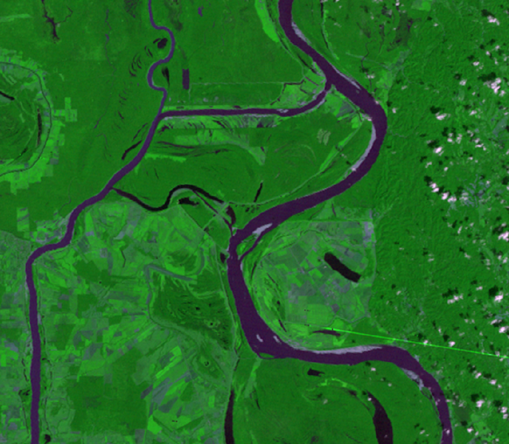
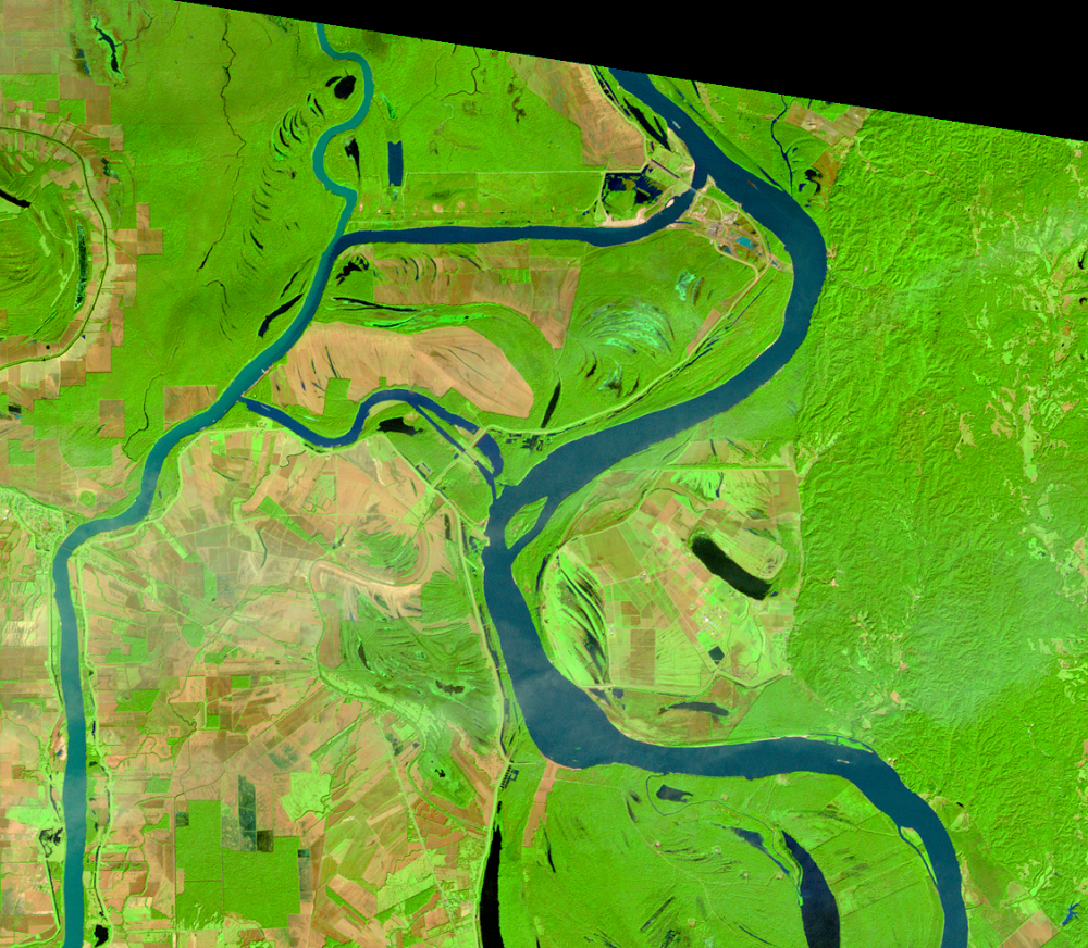
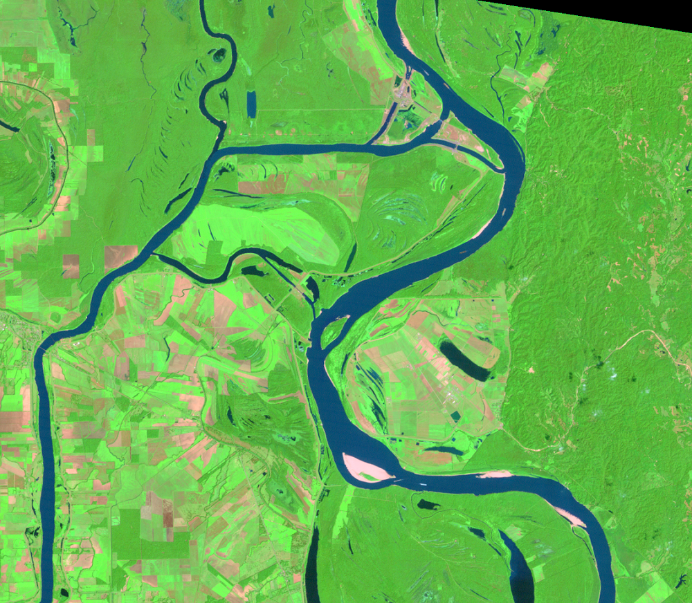
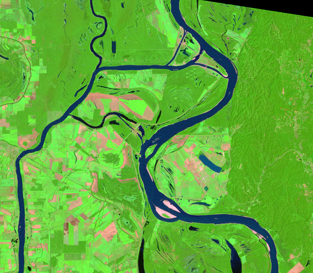
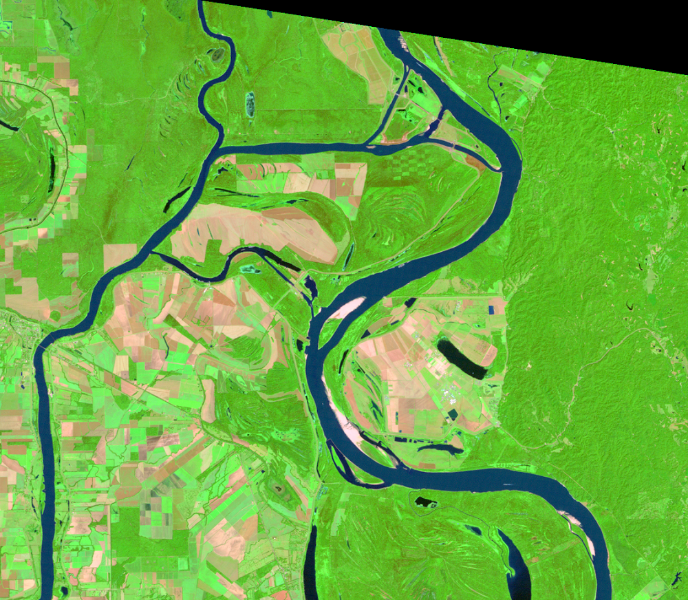
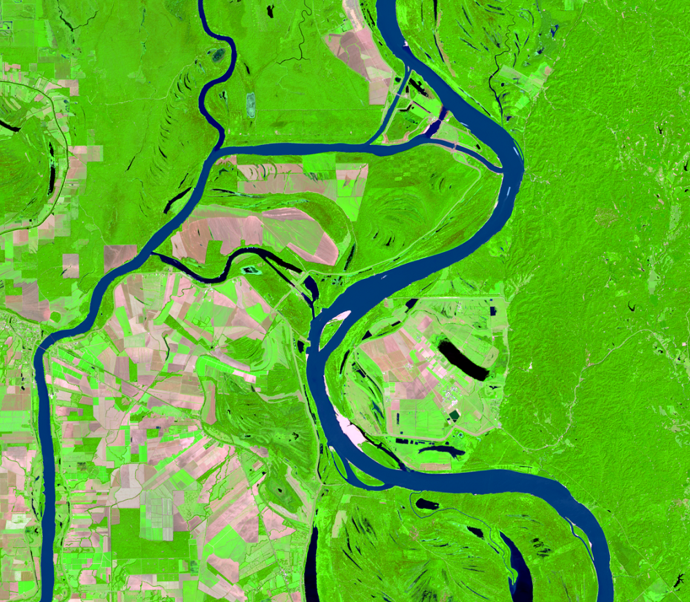
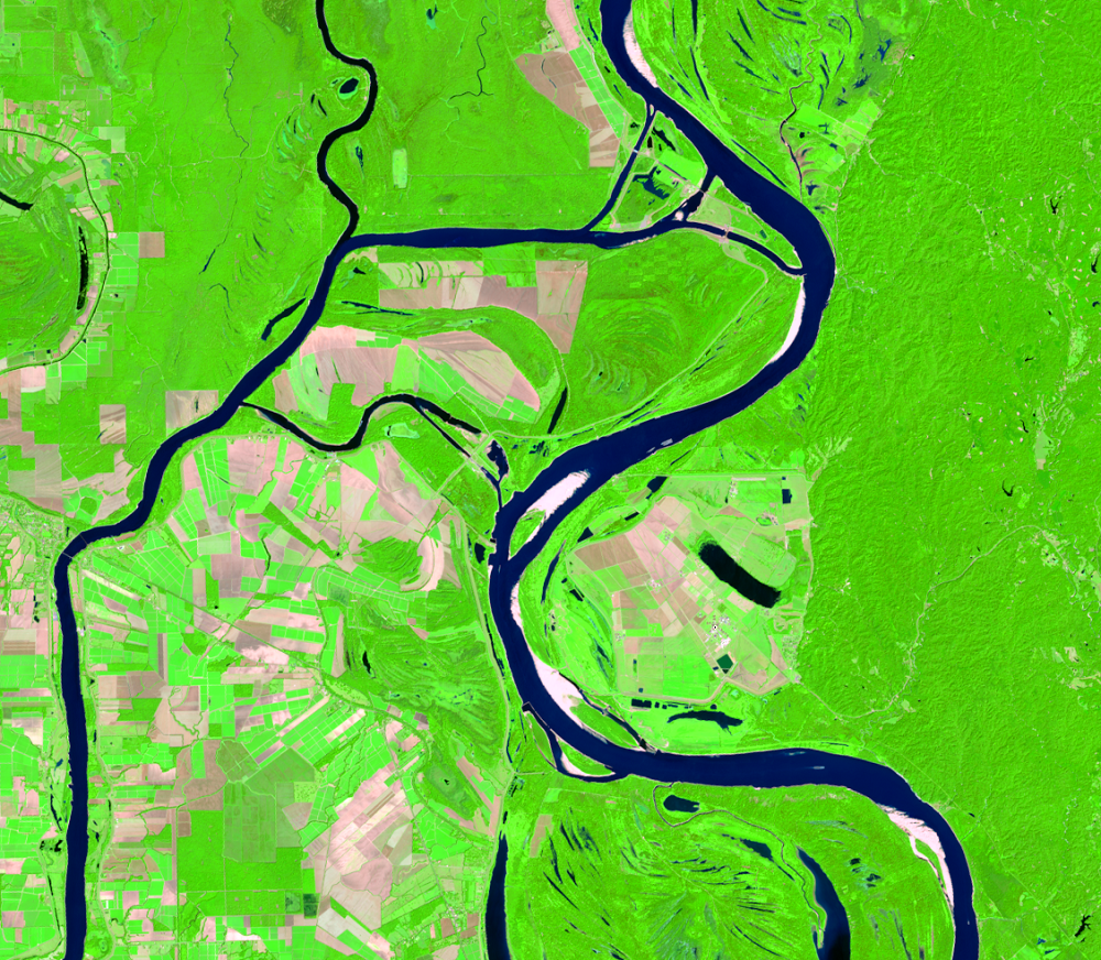
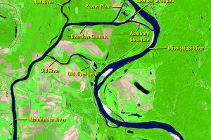
The Mississippi River Delta has naturally meandered and migrated over time, building lobes of low swampland in what is now southern Louisiana. If left to its own, the river might migrate west and join the Atchafalaya to take a direct southerly route to the Gulf. However, a system of levees, flood gates, and canals prevents that from happening.
Built in 1963 to regulate the amount of flow into the Atchafalaya, the Old River Control Structure prevents the Atchafalaya River from capturing the Mississippi. The system keeps 70% of the water in the Mississippi.
The 2022 image labels the parts of the Old River Control Structure and rivers. With more than 50 yeas of data, the Landsat program is a valuable tool in continuing to monitor both the land loss and land gain of the Mississippi River Delta.
Imagery

Downloads
Related Content
Atchafalaya Delta, Louisiana, USA
The Mississippi River Delta region in southern Louisiana is losing lan...
Deltas
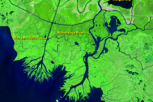
The Wax Lake Outlet is a prominent north-south waterway. This artifici...
Old River Control Structure
The Mississippi River Delta has naturally meandered and migrated over ...