

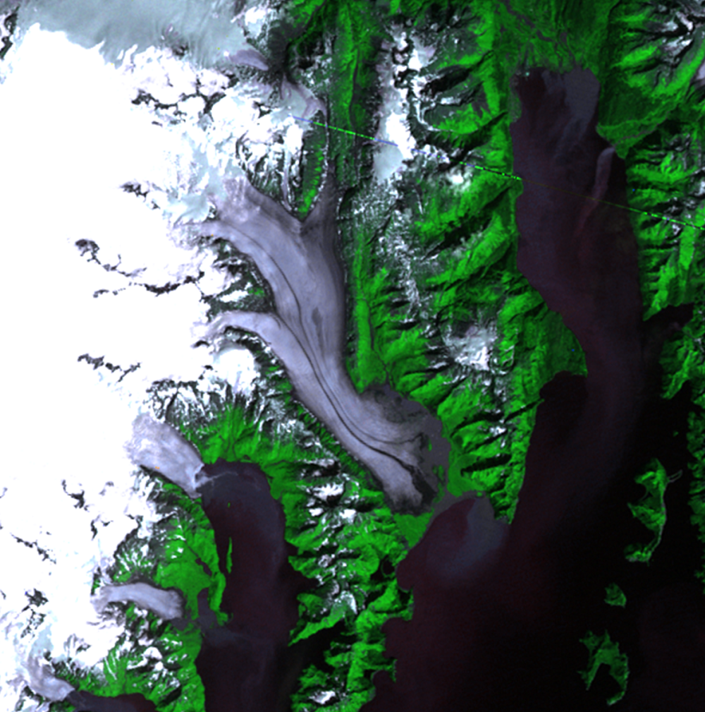
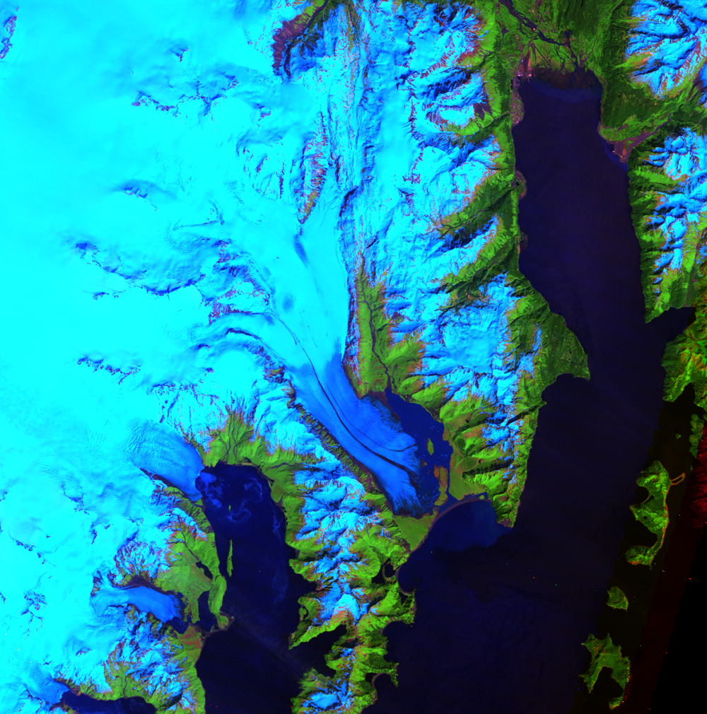
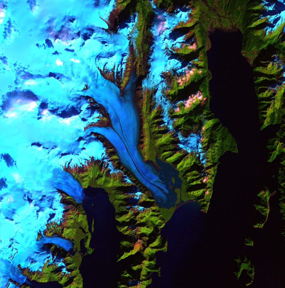
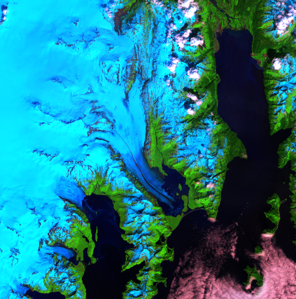
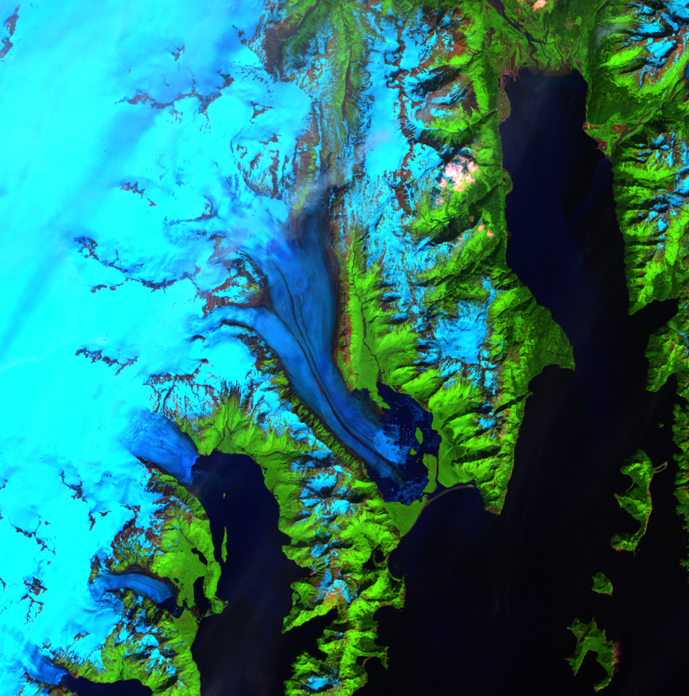
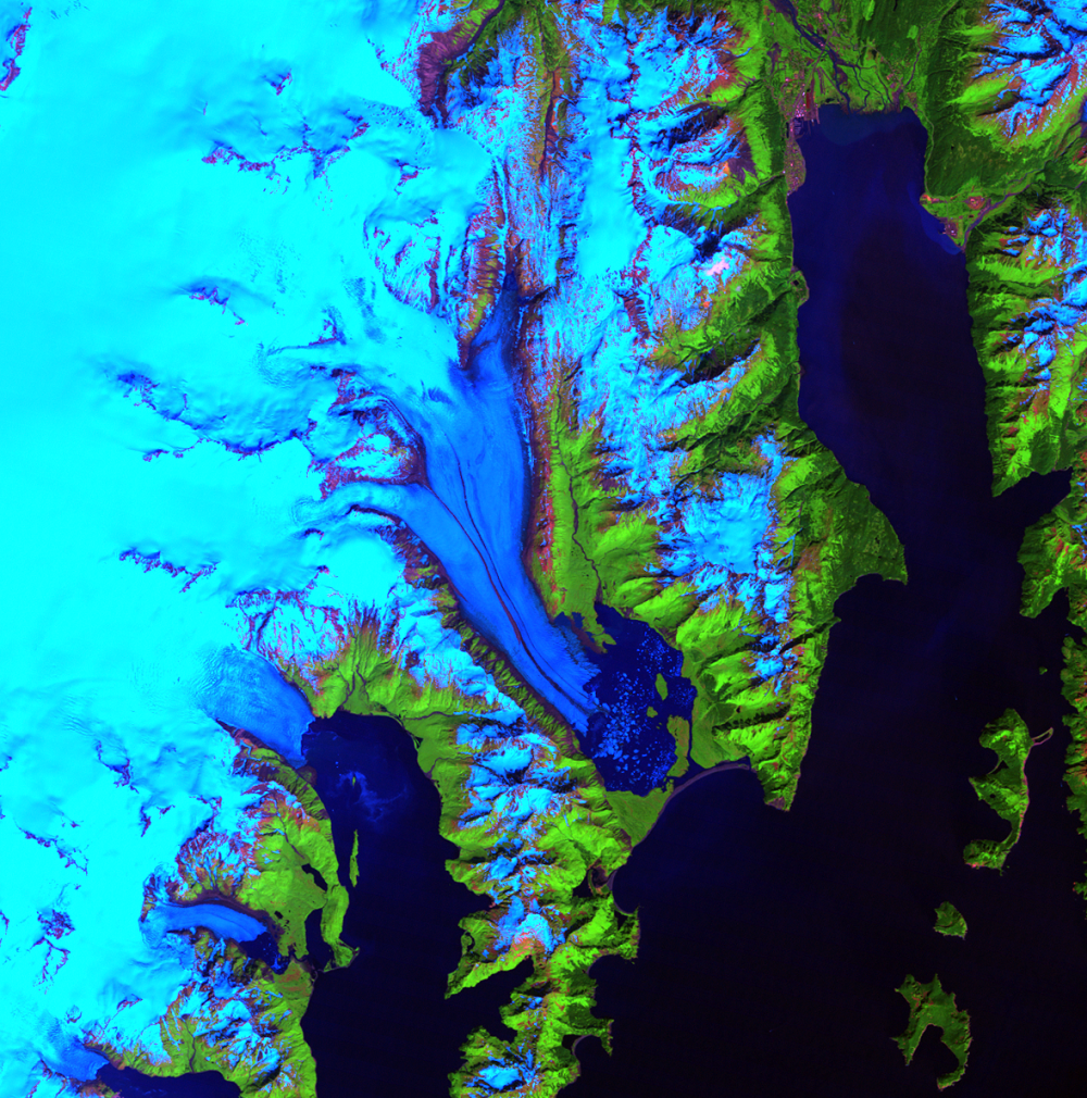
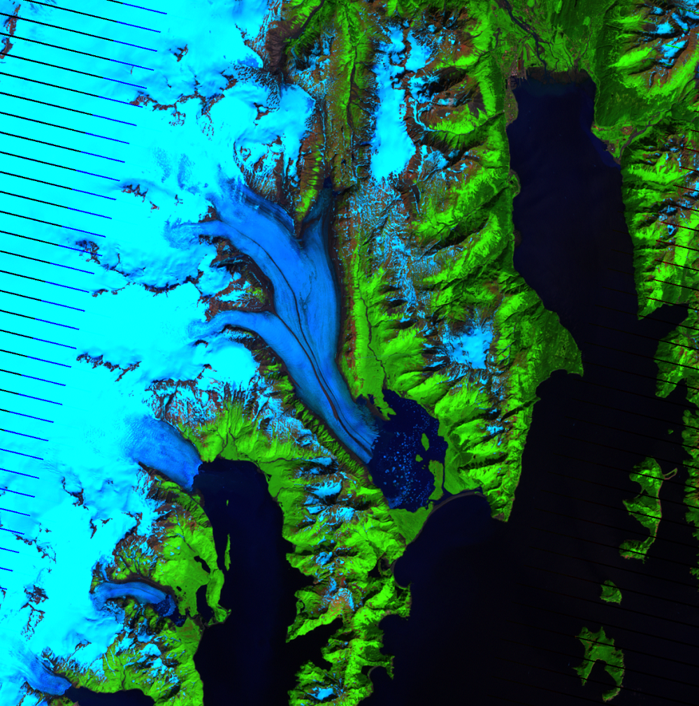
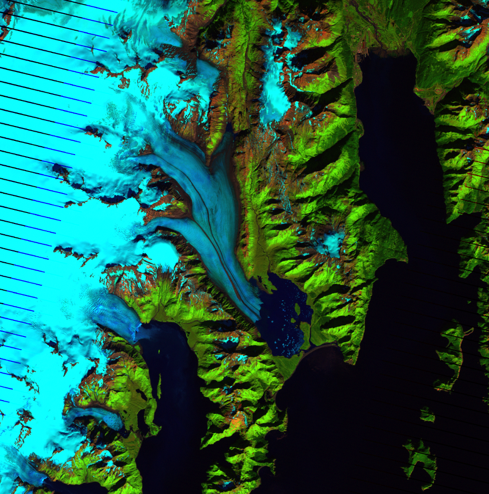
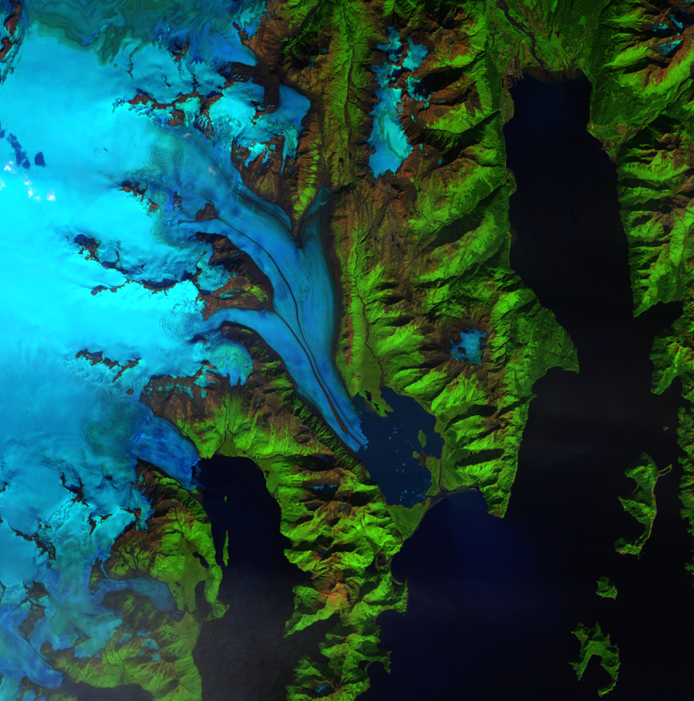
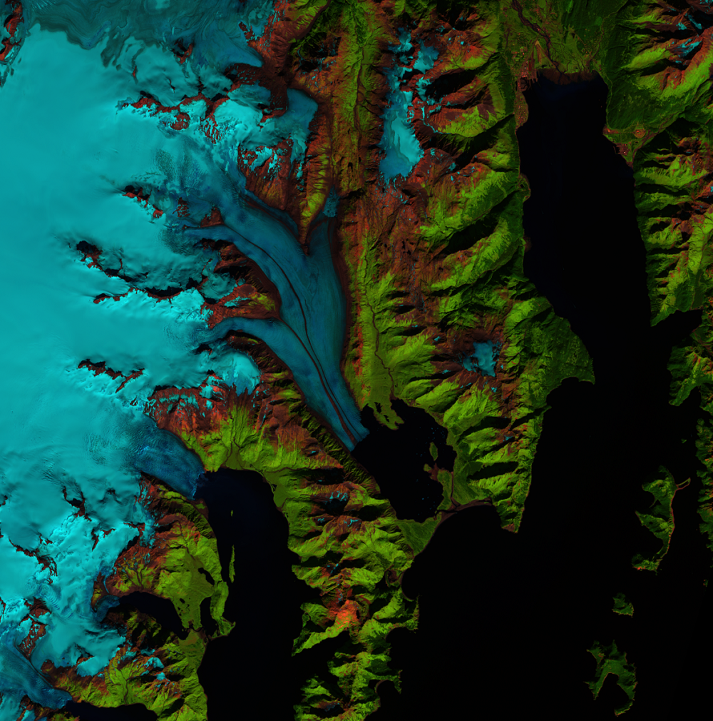
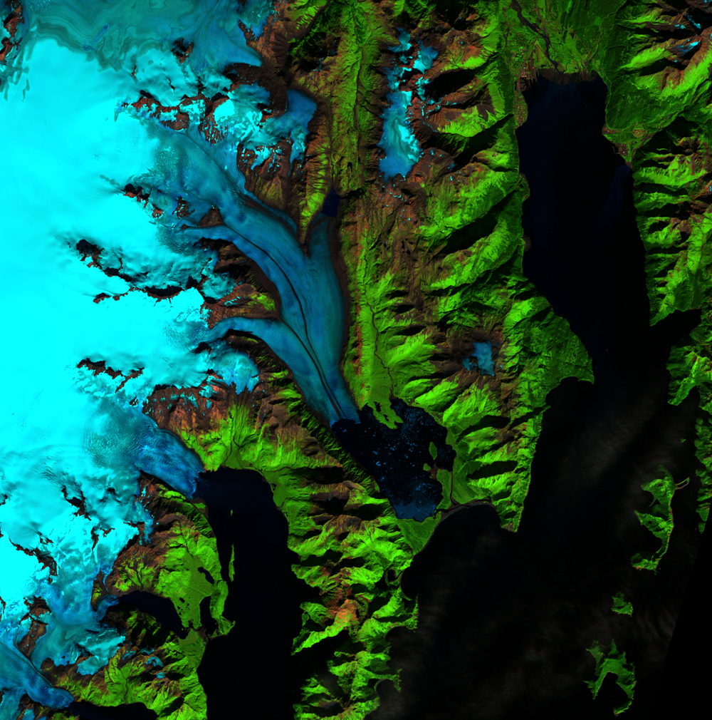
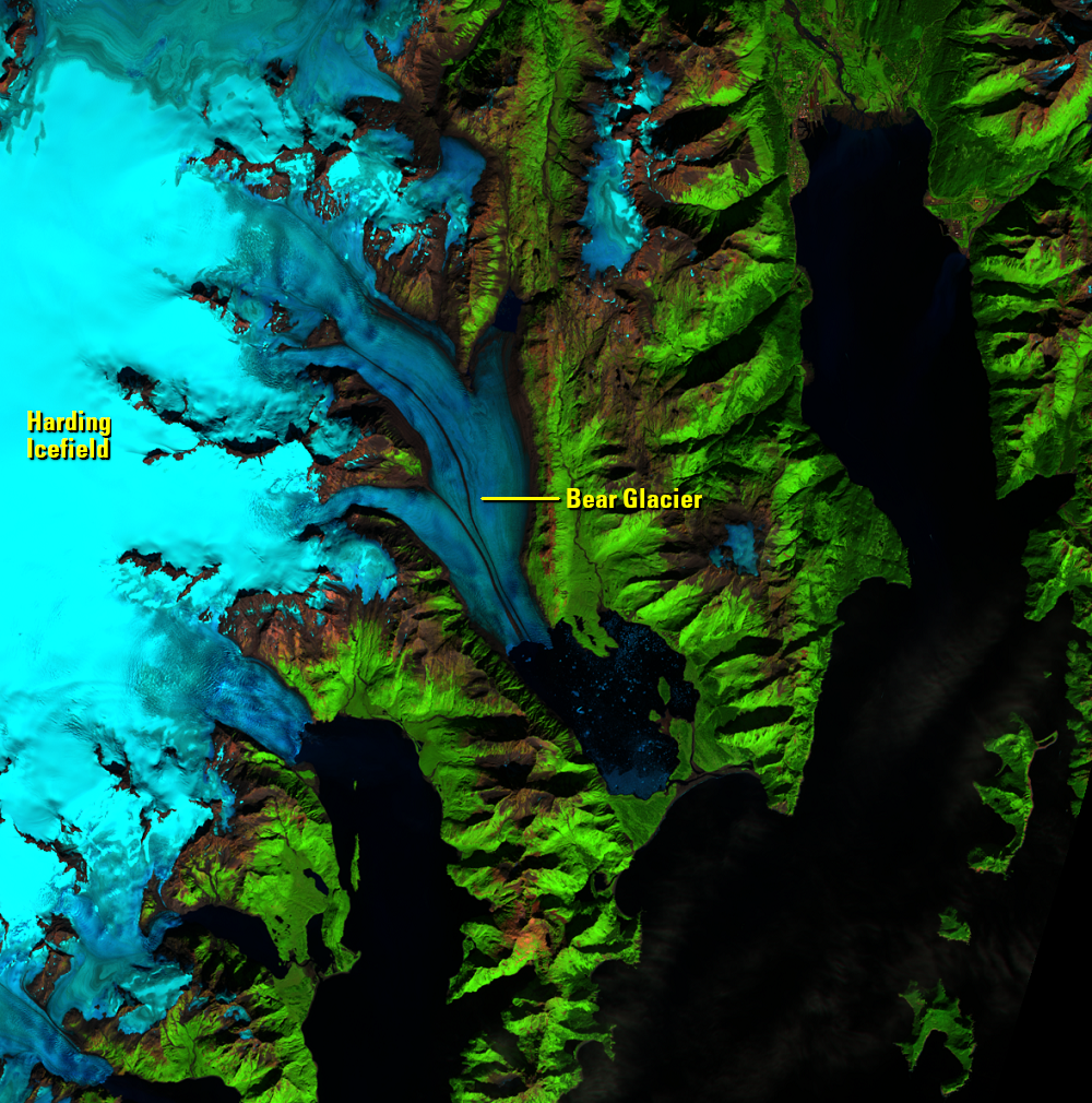
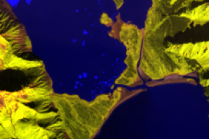
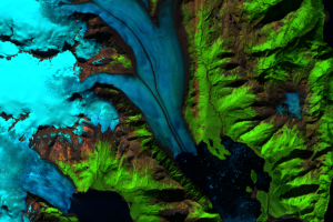
Bear Glacier, Alaska, USA
Earth Resources Observation and Science (EROS) Center - Earthshots
Satellite images of Earth help us observe locations that can be difficult to reach in person. Glaciers are sensitive to changes in regional and global climate, so scientists want to monitor them regularly. While some scientists study glaciers in the field, the Landsat satellites allow many others to monitor glacial change from the comfort of their office.
Bear Glacier is an outlet glacier of the Harding Icefield in Kenai Fjords National Park, Alaska. Glaciers form when fallen snow compresses into an ice mass over many years; the process usually takes centuries. The ice then flows to lower elevations. Besides showing visible retreat over the past few decades, Bear Glacier has also thinned about 2.5 feet (0.75 meters) per year from the early 1950s to the 1990s.
Since Bear Glacier and many other remote glaciers are largely inaccessible, satellite images provide important insights into how they change over time.
(Black stripes run through some of the images because of the Scan Line Corrector failure on Landsat 7 in May 2003.)
Imagery
Downloads
Alaska Channel, 2015, Bear Glacier: Alaska.org Web page at http://www.alaska.org/detail/bear-glacier. (Accessed January 14, 2015.)
Alaskan Coastal Safari, [n.d.], Seward Water Taxi—Bear Glacier Tours: Alaskan Coastal Safari Web page at https://www.sewardwatertaxi.com/bear-glacier. (Accessed January 14, 2015.)
Kurtz, D., 2014, Bear Glacier Lake Outburst Flood: National Park Service Web page at http://www.nps.gov/kefj/parknews/bear-glacier-lake-outburst-flood.htm. (Accessed January 14, 2015.)
Lemke, K.A., 2010, Illustrated Glossary of Alpine Glacial Landforms—Medial Moraine: University of Wisconsin-Stevens Point Web page at http://www4.uwsp.edu/geo/faculty/lemke/alpine_glacial_glossary/landforms/medial.html. (Accessed January 14, 2015.)
NSIDC, 2014, How Are Glaciers Formed? National Snow and Ice Date Center Web page at http://nsidc.org/cryosphere/glaciers/questions/formed.html. (Accessed February 13, 2015.)
NASA, 2006, Bear Glacier, Gulf of Alaska: NASA Earth Observatory, available at http://earthobservatory.nasa.gov/IOTD/view.php?id=7097. (Accessed January 14, 2015.)
NASA, 2008, A Sensitive Giant: Alaska’s Bear Glacier: NASA Goddard Space Flight Center, available at https://landsat.gsfc.nasa.gov/wp-content/uploads/2012/12/bear_glacier_4web.pdf. (Accessed January 14, 2015.)
Pelto, M., 2010, Bear Glacier, Kenai Alaska Recedes, New Lake Formed: From a Glaciers Perspective, available at https://glacierchange.wordpress.com/2010/08/28/bear-glacier-kenai-alaska-recedes-new-lake-formed/. (Accessed January 14, 2015.)
USGS, 2012, Repeat Photography of Alaskan Glaciers: USGS Northern Rocky Mountain Science Center Web page at http://www.usgs.gov/climate_landuse/glaciers/repeat_photography.asp. (Accessed January 14, 2015.)
Wilcox, A.C., Wade, A.A., and Evans, E.G., 2014, Drainage Events from a Glacier-dammed Lake, Bear Glacier, Alaska: Remote Sensing and Field Observations: Geomorphology, v. 220, p. 41–49. (Also available at http://www.sciencedirect.com/science/article/pii/S0169555X14002931.)
Related Content

Glacial Retreat
A stable glacier advances a little in the winter and retreats the same...

Glacier Repeat Photography
USGS uses repeat photography of glaciers to quantify changes in glacie...
Bear Glacier Lagoon
Before 1950, the entire basin was covered by Bear Glacier and ended at...
Racing Stripes
Glaciers move slowly, but Bear Glacier seems to have racing stripes. G...