

Glacier Repeat Photography
Earth Resources Observation and Science (EROS) Center - Earthshots
USGS uses repeat photography of glaciers to quantify changes in glaciers over time. Repeat photography is a technique in which a historical photograph and a modern photograph, both having the same field of view, are compared.
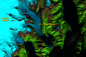
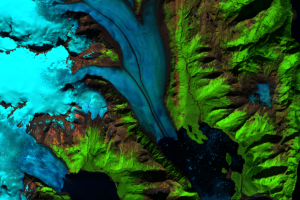
For example, oblique aerial photographs of Bear Glacier were taken facing north and show glacial retreat along with icebergs floating in Bear Glacier Lagoon.
Photographs taken from the ground look north and were from the same location on the eastern part of the terminus of Bear Glacier. In the 96 years between photographs, Bear Glacier has retreated more than 3 kilometers (1.9 miles) and thinned by as much as 200 meters (656 feet). Only a very small part of Bear Glacier is visible from this location today, and the terminus is obscured by the trees.
Imagery
Downloads
Related Content
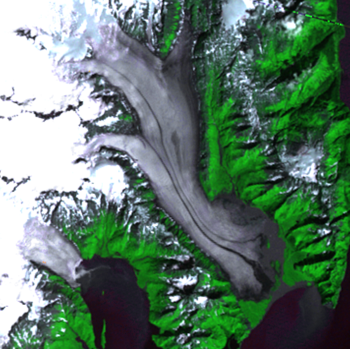
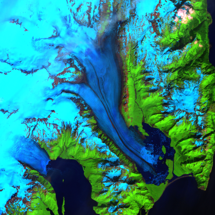
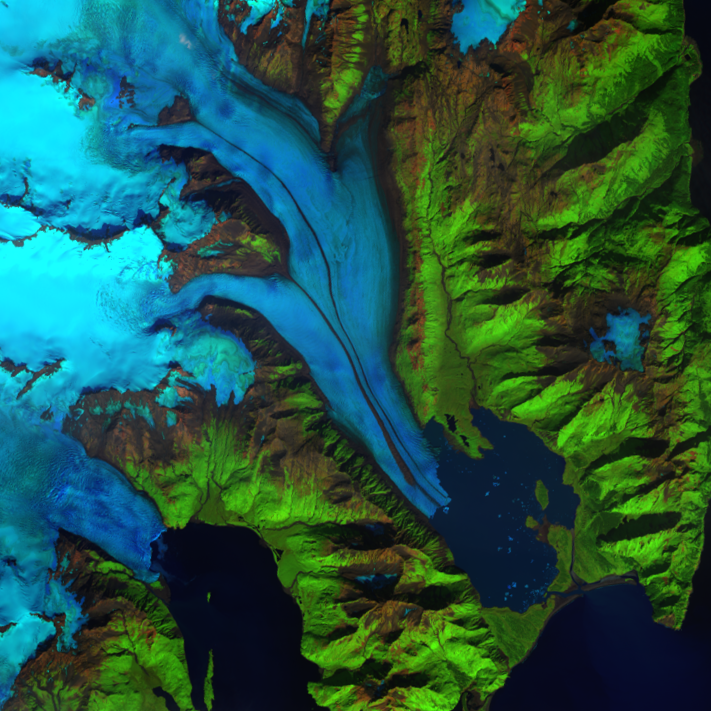
Bear Glacier, Alaska, USA
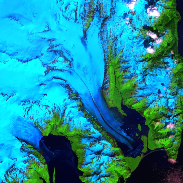
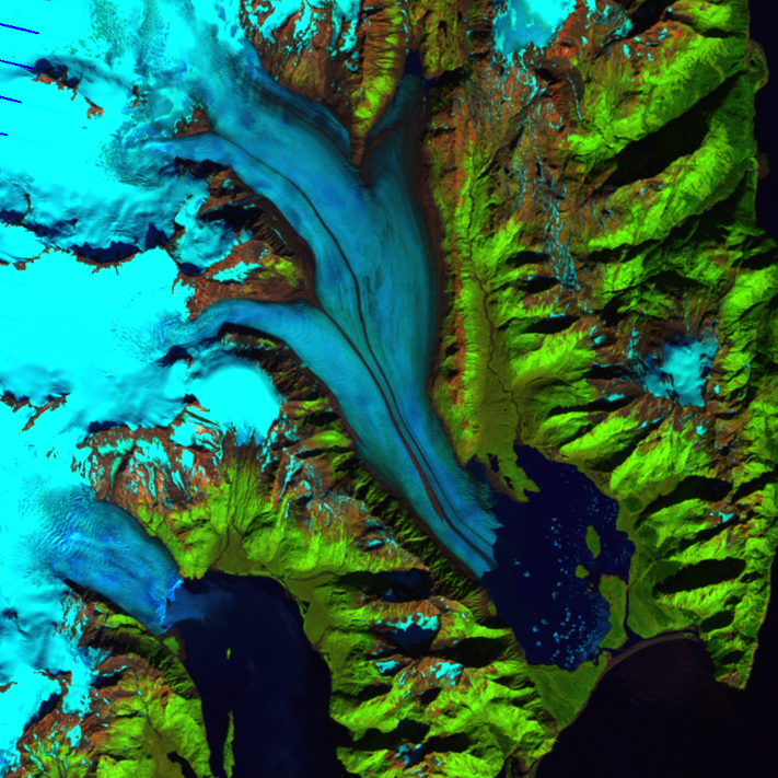
Satellite images of Earth help us observe locations that can be diffic...

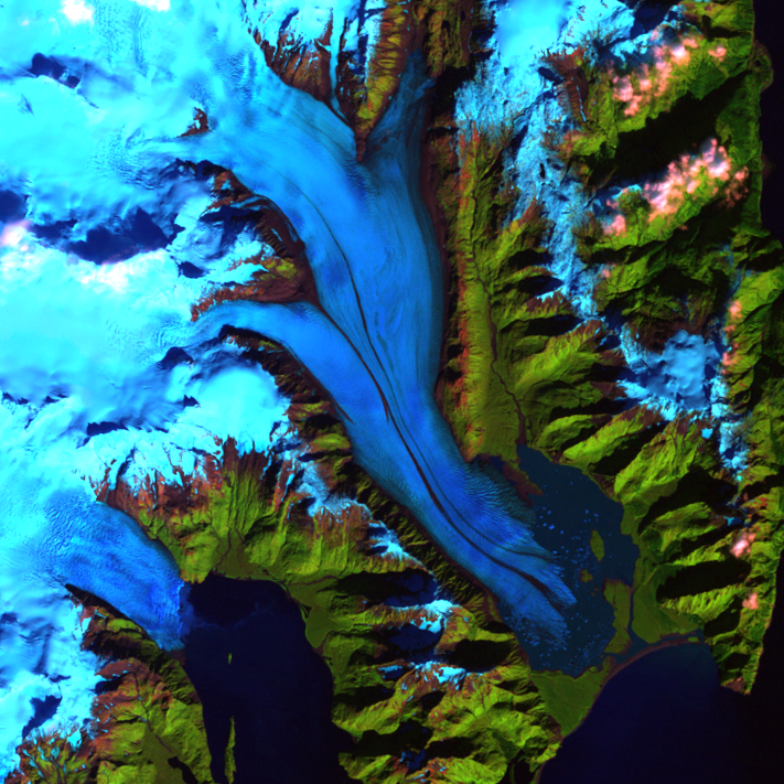
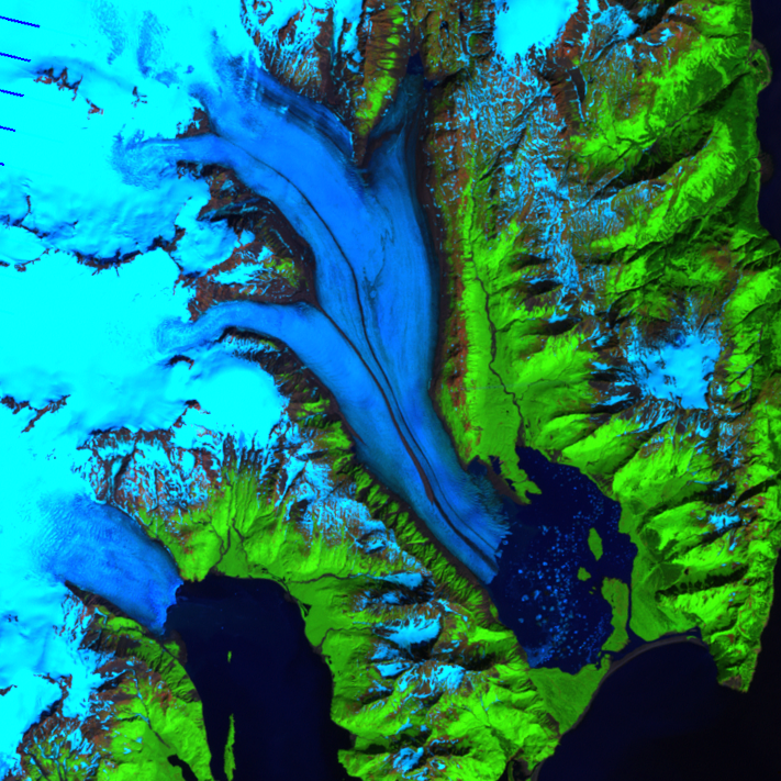
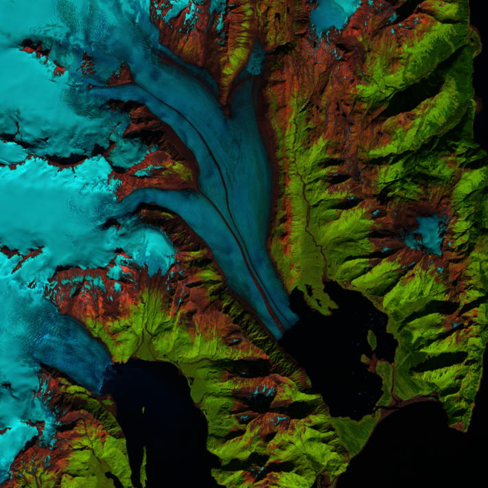
Glacial Retreat
A stable glacier advances a little in the winter and retreats the same...

Glacier Repeat Photography
USGS uses repeat photography of glaciers to quantify changes in glacie...
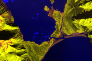
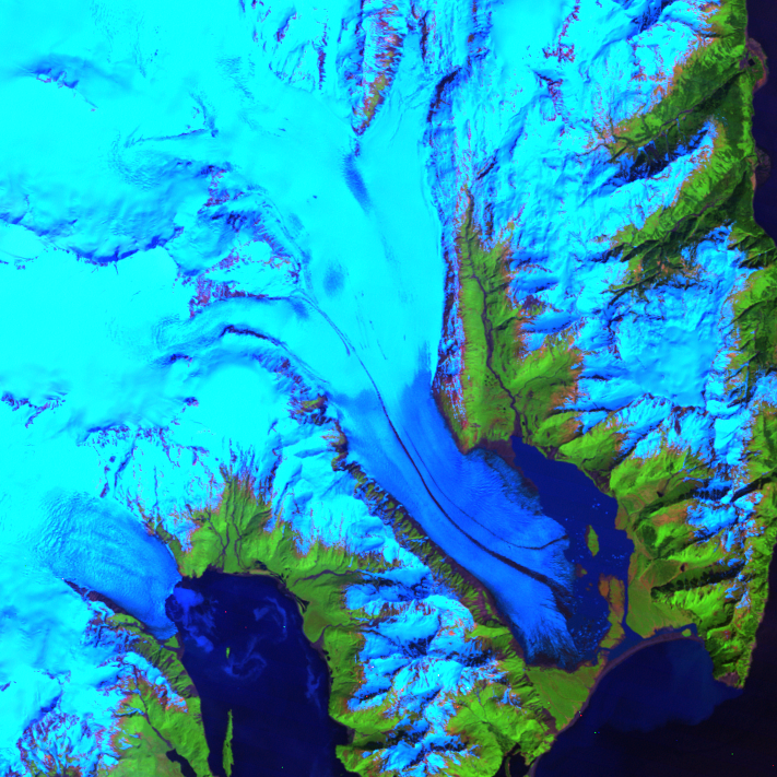
Bear Glacier Lagoon
Before 1950, the entire basin was covered by Bear Glacier and ended at...
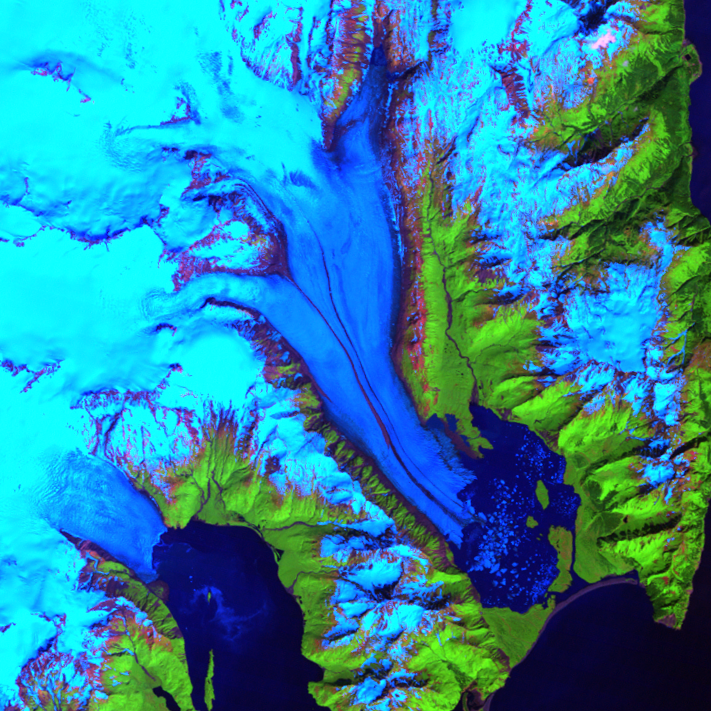
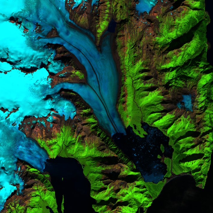
Racing Stripes
Glaciers move slowly, but Bear Glacier seems to have racing stripes. G...