

Causes and Plans
Earth Resources Observation and Science (EROS) Center - Earthshots
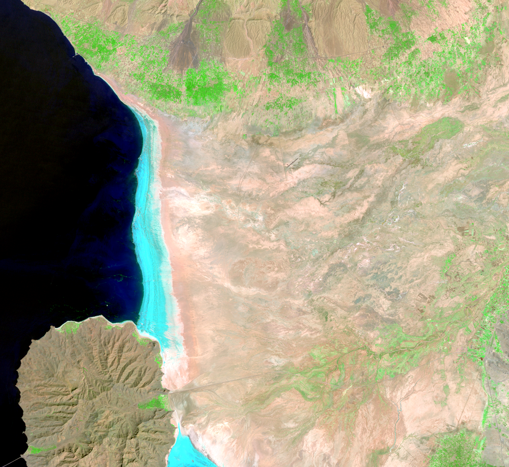
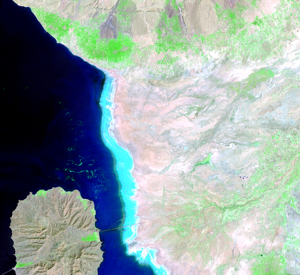
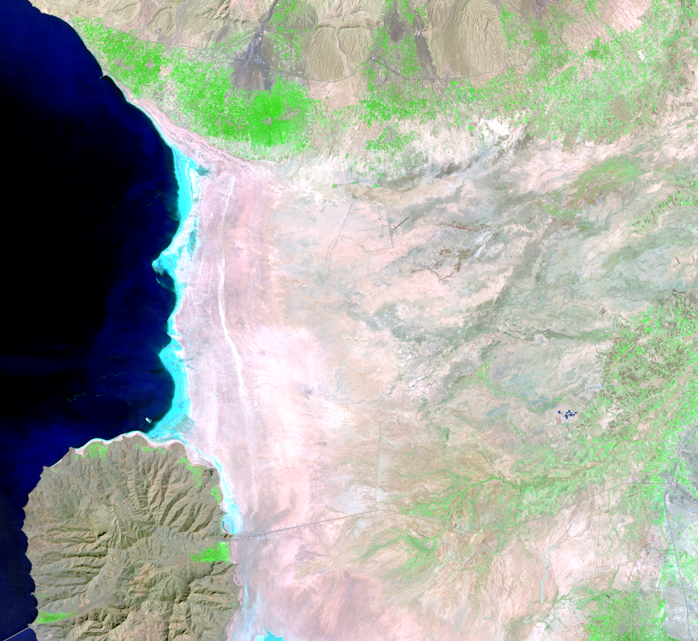
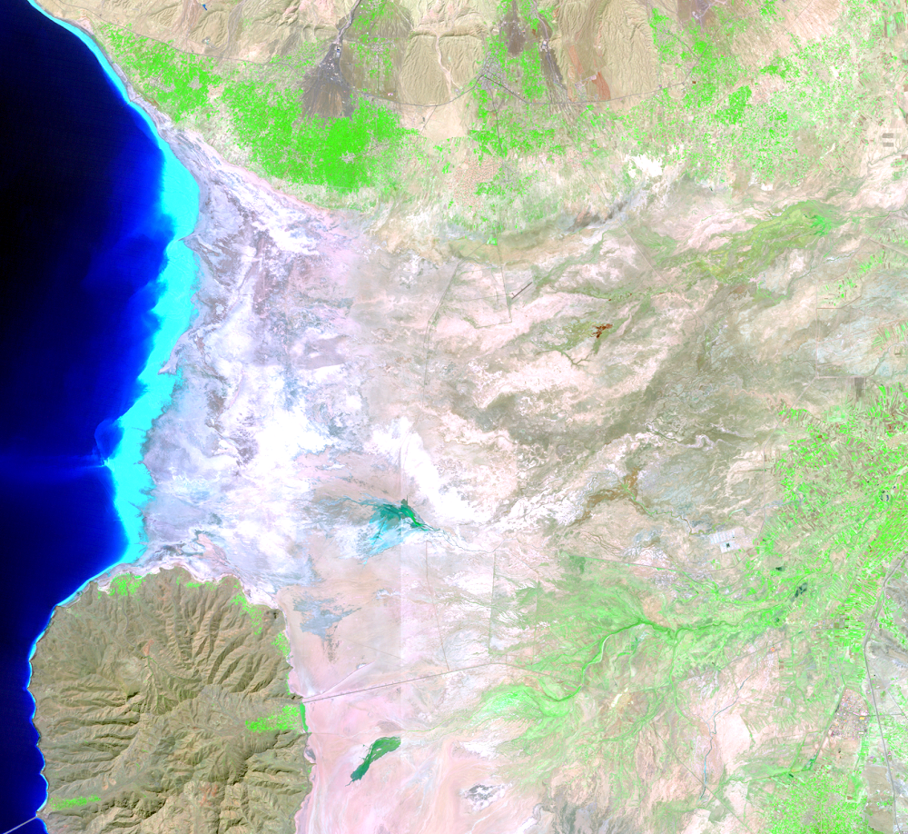
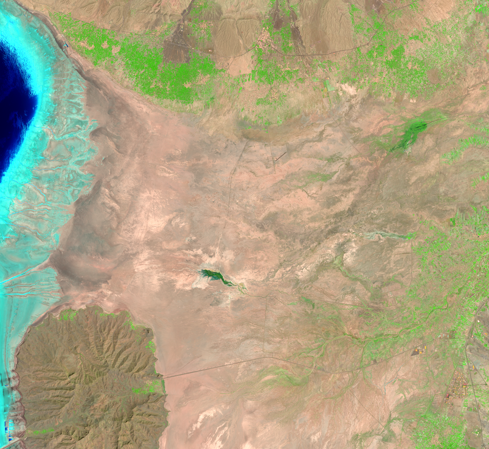
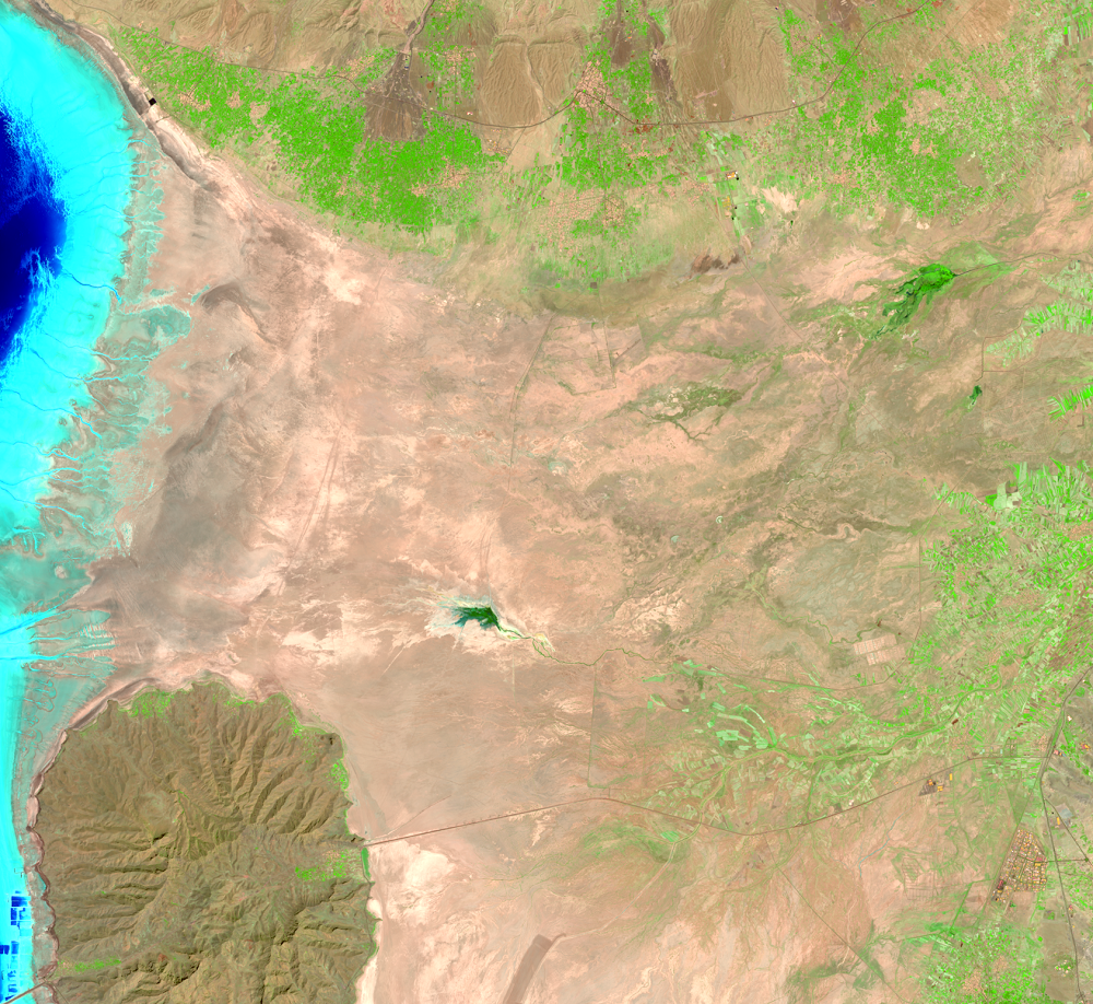
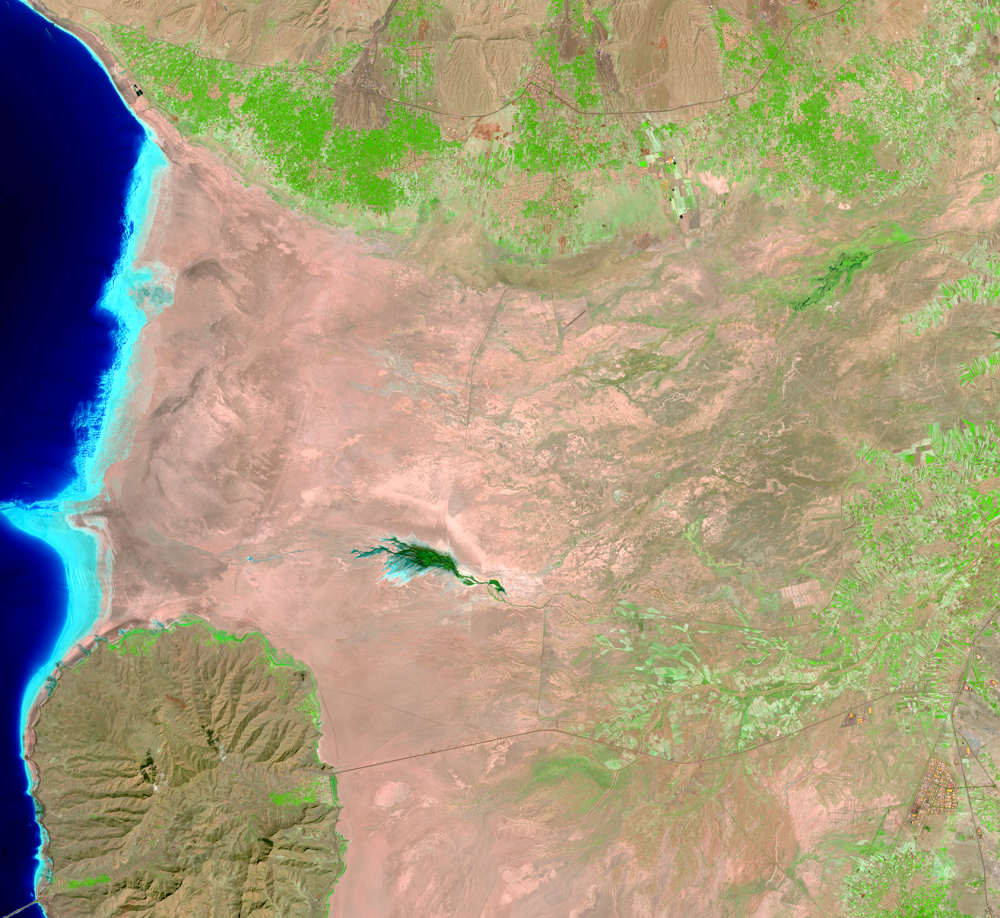
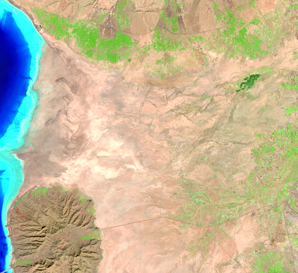
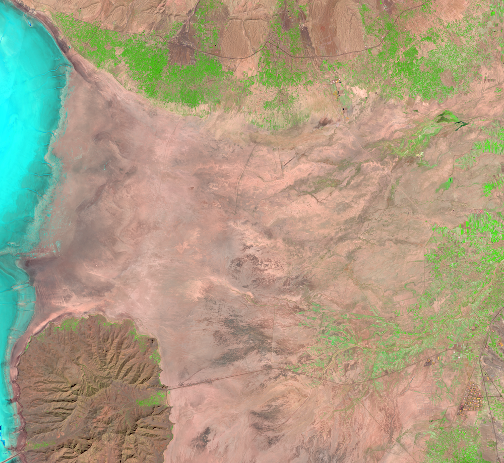
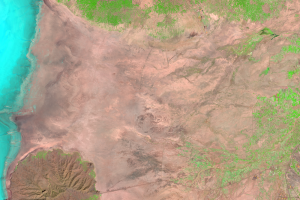
The diversion of water from the rivers for agricultural use is probably the most significant cause of Lake Urmia’s decline. Several dams have also been built on rivers that flow into the lake. Since 1996, droughts have further contributed to the lower lake levels.
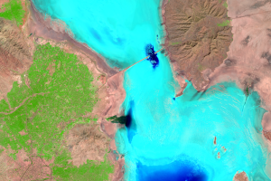
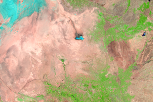
Rainfall in 2018-19 brought water levels back up. That rainfall did not bring a permanent restoration of the lake, as the 2023 image shows.
No single fix can help the lake recover. But the continual monitoring from Landsat helps decision makers plan for the best solutions.
Imagery
Downloads
Related Content
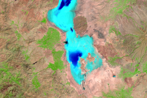
Lake Urmia, Iran
Lake Urmia in Iran is another closed basin lake that has been shrinkin...
Populations
About 76 million people live within 500 kilometers (310 miles) of Lake...
Salt and Farming
Lake Urmia is a hypersaline lake. Rivers carry sediments and minerals ...
Causes and Plans
The diversion of water from the rivers for agricultural use is probabl...