

Farmland Inundated
Earth Resources Observation and Science (EROS) Center - Earthshots
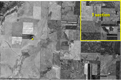
The aerial photo from 1952 is black and white and doesn’t have the infrared imaging capability of Landsat, but it has something that Landsat doesn’t—very high resolution.
It’s possible to locate trees and buildings in this image. Zooming in to an area near the lake is a location that is cultivated cropland. The sharp corners mark the different fields.
Land here is divided into sections of 1 square mile. These extreme closeups show an area of land covering approximately six sections. This area shows three sections across and two sections high.
A closer look shows farm buildings, with a shelterbelt of trees beside them.
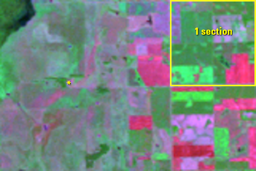
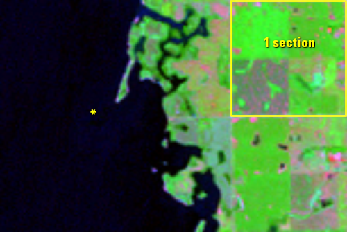
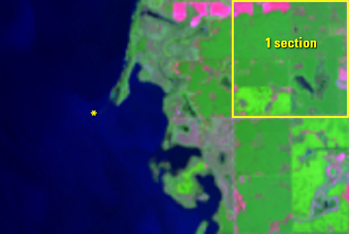
Later Landsat images reveal that those fields and structures are underwater.
* = Location of farm structures shown in the aerial photo closeup.
Imagery
Downloads
Related Content
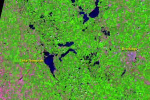
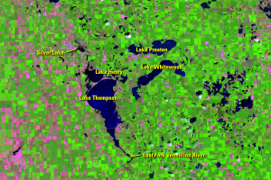
Lake Thompson, South Dakota, USA
Many lakes in eastern South Dakota have expanded during the Landsat re...
Hydrology
An aerial image from 1952 shows Lake Thompson as a wetland, with about...

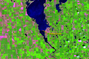
Farmland Inundated
The aerial photo from 1952 is black and white and doesn’t have the inf...
Wildlife
Lake Thompson is a crucial habitat for migratory birds. The simultaneo...