

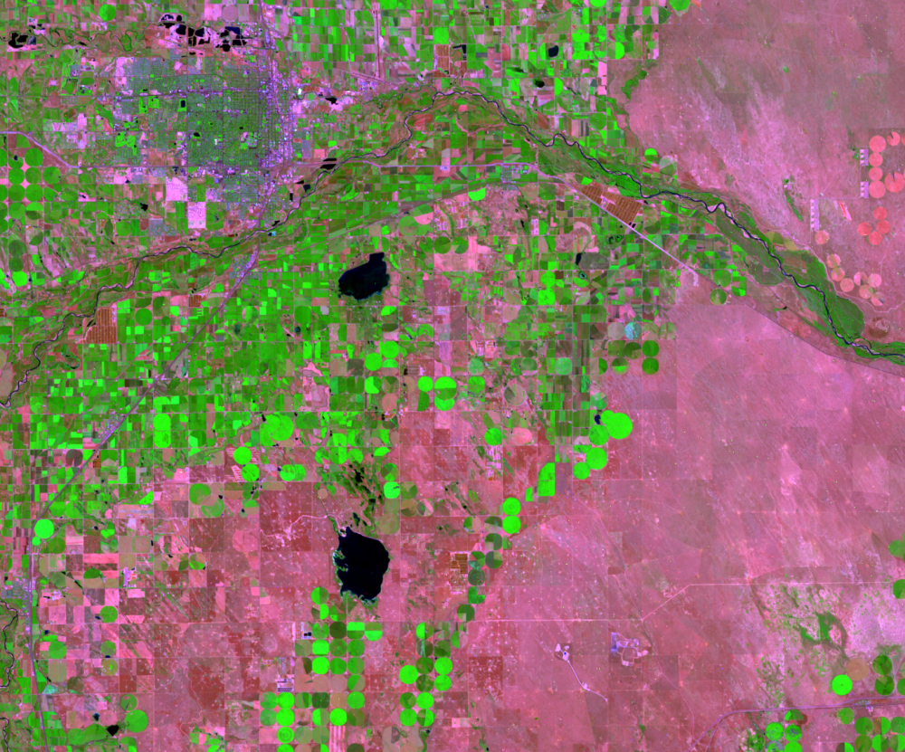
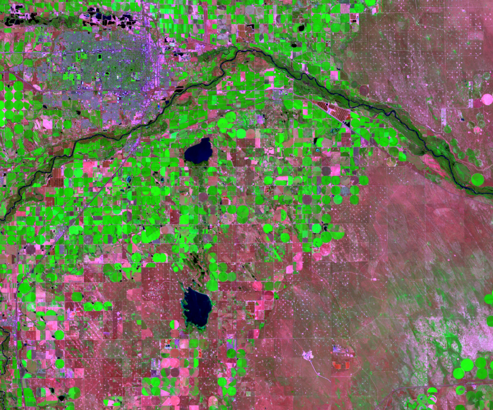
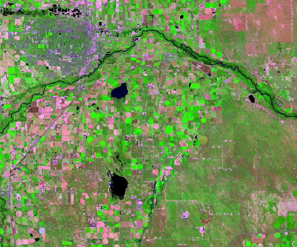
Greeley
Earth Resources Observation and Science (EROS) Center - Earthshots
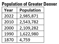
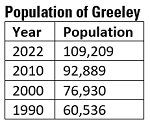
Other urban centers near Denver are also growing quickly. While the population of the Denver metropolitan area increased by 84% between 1990 and 2022, Greeley, about 40 miles north of Denver, increased by 80.4% in the same time period.
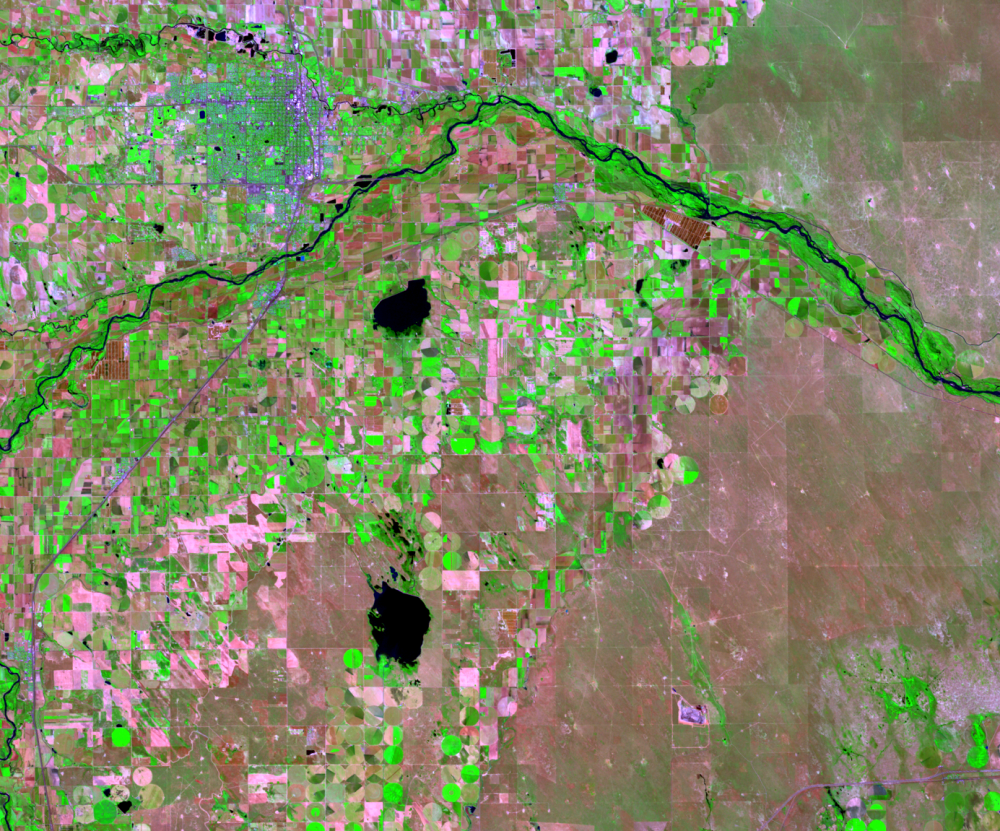
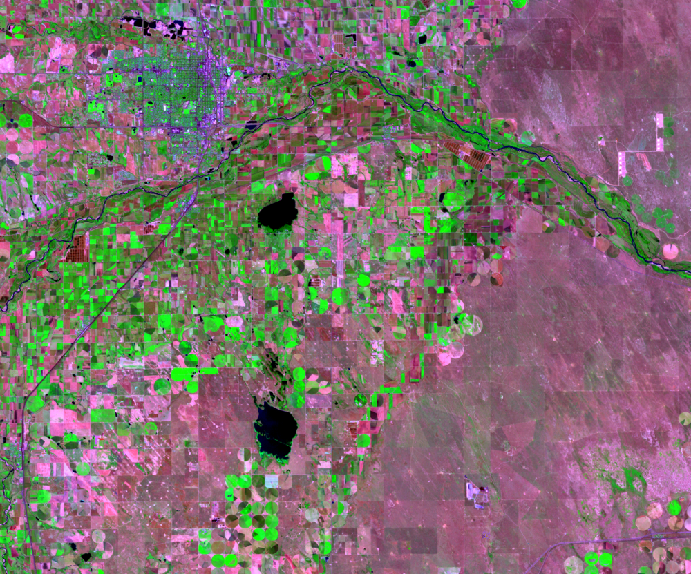
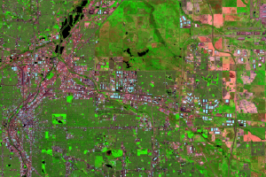
In these false color images, residential areas are a mottled green, with streets, highways, and other infrastructure showing up in purple hues. The brightest green spots are golf courses, parks, and other areas that have growing green grass. Bright green circles and rectangles are farm fields. In fact, just about everything that is green in these images away from the mountains is irrigated.
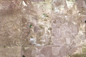
Other expansion seen in these images is the petroleum and natural gas industry. An increased number of bright spots indicates more oil and gas wells.
Imagery

Downloads
Related Content
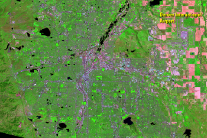
Denver, Colorado, USA
Denver has all the classic marks of substantial urban growth over the ...
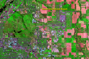
New Airport
A major development in this time series of images is Denver Inter...
Stapleton
Stapleton Airport near downtown Denver served the city since 1929. By ...
Wildlife Refuge
There is a noticeable area of undeveloped land in all that urban growt...
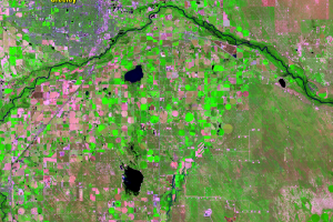
Greeley
Other urban centers near Denver are also growing quickly. While the po...