

Kok-Aral Dam
Earth Resources Observation and Science (EROS) Center - Earthshots
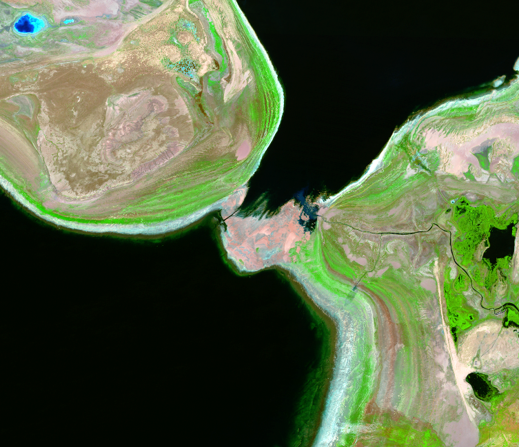
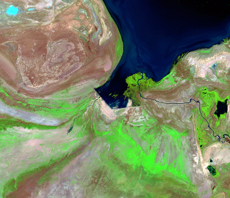
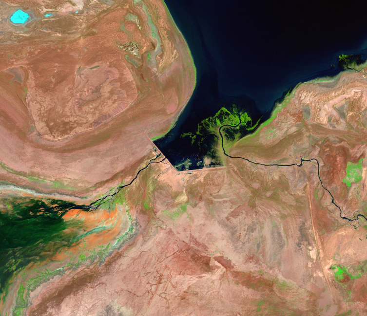
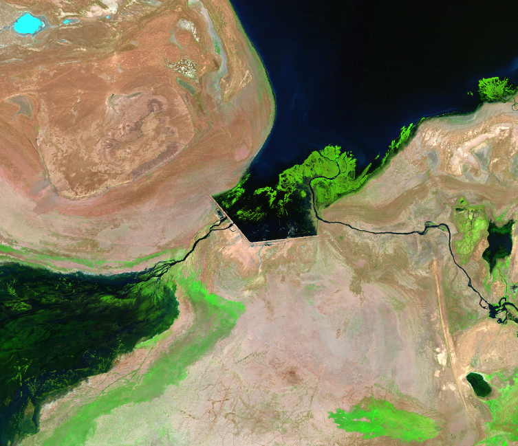
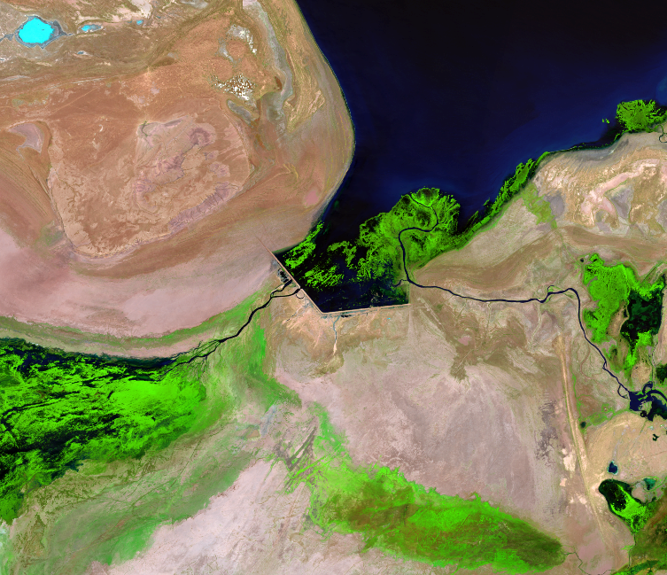
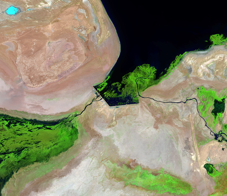
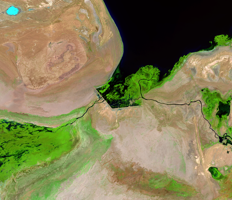
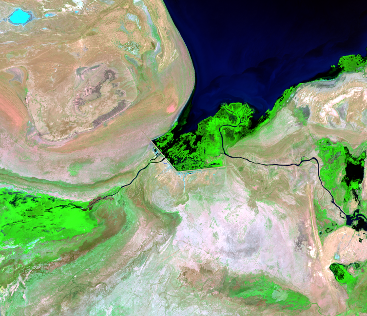
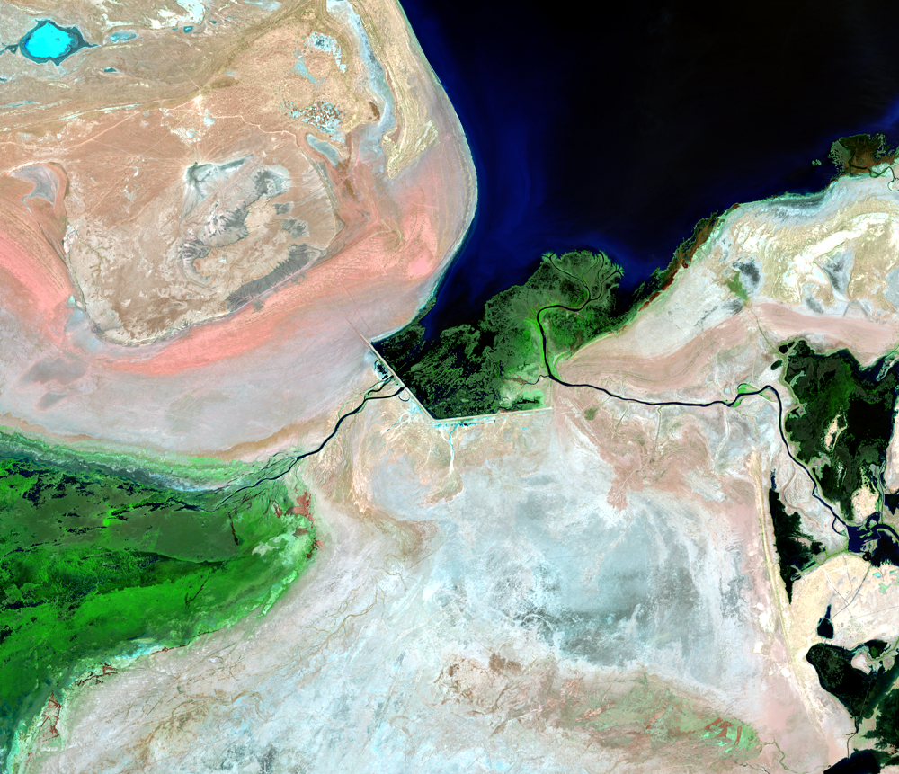
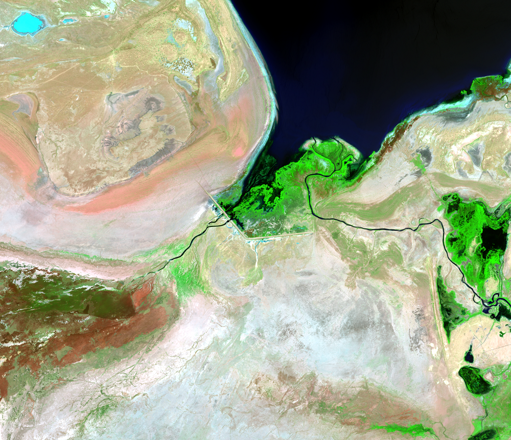
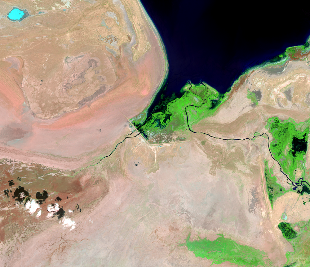
The Kok-Aral Dam was completed in 2005 to control the water level of the North Aral Sea. This dam has prevented further decline of the North Aral Sea, and by 2011 it helped restore the water salinity level to the that of the 1960s (8 grams per liter).
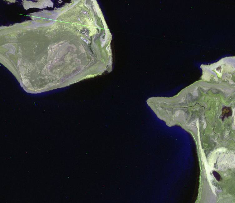
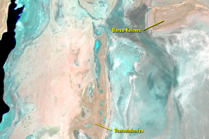
A dam can be seen as early as the 1998 image. It’s the straight angled lines on the southernmost part of the North Aral. This earthen dike was built in 1992 and later replaced by a concrete dam in 2005. At times, water from the North Aral is allowed to flow southward into the South Aral through the dam in the Berg Strait.
Imagery
Downloads
Related Content
Aral Sea, Kazakhstan and Uzbekistan
We see a lot of change with 50 years of Landsat imagery, along with th...
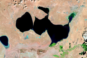
Kazakhstan, North Aral Sea
While the entire Aral Sea is shrinking dramatically, these images show...
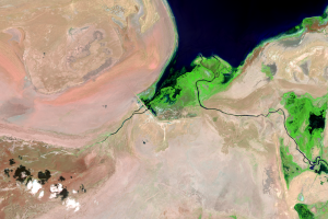
Kok-Aral Dam
The Kok-Aral Dam was completed in 2005 to control the water level of t...
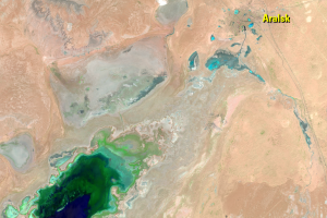
Aralsk
The city of Aralsk is shown in the 1964 ARGON image on the coast of th...
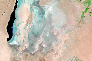
Uzbekistan, South Aral Sea
Although using the dam to retain most of the water from the Syr Darya ...
Islands
The name Aral means Island. The sea did once have many islan...
Where Is the Water?
The first question people have when seeing these images of the Aral Se...