

Point Bars
Earth Resources Observation and Science (EROS) Center - Earthshots
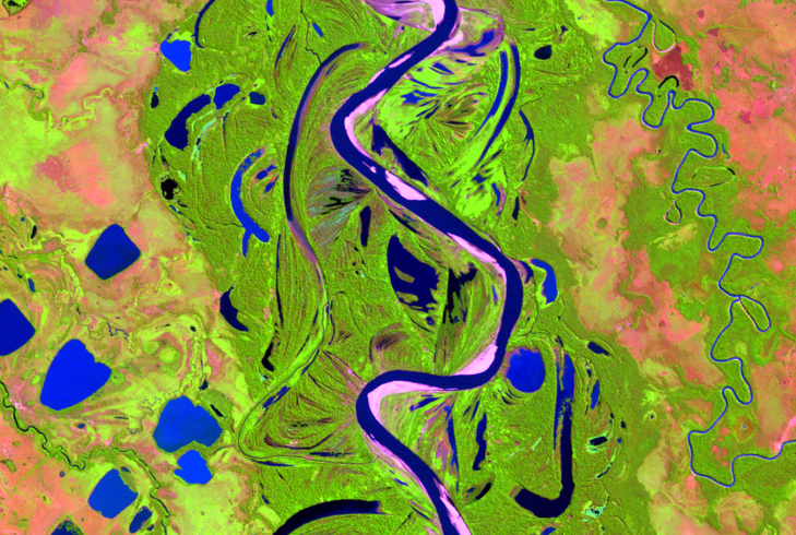
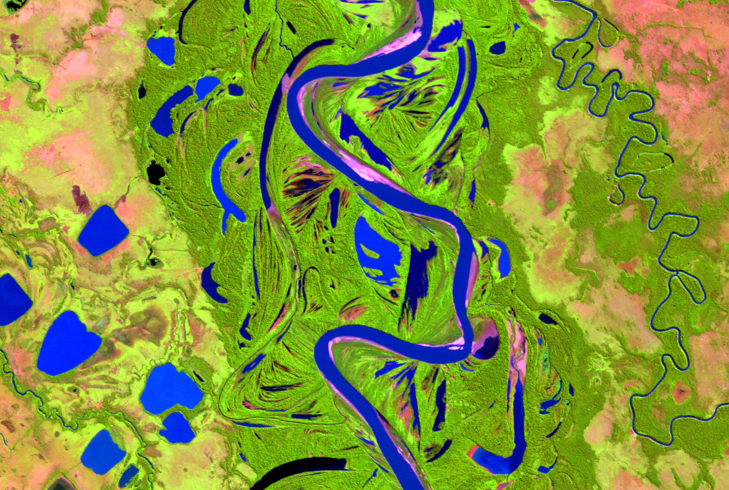
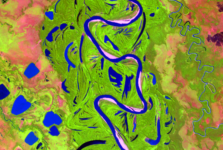
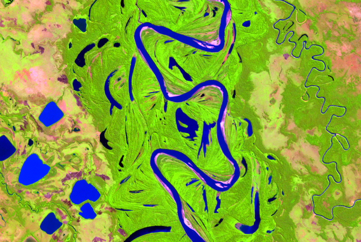
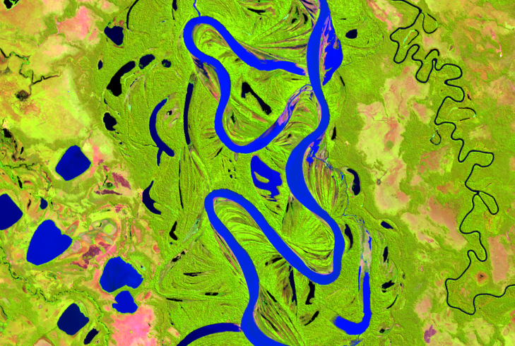
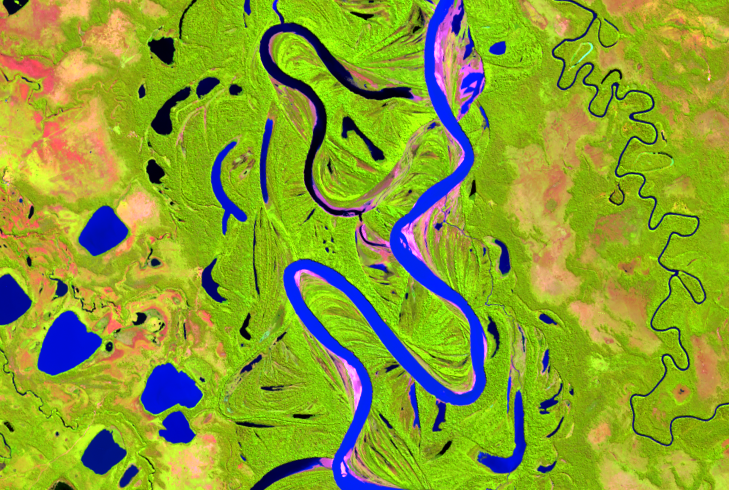
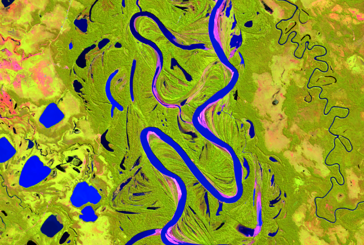
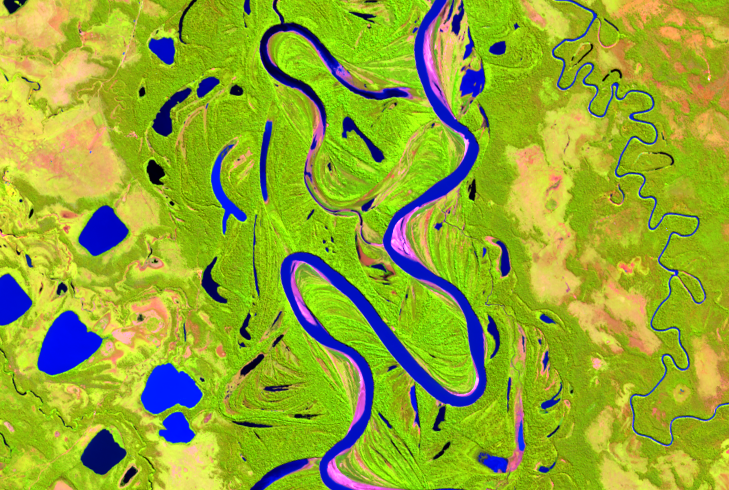
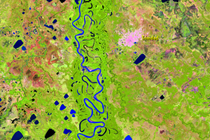
The Mamoré River carries sediment from the rapidly eroding Bolivian Andes. The steep terrain coupled with high river discharge in the Andes causes a high degree of soil erosion.
The high sediment load encourages the growth of point bars, which are seen in these Landsat images as the lighter colored areas along the inside bends of the river. These sandy areas are mostly vegetation-free. Point bars increase the erosion on the opposite side of the river, causing it to further push the river’s course off to the side.
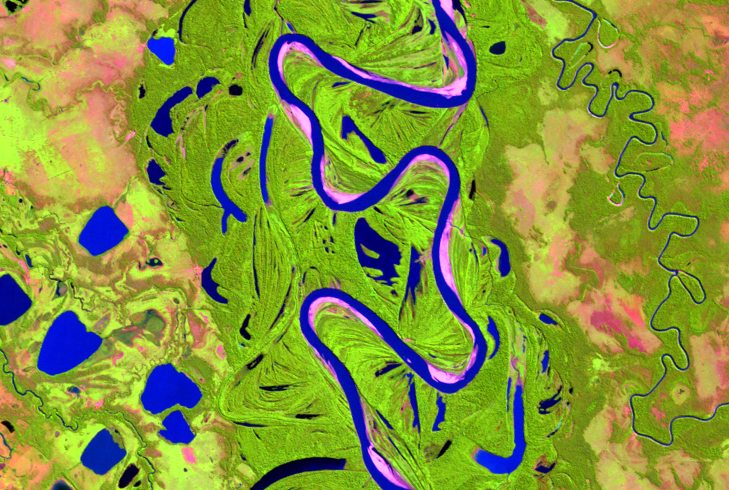
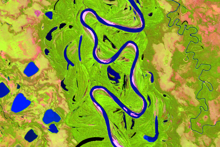
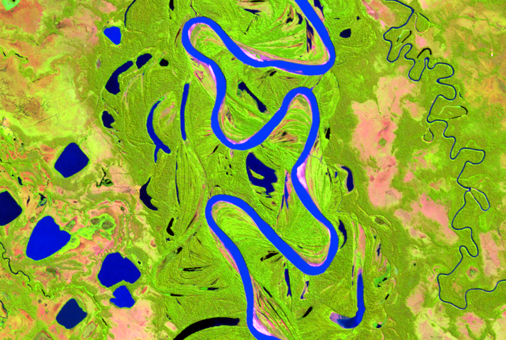
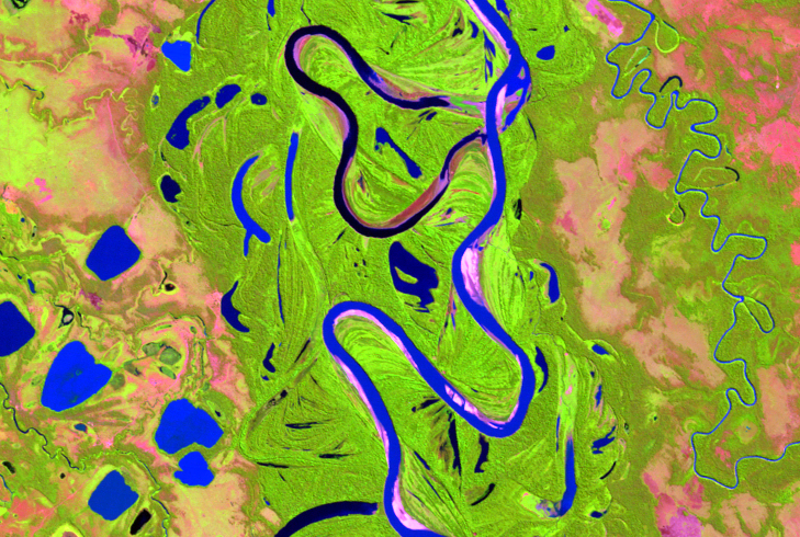
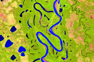
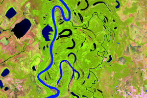
These close-up images show a location on the Mamoré River where several point bars have formed. At the top of these images, this action created a cutoff. Point bars tend to increase the rate of cutoff formation. And the bends that have more sediment (pink) move more than the bends that have less.
View this animation to really see this process in action.
Imagery

Downloads
Related Content
Mamoré River, Bolivia
In the Amazon basin, some rivers run wild. With no dams or levees to c...
Point Bars
The Mamoré River carries sediment from the rapidly eroding Bolivian An...
Oxbow Lakes
The more a river meanders, the more cutoffs form. Cutoffs form more fr...