

Water Levels
Earth Resources Observation and Science (EROS) Center - Earthshots
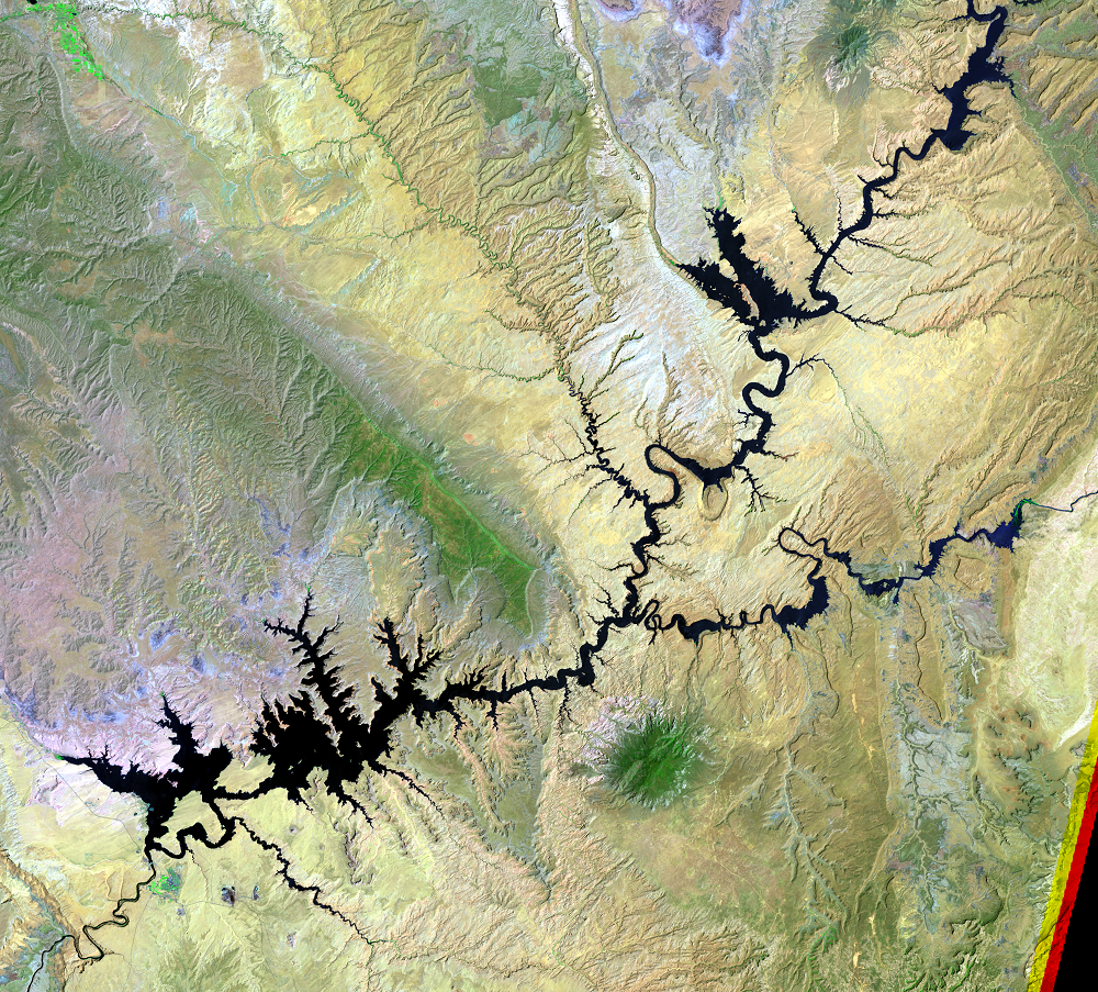
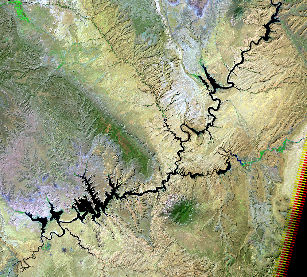
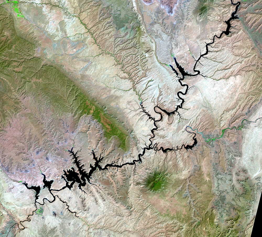
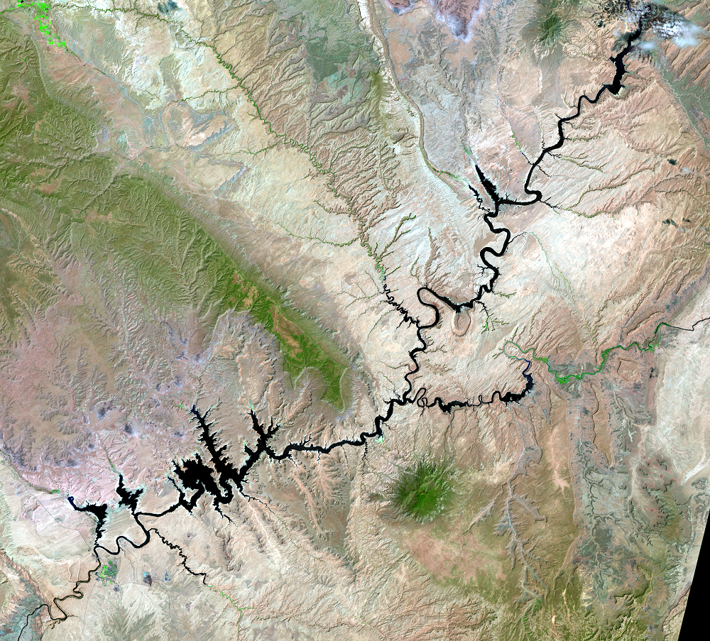
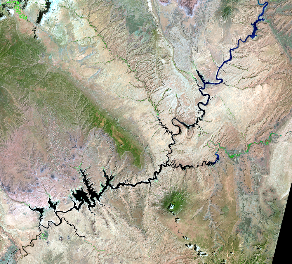
Drought combined with water withdrawals has caused a drop in the lake’s water level. The reservoir finished filling in 1980. The highest water level recorded was in July 1983. The lowest was in April 2022, when the lake level was down about 185 feet from its high mark.
On the chart, the numbers on the left indicate feet above sea level for the lake’s water level. A water level of 3,700 feet is the reservoir at full capacity.
Lake Powell Historical Water Level Data
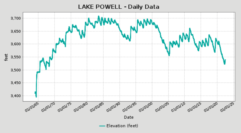
Source: U.S. Bureau of Reclamation.
Imagery
Downloads
Related Content

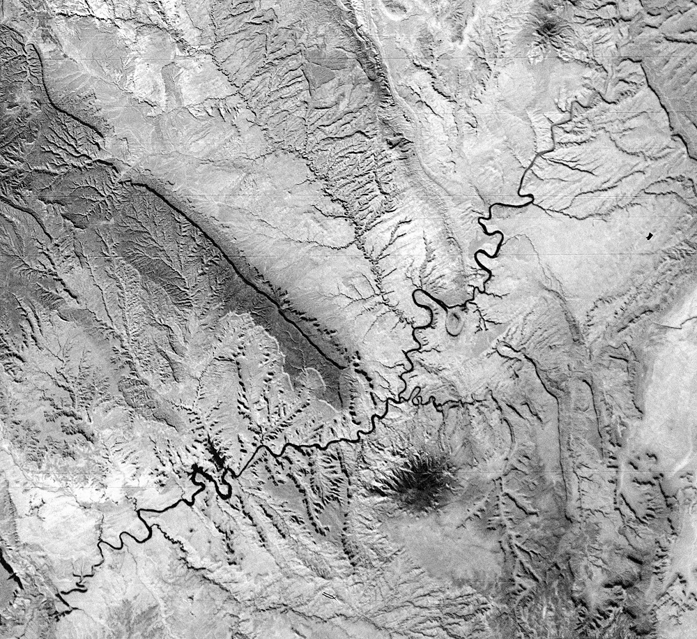
Lake Powell, Utah and Arizona, USA
Glen Canyon Dam on the Colorado River was completed in 1963. It create...
Water Levels
Drought combined with water withdrawals has caused a drop in the lake’...
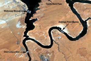
Glen Canyon Dam
Glen Canyon Dam near Page, Arizona, creates Lake Powell. The 710-...
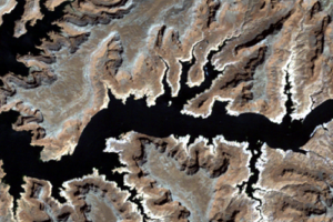
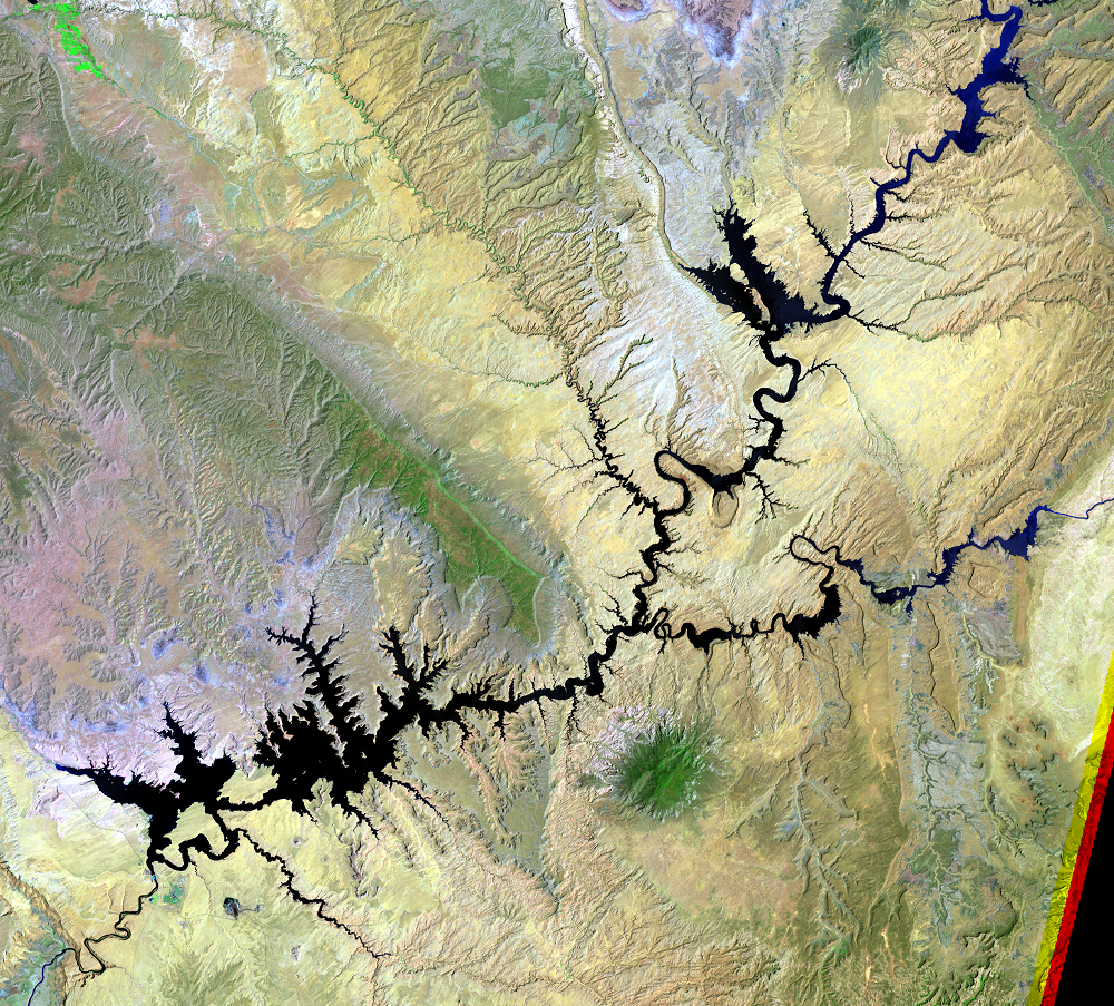
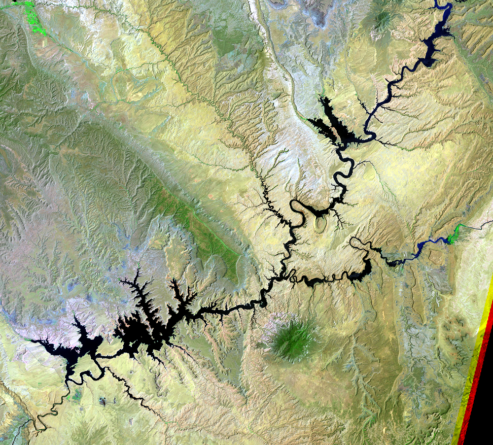
Bathtub Ring
Comparing the 1984 (high water level) and 2005 (low water level) image...
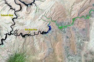
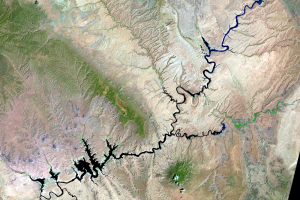
San Juan River
Farther upstream, the San Juan River flows into the Colorado River. In...