

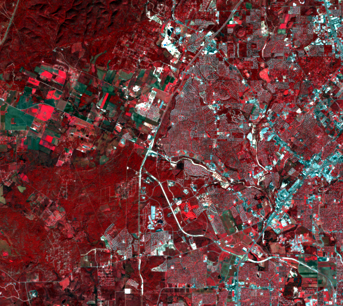
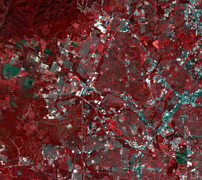
Westward Expansion
Earth Resources Observation and Science (EROS) Center - Earthshots
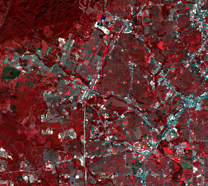
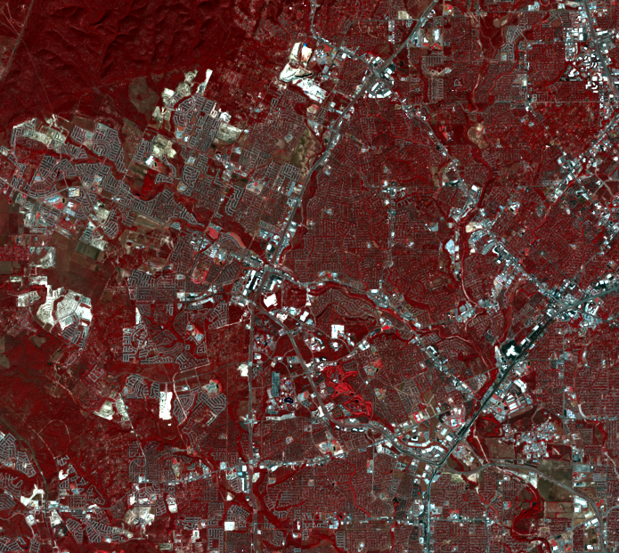
Pronounced urban/suburban expansion is visible on the west edge of the city. The main outer loop highway visible in all images is 1604. New residential areas push westward to expand beyond this outer loop into the surrounding forests. Also noticeable is the addition of Highway 151, which runs from east to west. New retail development can be seen as the small bright white shapes just north of where this highway intersects with 1604. Can you also spot where a golf course was built in this time period? How about the progression of other new roadways?
Imagery
Downloads
Related Content
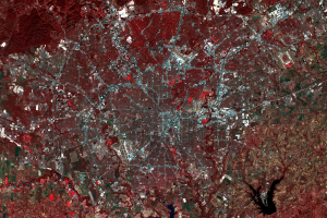
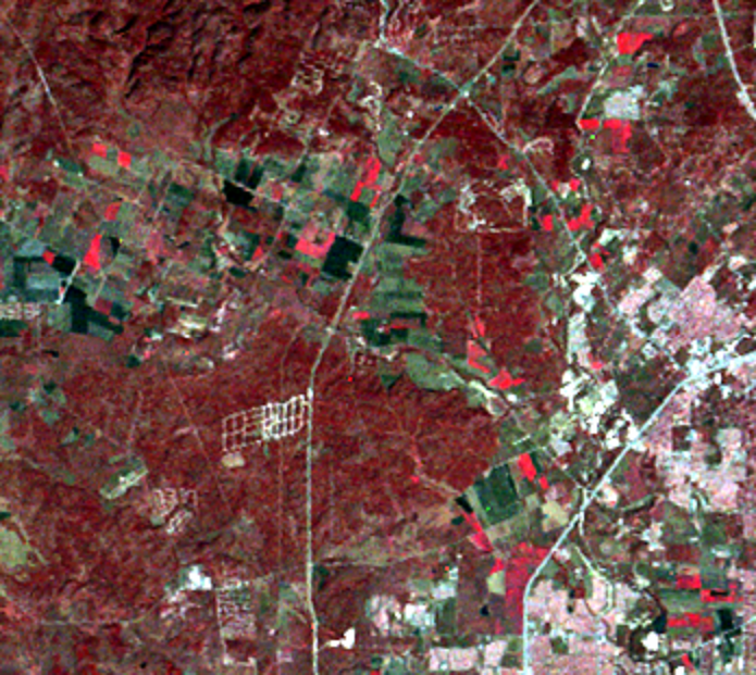
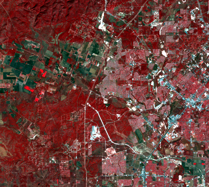
San Antonio, Texas, USA
These images show the metropolitan area of San Antonio, Texas. Accordi...
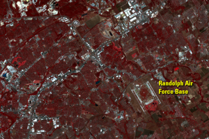
Randolph Air Force Base
Randolph Air Force Base is visible as two white strips northeast of th...
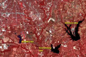
Reservoirs
Calaveras Lake and Victor Braunig Lake are artificial lakes that provi...
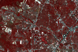
Westward Expansion
Pronounced urban/suburban expansion is visible on the west edge of the...