

When a Glacier Is a Dam
Earth Resources Observation and Science (EROS) Center - Earthshots
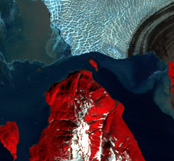
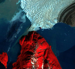
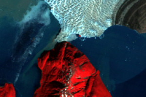
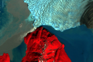
Hubbard Glacier slides in from the north in these images. Two bodies of water meet at the end of the glacier. Disenchantment Bay extends to the southwest into Yakutat Bay, which eventually connects to the Gulf of Alaska. Russell Fjord is the narrow body of saltwater extending southeast and is connected to Disenchantment Bay.
In May 1986, Hubbard Glacier blocked the outlet of Russell Fjord, creating a dam that formed “Russell Lake.” That summer, the new lake filled with runoff; its water level rose 25 meters, and a decrease in salinity levels threatened its marine life.
Around midnight on October 8, 1986, the dam began to give way. In the next 24 hours an estimated 5.3 billion cubic meters of water gushed through the gap, and the fjord was reconnected to Disenchantment Bay, returning to its previous level.
Imagery
Downloads
Related Content
Hubbard Glacier, Alaska, USA
Unlike many glaciers in Alaska and around the world, Hubbard Glacier i...
When a Glacier Is a Dam
Hubbard Glacier slides in from the north in these images. Two bodies o...
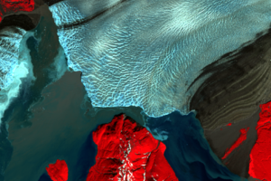
When a Glacier Is a Dam, Part 2
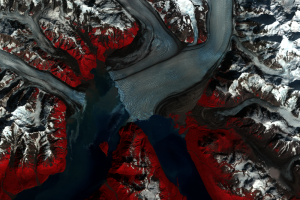
Hubbard Glacier blocked the entrance to Russell Fjord again in 2002. T...
What If the Glacier Dam Doesn't Break?
If the glacier permanently blocks Russell Fjord, the fjord would turn ...