

Bahrain
Earth Resources Observation and Science (EROS) Center - Earthshots
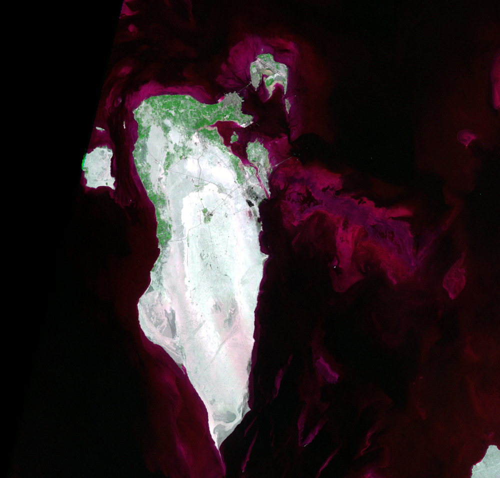
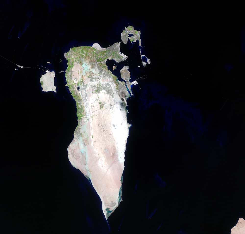
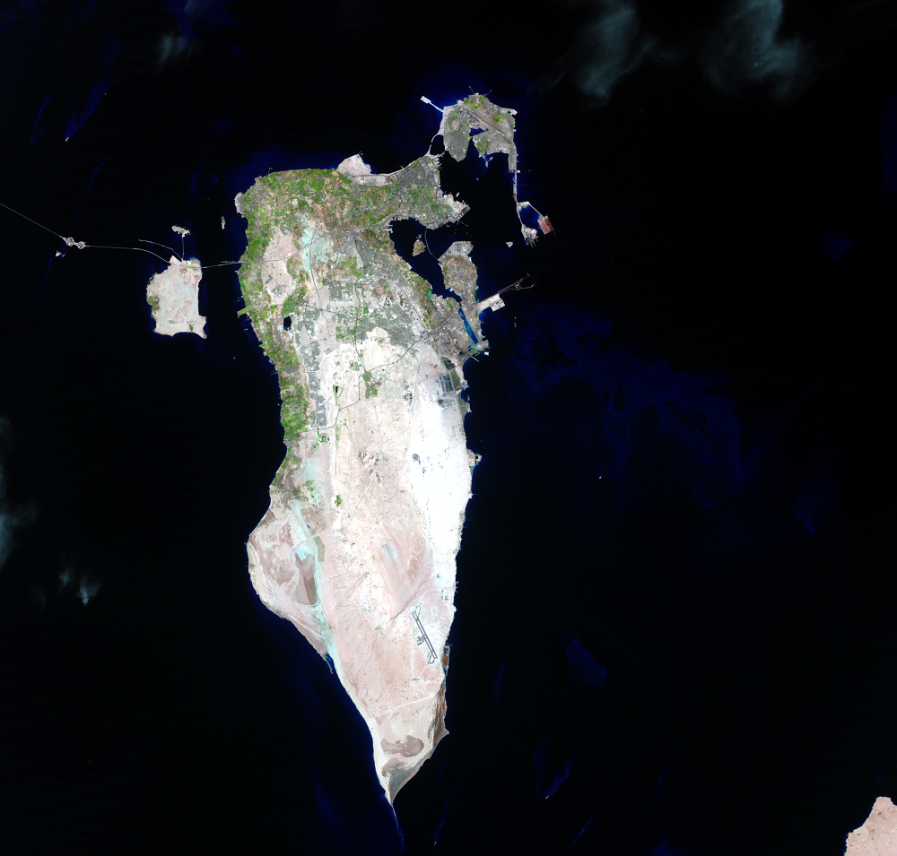
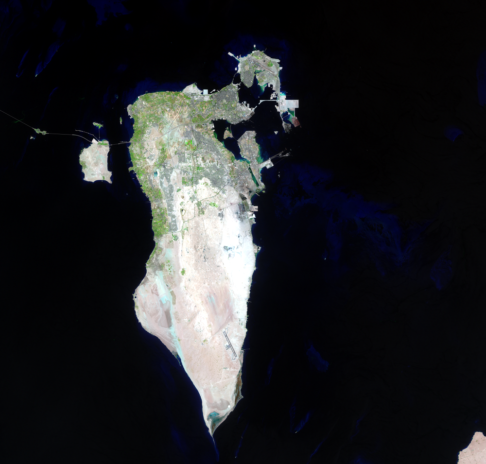
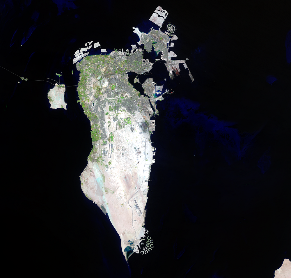
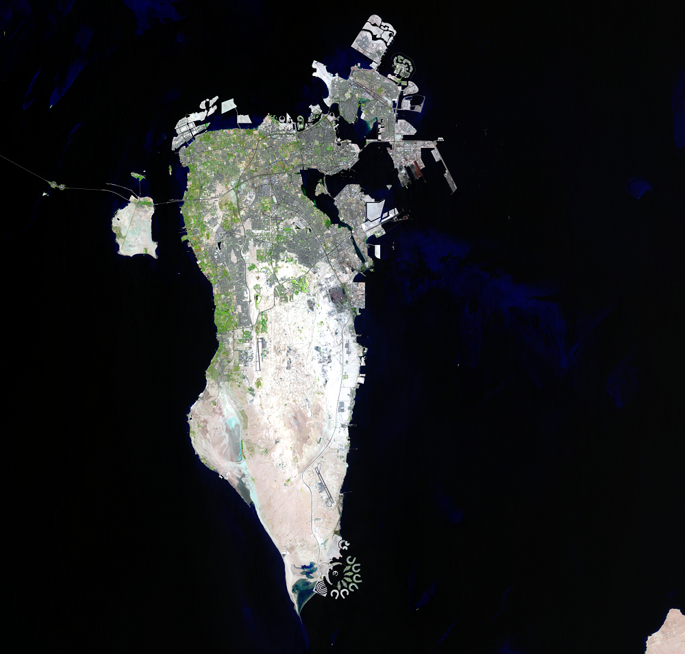
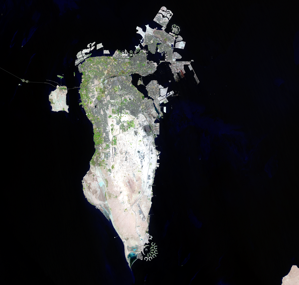
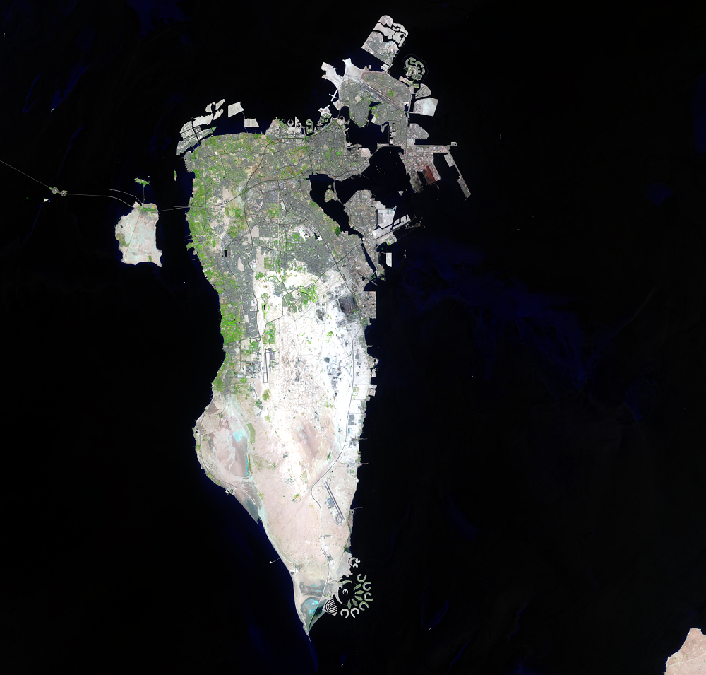
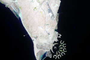
The most noticeable land change in these Landsat images is simply the addition of land itself. In Bahrain, a nation of 36 islands in the Middle East, the sea is shallow enough along the northern and eastern coast to make the addition of land relatively inexpensive.
The main Bahrain Island is about 990 square kilometers; however, it took less than two decades for the coastal zone of Bahrain to increase by about 40 square kilometers. All of this added land is dredged from the seabed in massive land reclamation projects.
Besides the large land additions, an obvious increase in urban areas dominates the images. Bahrain’s 1970 population was 213,000; in 2014 it was estimated to be 1,316,000. The country’s urban extent doubled between 1987 and 2013.
Imagery

Downloads
ASRY, [n.d.], Arab Shipbuilding and Repair Yard, Web site at http://www.asry.net/layout-and-facilities/. (Accessed April 22, 2015.)
Bahrain Airport Company, 2015, Bahrain Airport Company, Web site at http://www.bahrainairport.com/en.html. (Accessed April 22, 2015.)
Demographia, 2017, Demographia World Urban Areas—Built Up Urban Areas or World Agglomerations (13th ed.): Belleville, Ill., Demographia, 112p., accessed on August 25, 2017, at http://demographia.com/db-worldua.pdf.
Durrat Al Bahrain, [n.d.], Durrat Al Bahrain Web site at http://www.durratbahrain.com/. (Accessed April 22, 2015.)
Geospatial Technologies and Human Rights Project, 2014, Investigating Land Use and Land Cover Change in Bahrain—1987–2013: New York, American Association for the Advancement of Science, 22 p., available online at http://www.aaas.org/page/investigating-land-use-and-land-cover-change-bahrain-1987-2013. (Accessed April 22, 2015.)
Ministry of Information Affairs, 2015, Population and Demographics: Ministry of Information Affairs Web page at http://www.mia.gov.bh/en/Kingdom-of-Bahrain/Pages/Population-and-Demographic-Growth.aspx. (Accessed August 25, 2017.)
Ministry of Transportation and Telecommunications, 2015, Khalifa Bin Salman Port, Web site at http://mtt.gov.bh/content/khalifa-bin-salman-port. (Accessed April 22, 2015.)
Modara, M., Ait Belaid, M., and AlJenaid, S., 2014, Assessment of land-use/land-cover change in Muharraq Island using multi-temporal and multi-source geospatial data: International Journal of Image and Data Fusion, v. 5, no. 3, p. 210–225. (Also available online at http://www.tandfonline.com/doi/full/10.1080/19479832.2014.904446.)
NASA, 2011, Durrat Al Bahrain, Persian Gulf: NASA Earth Observatory, available at http://earthobservatory.nasa.gov/IOTD/view.php?id=49117. (Accessed April 22, 2015.)
NASA, 2014, Looking at Urban Expansion in Bahrain: NASA Landsat Science Web page at http://landsat.gsfc.nasa.gov/?p=8239. (Accessed April 22, 2015.)
Noor Al-Nabi, Mohammad, 2012, The History of Land use and Development in Bahrain: Bahrain, Information Affairs Authority, 345p.
Zainal, K., Al-Madany, I., Al-Sayad, H., Khamis, A., Al Shuhaby, S., Al Hisaby, A., Elhoussiny, W., and Khalaf, E., 2012, The cumulative impacts of reclamation and dredging on the marine ecology and land-use in the Kingdom of Bahrain: Marine Pollution Bulletin, v. 64, no. 7, p. 1452–1458. (Also available online at http://www.sciencedirect.com/science/article/pii/S0025326X12001567.)
Related Content
Durrat Al Bahrain
At the southern end of Bahrain is a sight that can only really be appr...
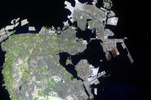
Manama
Bahrain’s capital is Manama, a city with an estimated population of 1,...