

Mining
Earth Resources Observation and Science (EROS) Center - Earthshots
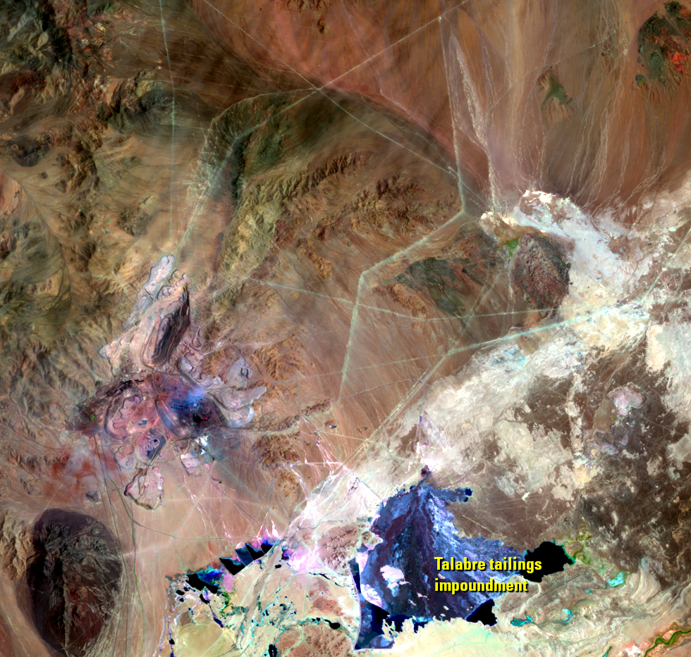
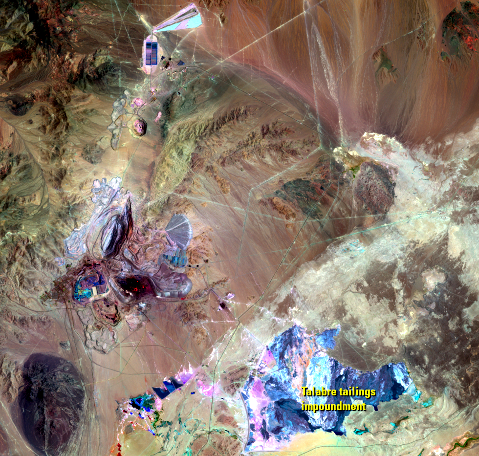
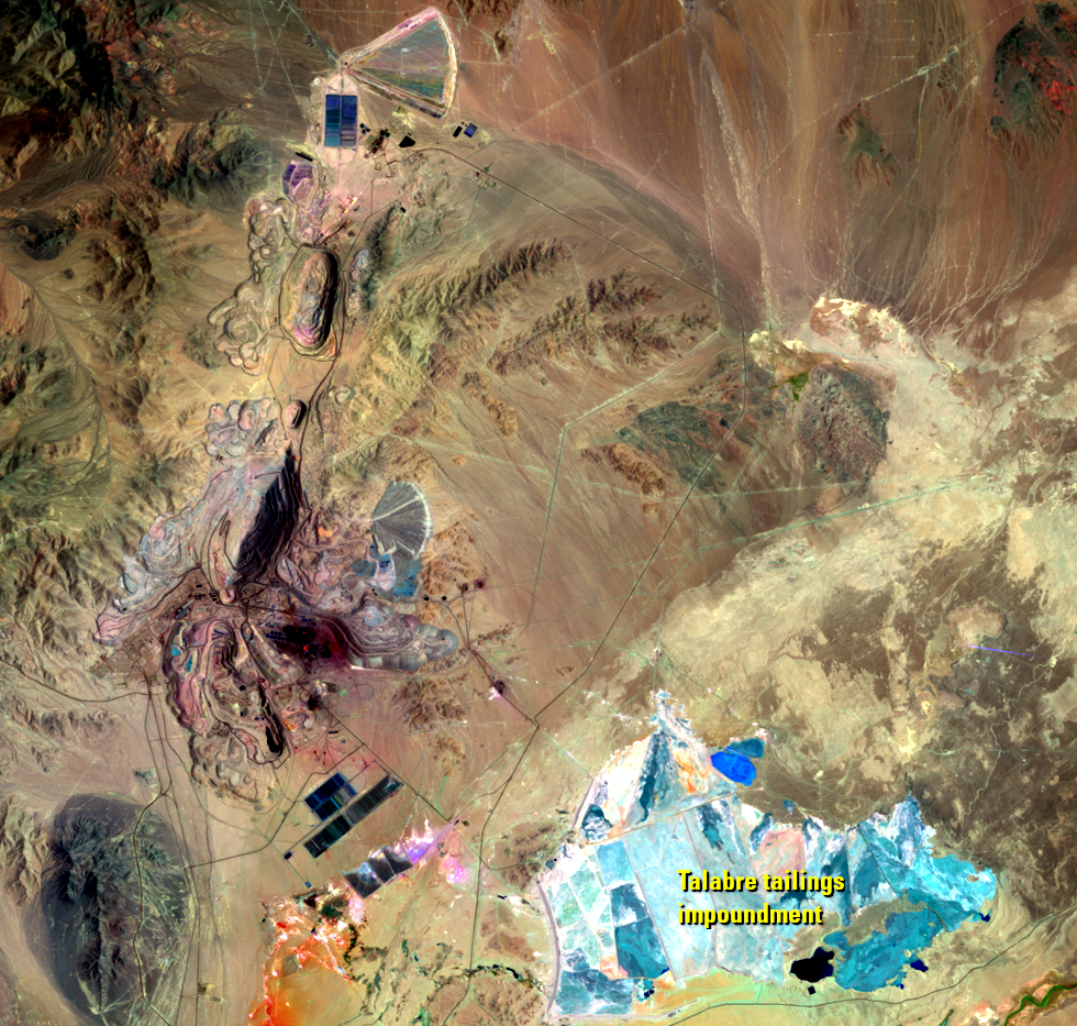
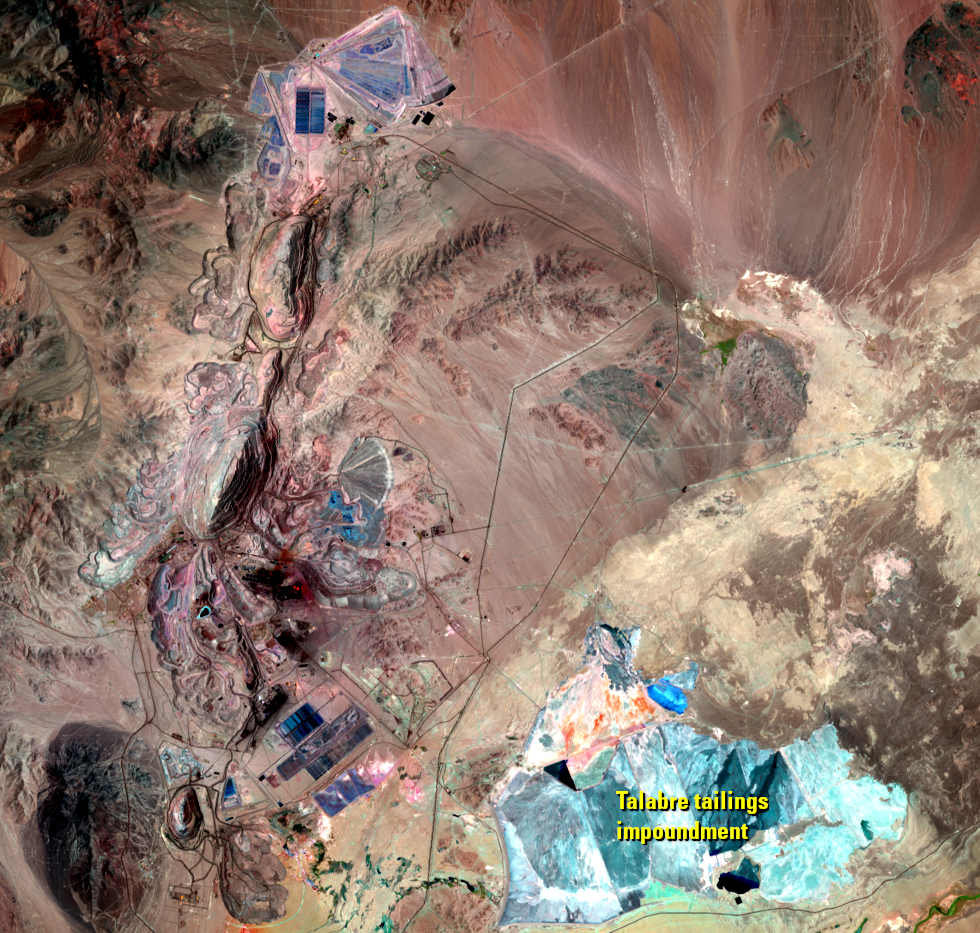
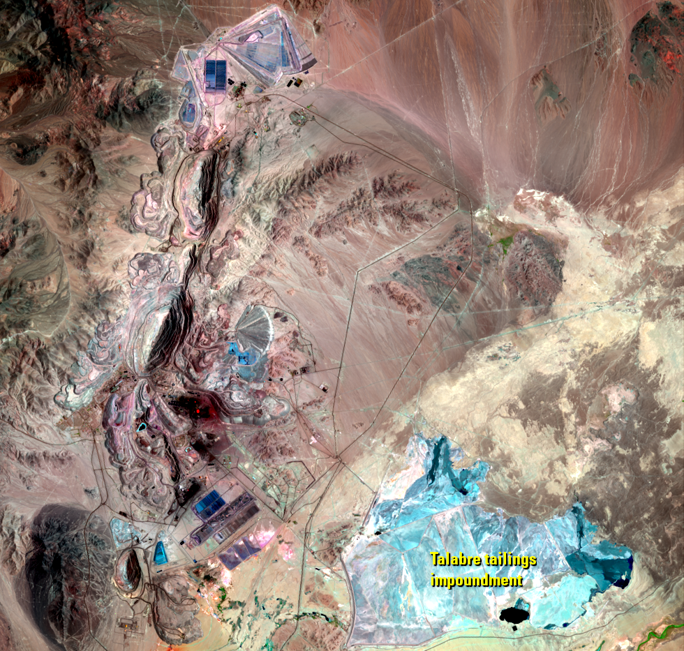
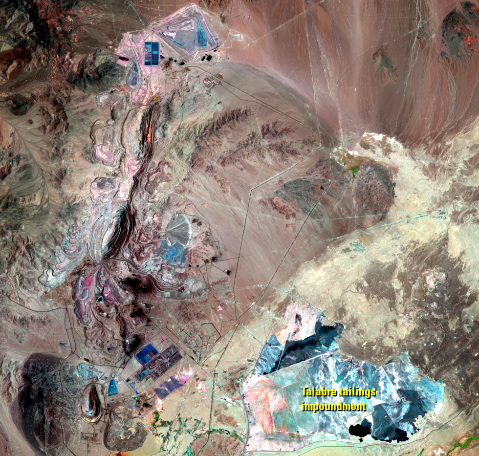
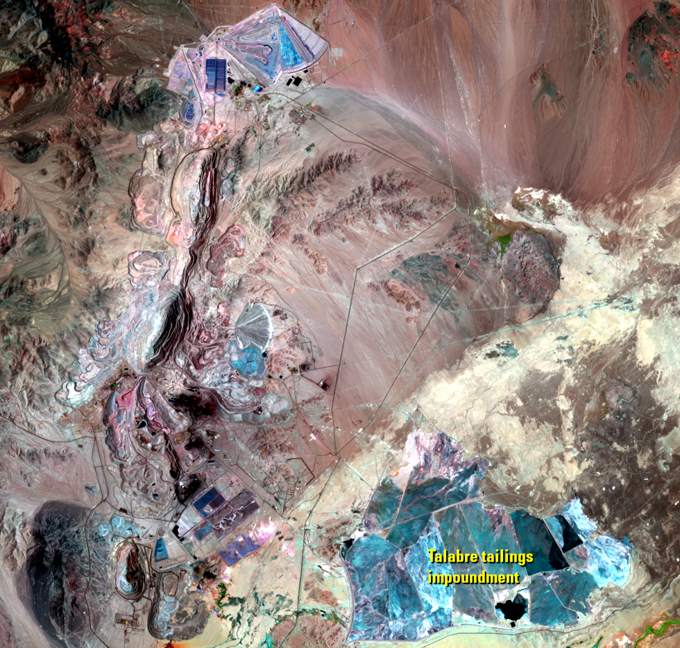
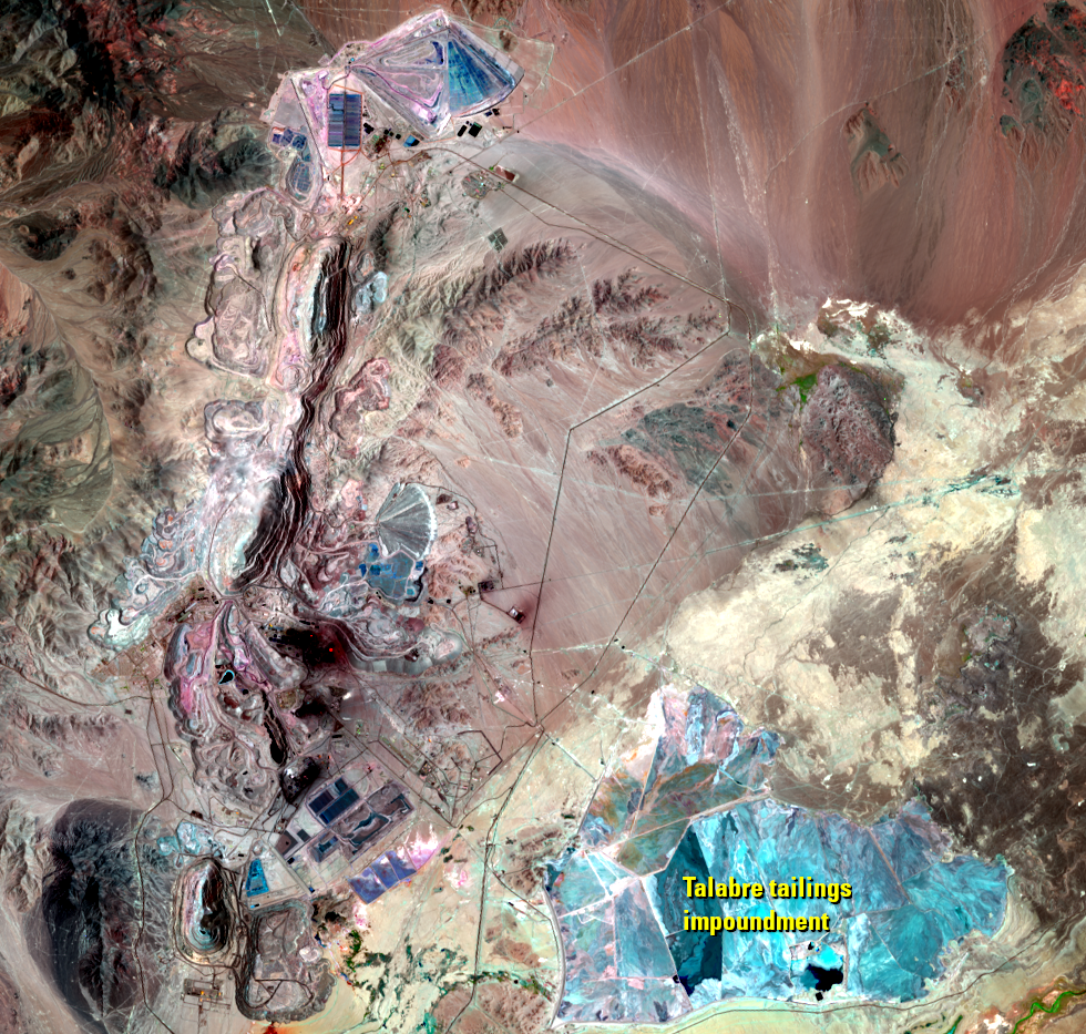
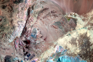
As part of the mining, huge amounts of material are dug up and removed. The ore is crushed within the pit, and conveyors bring the ore to the mill.
New pits open up as the time series of Landsat images progresses. Landsat shows not only the expansion of the mining pits but also the extent of the material piled up alongside the pits.
The shifting shape of gray and blue on the right is the Talabre tailings impoundment. The Talabre is a natural depression, and the tailings, the materials left over after the ore is extracted, are dumped into several basins. The basins are separated with dikes, and the impoundment is bordered by dams, all made with dry tailings.
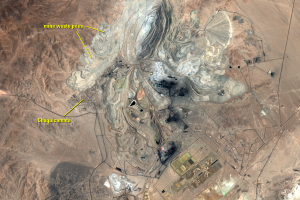
An underground mining operation is now underway. Testing indicates that 2.3 billion tons of copper ore lie below the open pit. Underground mining began operations in 2019.
Imagery
Downloads
Related Content
Chuquicamata Mine, Chile
The Atacama Desert of northern Chile has minimal vegetation. But it ha...
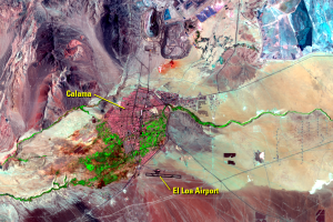
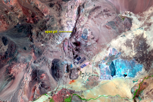
Calama
As expected in the Atacama Desert, Landsat doesn’t detect much vegetat...
Mining
As part of the mining, huge amounts of material are dug up and removed...
Moving a Town
The town of Chuquicamata was established as a mining camp when mining ...