

Mount Pinatubo, Philippines
Earth Resources Observation and Science (EROS) Center - Earthshots
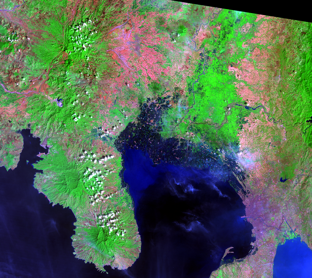
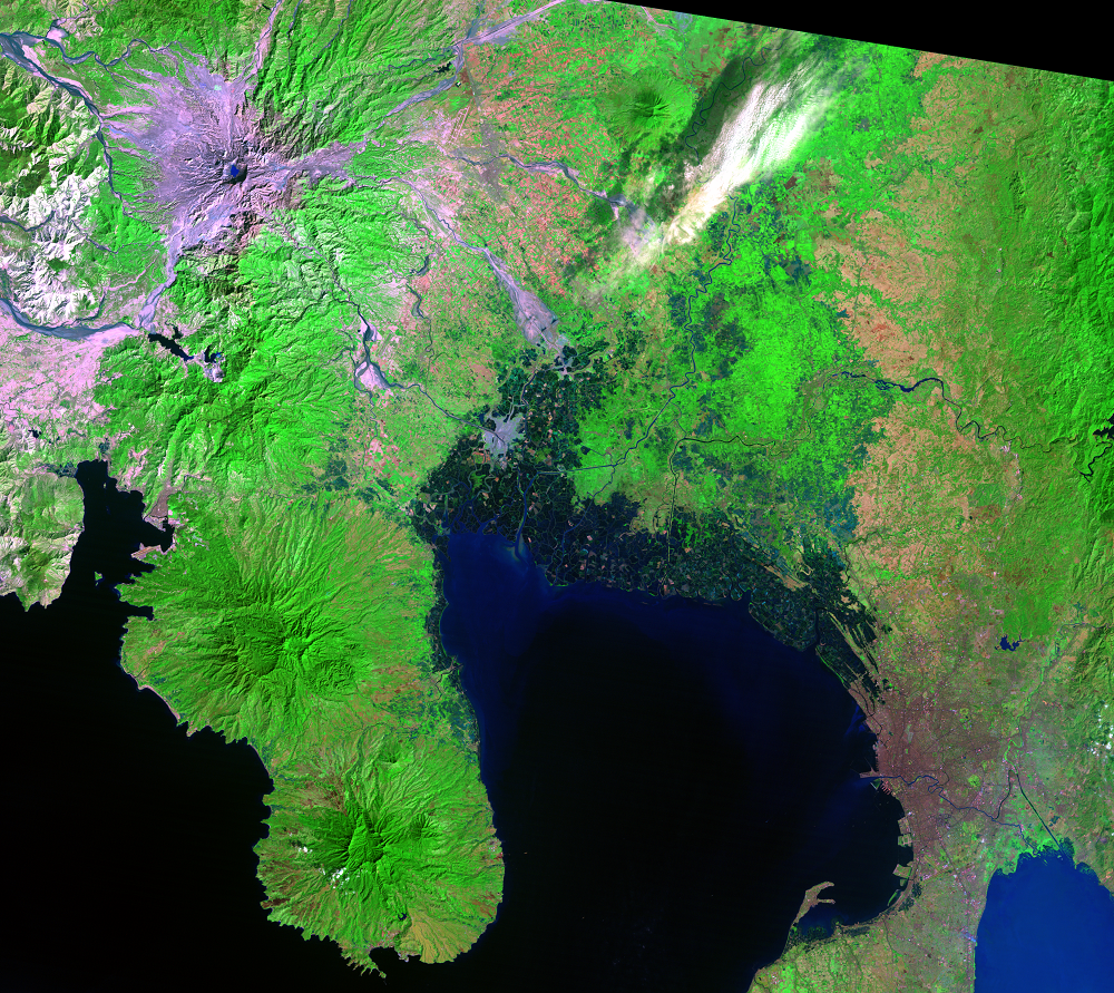
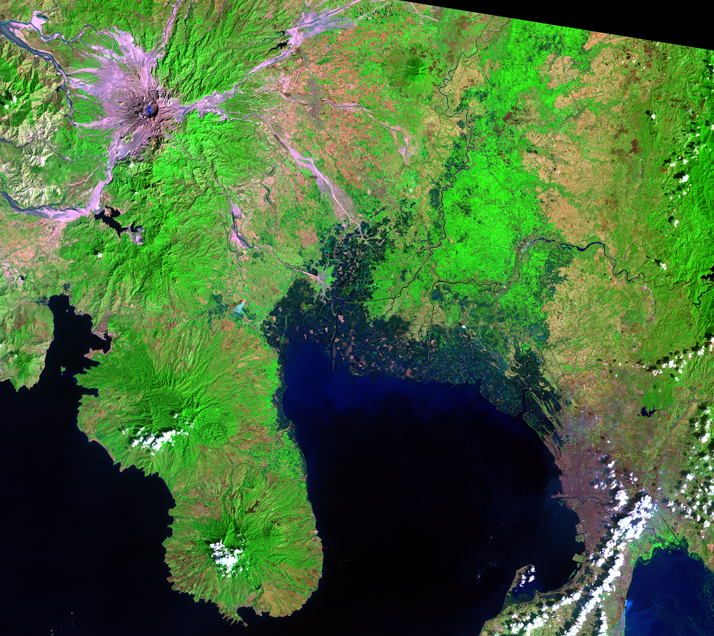
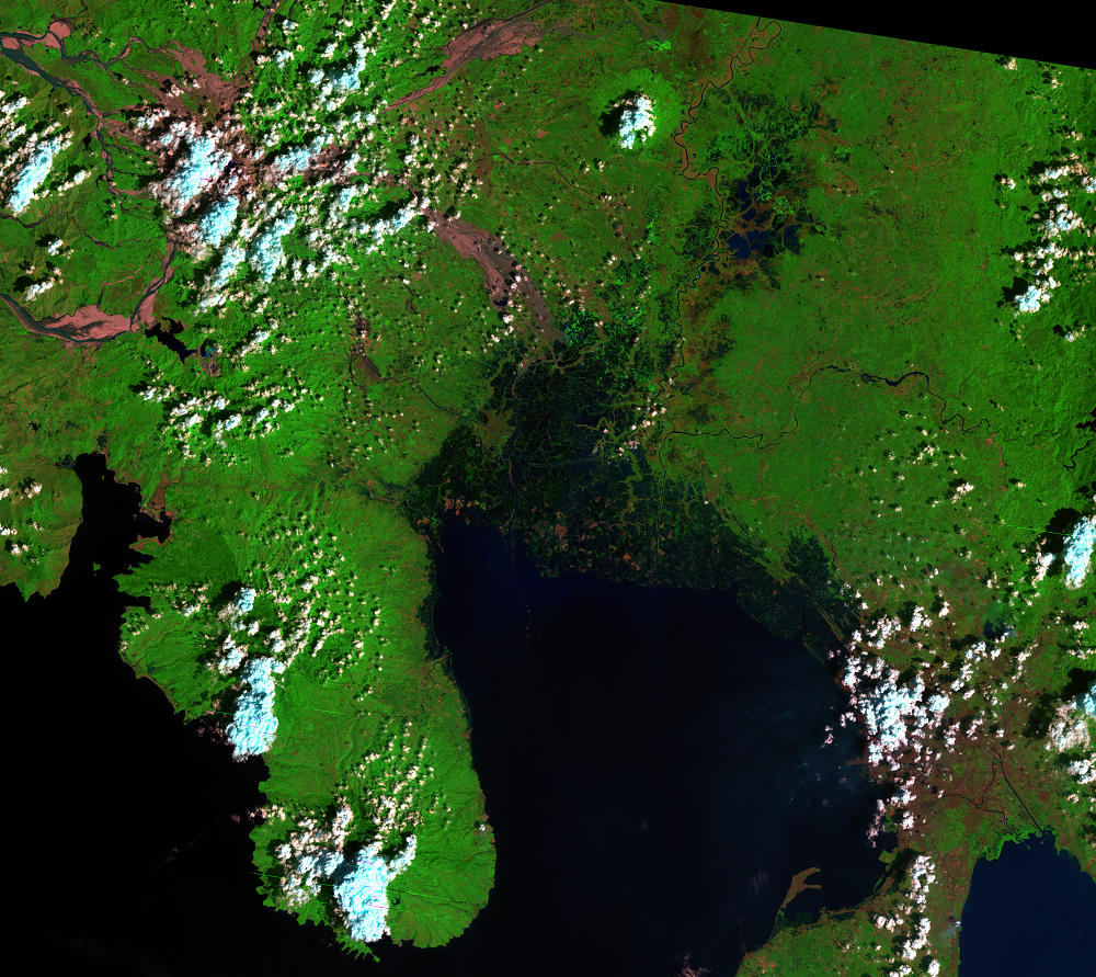
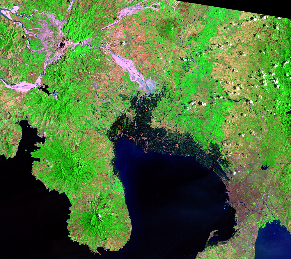
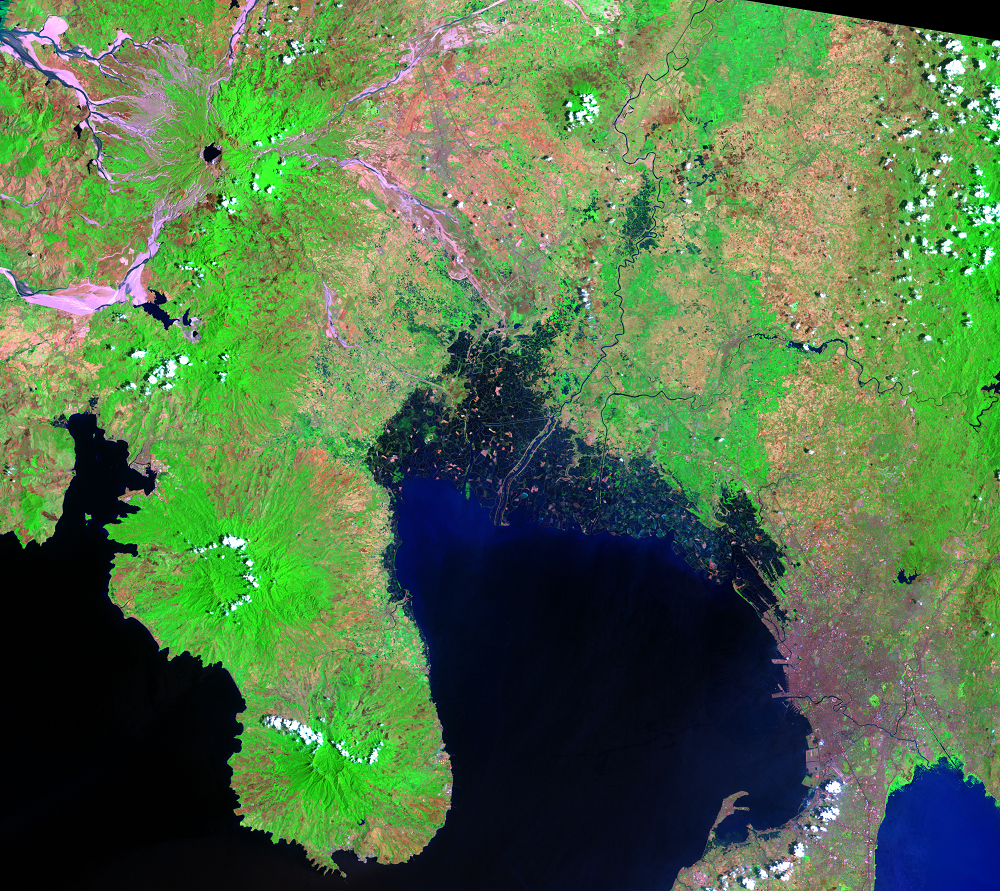
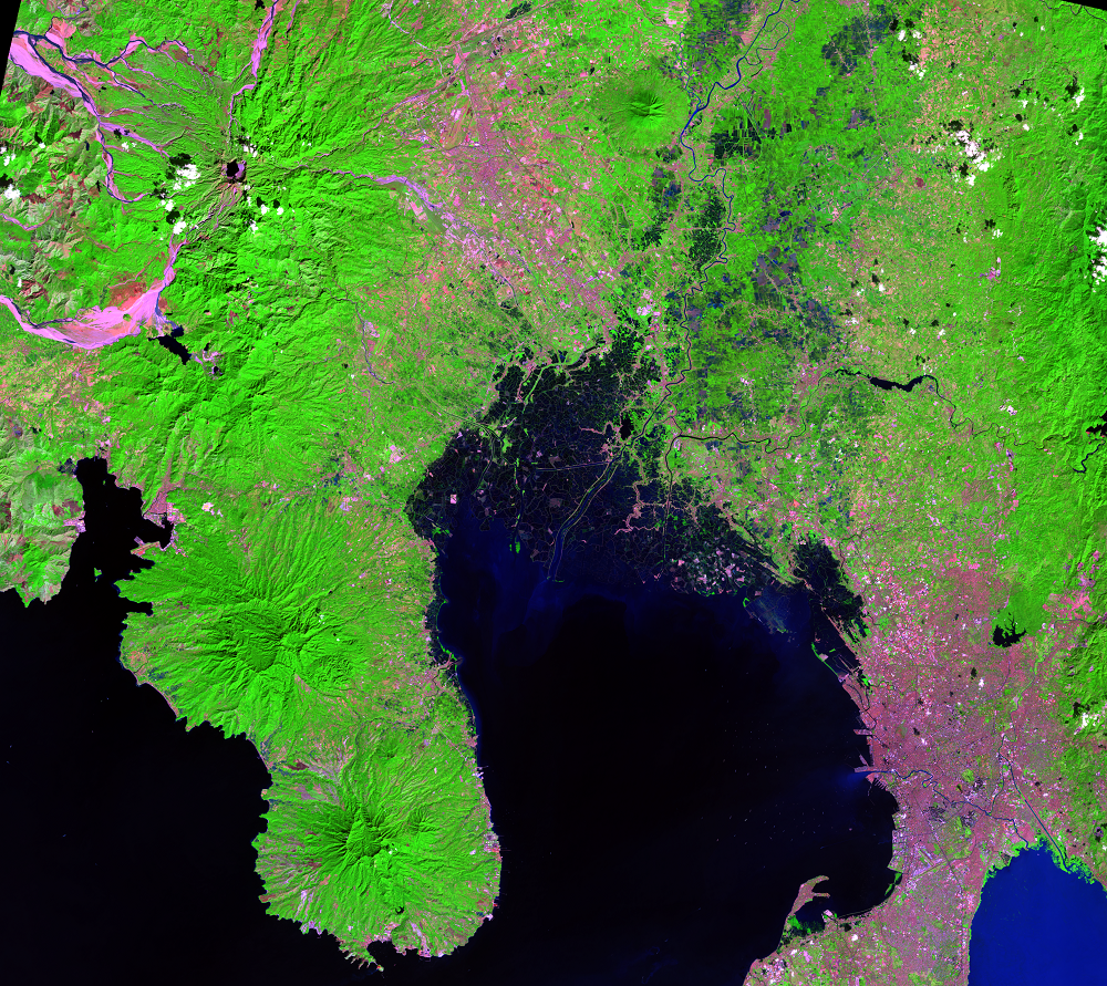
Mount Pinatubo had likely been dormant for hundreds of years. There had been no historical records of volcanic eruptions. Local residents in this part of the Philippines hardly believed Pinatubo was a volcano, so it was difficult to convince them to evacuate once it began showing signs of an eruption throughout the spring of 1991. When it did erupt explosively on June 15, 1991, it was one of the largest volcanic eruptions of the 20th century.
The ash cloud rose 40 kilometers high, and volcanic ash blanketed the region. Making the disaster worse was the arrival of Typhoon Yunya, which hit on the same day. The heavy rains from the storm sent flows of mud and volcanic debris rushing down the mountainside in all directions. Rice and sugarcane fields were smothered. Rooftops collapsed from the weight of ash saturated with rain. Nearly all bridges within 29 kilometers of the mountain were destroyed.
Today, the mountain is relatively quiet, and about 300 meters shorter than it was before the eruption.
Landsat’s historical record reveals the changes and regrowth as it happens, something that can’t be witnessed from the ground. Furthermore, images from the Advanced Spaceborne Thermal Emission and Reflection Radiometer (ASTER) sensor on NASA’s Terra satellite add more information about the changes to the mountain and surrounding region. Data from these satellites can help us analyze a larger area in a much shorter amount of time than ground surveys, providing valuable information for local decision making.

Imagery

Downloads
Cole, S., 2000, When Rivers of Rock Flow: NASA Earth Observatory, accessed April 6, 2017, at https://earthobservatory.nasa.gov/Features/Lahars/.
Demographia, 2016, Demographia World Urban Areas—Built-Up Urban Areas or World Agglomerations (12th ed.): Belleville, Ill., Demographia, 110 p., available online at http://demographia.com/db-worldua.pdf.
Hayes, S.K., Montgomery, D.R., and Newhall, C.G., 2002, Fluvial sediment transport and deposition following the 1991 eruption of Mount Pinatubo: Geomorphology, v. 45, no. 3–4, p. 211–224.
Jochen Zschau, Andreas N. Küppers, eds., 2013, Early Warning Systems for Natural Disaster Reduction: Springer Science & Business Media, 834 p.
Mouginis-Mark, P., 2004, Post Eruption Hazards at Mt. Pinatubo, Philippines: Final Report NAG5-7578, University of Hawaii at Manoa, accessed April 6, 2017, at https://ntrs.nasa.gov/search.jsp?R=20040112061.
NASA, [n.d.], Aerosols, Floods, and Mudslides: NASA Earth Observatory, accessed April 6, 2017, at https://earthobservatory.nasa.gov/Features/AstronautPinatubo/astronaut_pinatubo2.php.
NASA, [n.d.], Landsat Looks at Mt. Pinatubo: NASA Scientific Visualization Studio, accessed April 6, 2017, at https://svs.gsfc.nasa.gov//stories/pinatubo_20010618/images.html.
Newhall, C.G., and Punongbayan, R.S. (eds.), 1996, Fire and Mud—Eruptions and Lahars of Mount Pinatubo, Philippines: USGS, accessed April 6, 2017, at https://pubs.usgs.gov/pinatubo/prelim.html.
Smithsonian Institution, 2013, Pinatubo: Smithsonian Institution National Museum of Natural History Global Volcanism Program, accessed April 6, 2017, at http://volcano.si.edu/volcano.cfm?vn=273083.
Swarts, P., 2016, New air contingent in Philippines will bolster relations but could aggravate China: Air Force Times, accessed April 6, 2017, at https://www.airforcetimes.com/news/your-air-force/2016/04/23/new-air-contingent-in-philippines-will-bolster-relations-but-could-aggravate-china.
Torres, R., Mouginis-Mark, P., Self, S., Garbeil, H., Kallianpur, K., and Quiambao, R., 2004, Monitoring the evolution of the Pasig–Potrero alluvial fan, Pinatubo Volcano, using a decade of remote sensing data: Journal of Volcanology and Geothermal Research, v. 138, no. 3–4, p. 371–392.
USGS, 2016, Lahars move rapidly down valleys like rivers of concrete: USGS Volcano Hazards Program, accessed April 6, 2017, at https://volcanoes.usgs.gov/vhp/lahars.html.
Volcano Discovery, [n.d.], Chronology of the 1991 eruption of Pinatubo volcano, Philippines: Volcano Discovery, accessed April 6, 2017, at https://www.volcanodiscovery.com/pinatubo/chronology-1991-eruption.html.
Wendel, J., and Kumar, M., 2016, Pinatubo 25 Years Later—Eight Ways the Eruption Broke Ground: Eos, v. 97, accessed April 6, 2017, at https://doi.org/10.1029/2016EO053889.
Westby, E., and Gordon, L.C., 2016, Remembering Mount Pinatubo 25 Years Ago—Mitigating a Crisis: USGS, accessed April 6, 2017, at https://www.usgs.gov/news/remembering-mount-pinatubo-25-years-ago-mitigating-crisis.
Wright, R., Harris, A.J.L., Torres, R., and Flynn, L.P., 2015, The effects of volcanic eruptions observed in satellite images—Examples from outside the North Pacific region, in Dean, K.G., and Dehn, J. (eds.), Monitoring Volcanoes in the North Pacific: Berlin, Springer-Verlag, pp. 323–354.
Related Content
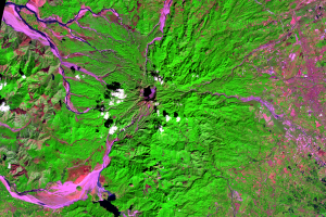
Eruption
After the eruption, many areas near the volcano were stripped of veget...
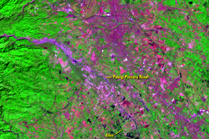
Pasig-Potrero
The Pasig-Potrero River drains the east side of Mount Pinatubo, just s...
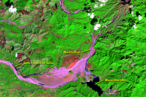
Mapanuepe Lake
The lahars produced by Pinatubo’s eruption blocked the flow of the Map...