

Øresund Link
Earth Resources Observation and Science (EROS) Center - Earthshots
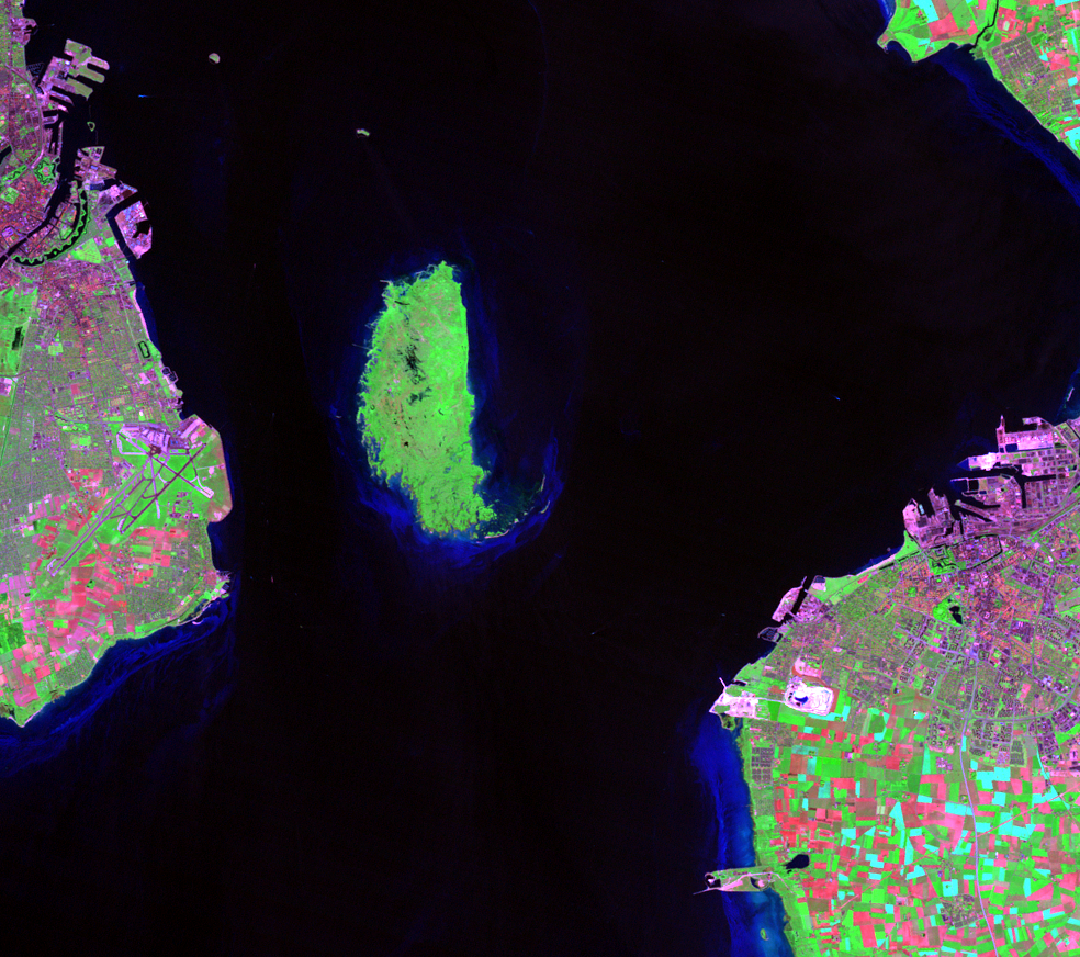
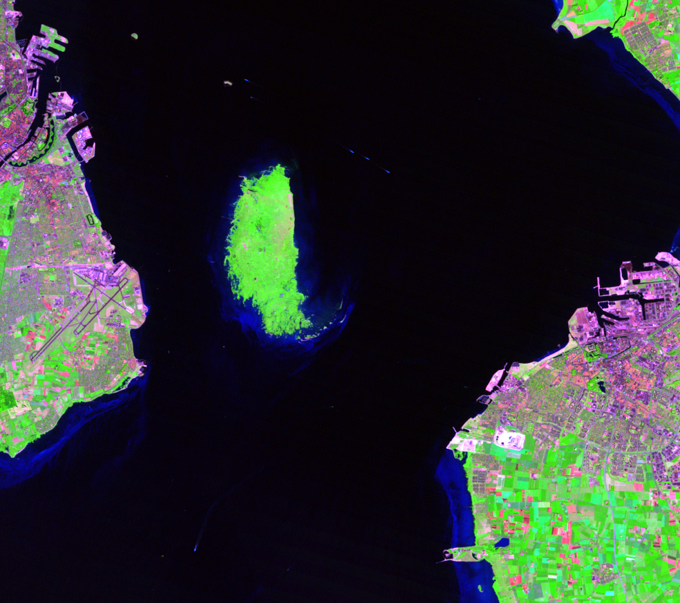
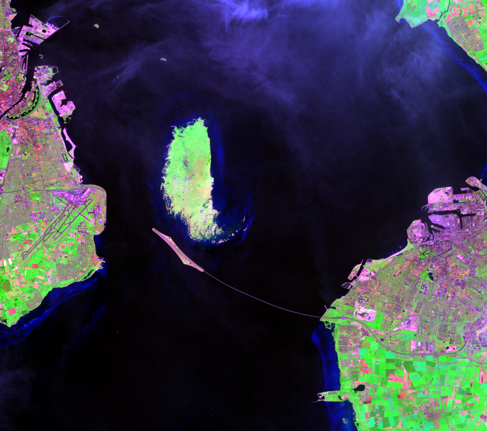
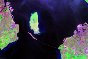
An artificial island first appears in the Øresund Strait in the 1998 image. The 4-km-long (2.5-mile-long) island is called Peberholm and was built from material dredged from the seabed. It’s a key point in the construction of the Øresund Link, which connects Copenhagen and Malmö.
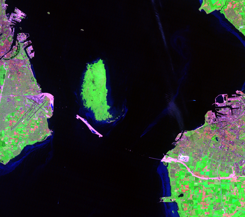
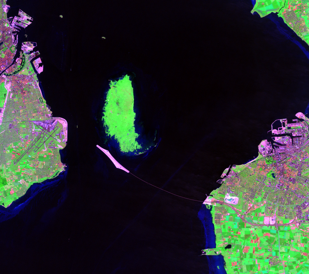
Open for traffic since 2000, the Øresund Link is made up of three segments. Starting from Copenhagen on the northern end of the airport, the link begins with an underwater tunnel that is 3,510 meters (2.2 miles) long. The roadway on Peberholm Island is 4,055 meters (2.5 miles) long. Finally, Øresund Bridge spans the rest of the strait to Malmö. The cable-stayed bridge is 7,845 meters (4.9 miles) long and is visible as the thin line curving from the island to Malmö.
Imagery
Downloads
Related Content
Copenhagen, Denmark
Often described as one of the world’s best cities to live, Copenhagen ...
Five Finger Plan
In 1947, Copenhagen established the Five Finger Plan. The plan for the...
Nordhavn
One solution to accommodate Copenhagen’s population growth is to grow ...
Øresund Link
An artificial island first appears in the Øresund Strait in the 1998 i...