

Salt and Farming
Earth Resources Observation and Science (EROS) Center - Earthshots
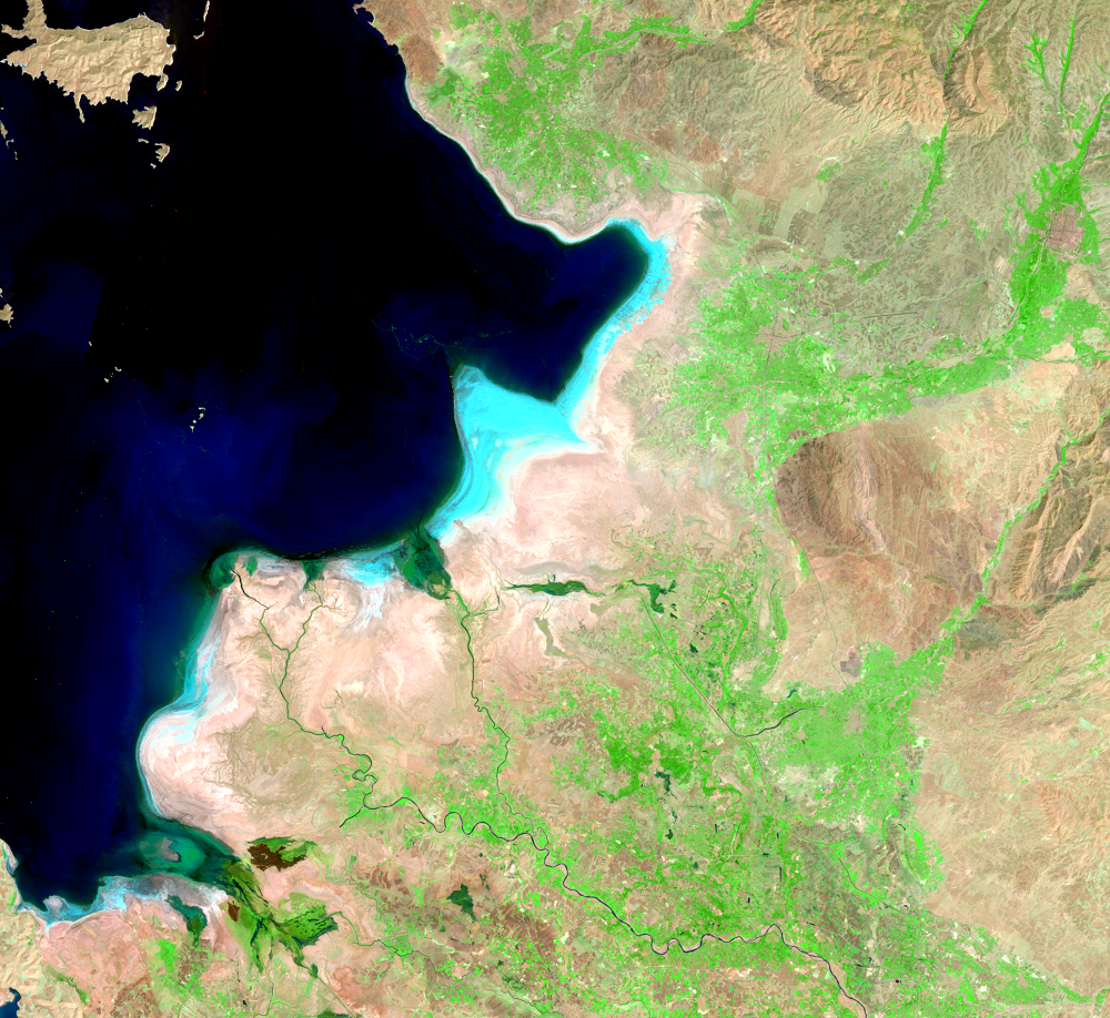
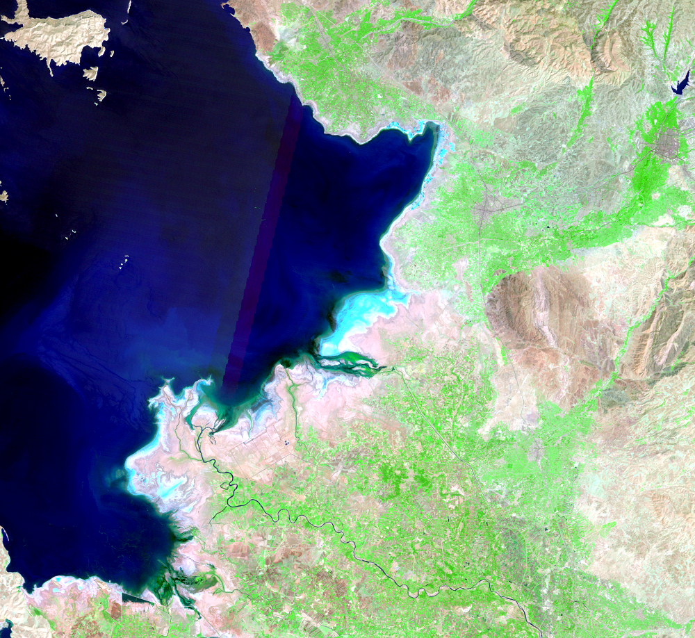
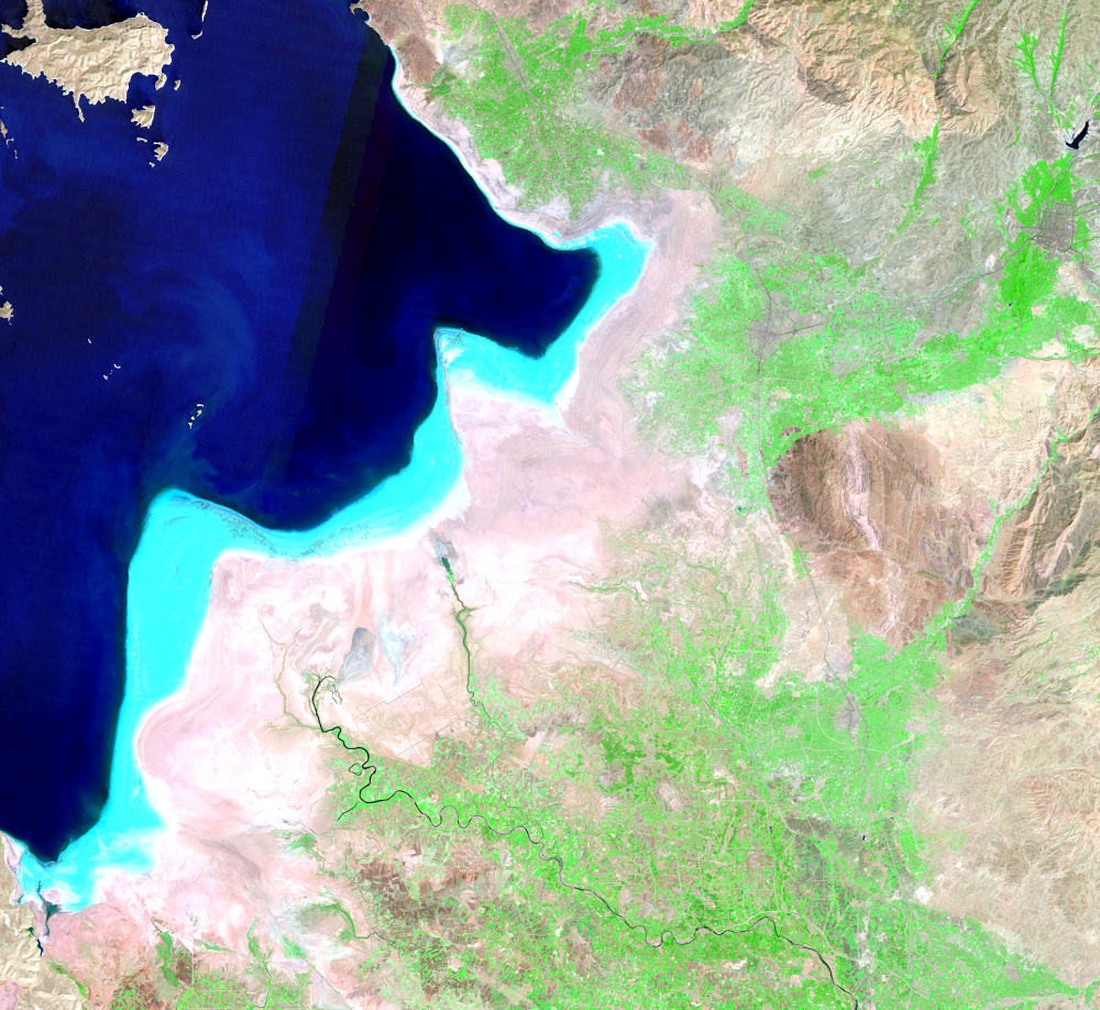
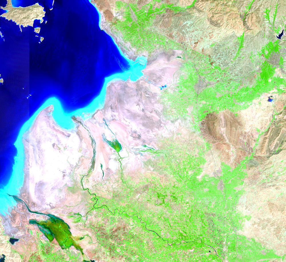
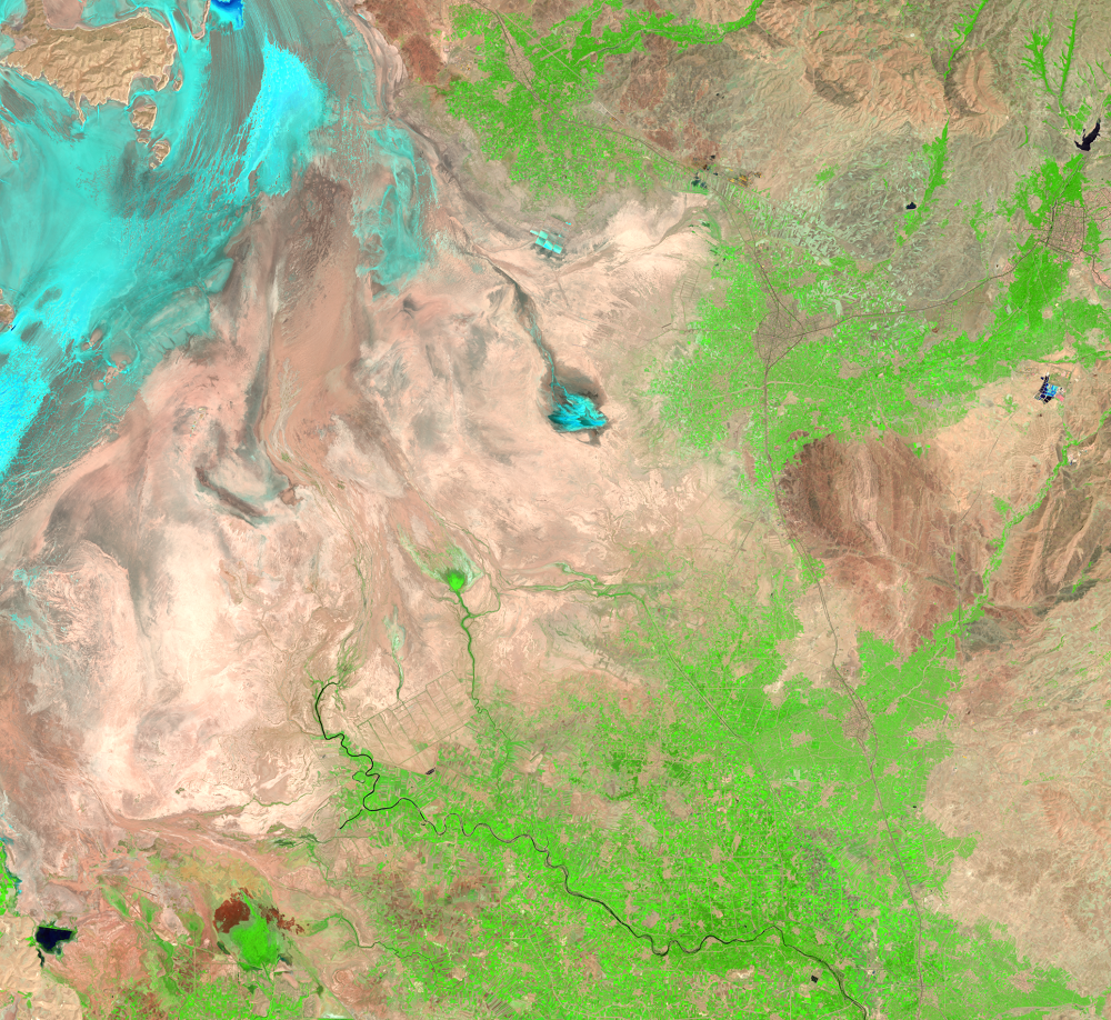
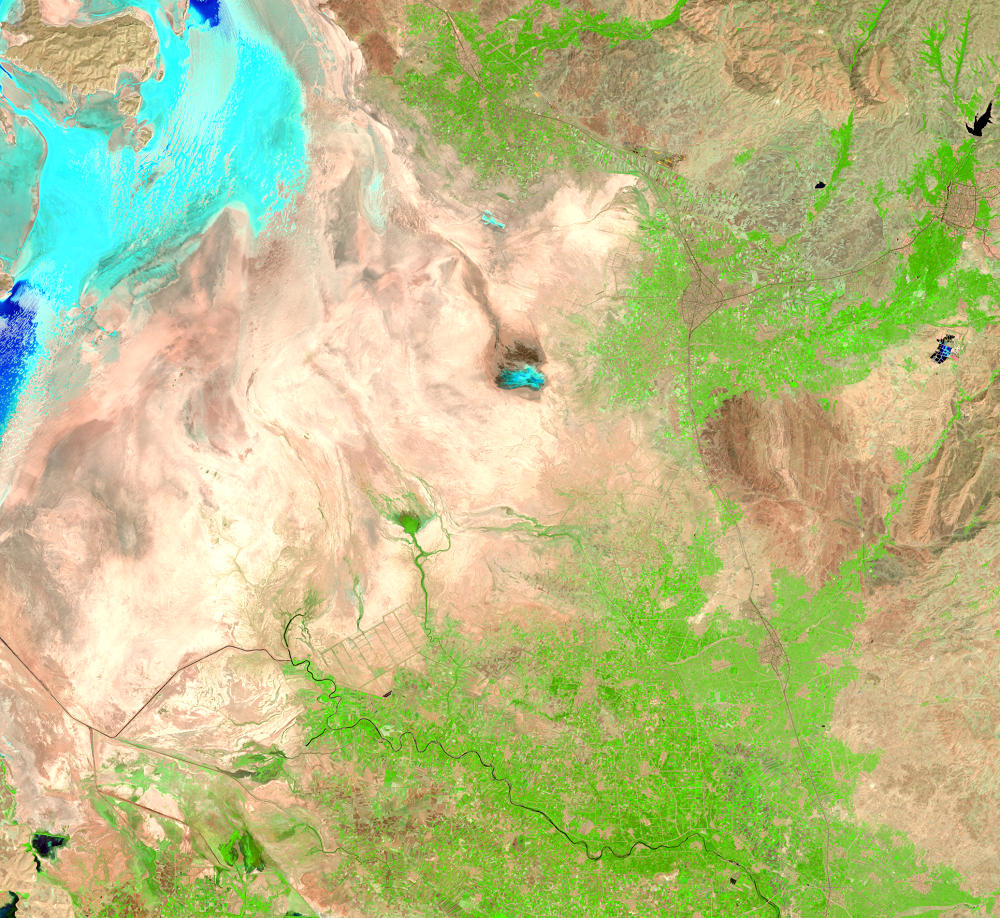
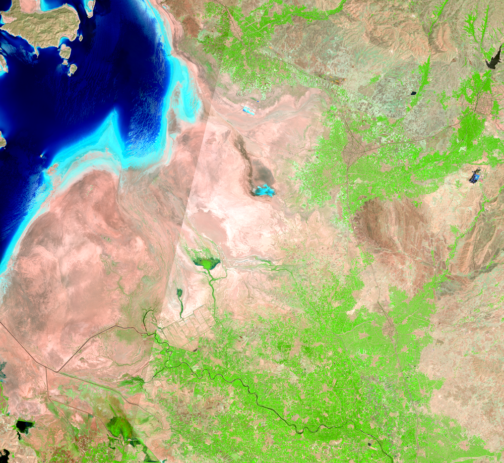
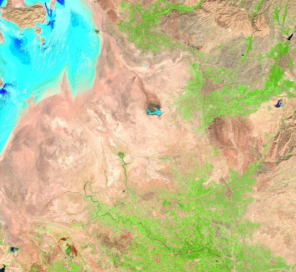
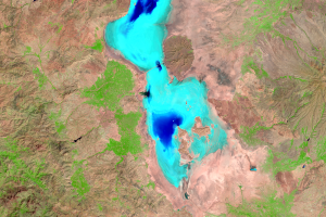
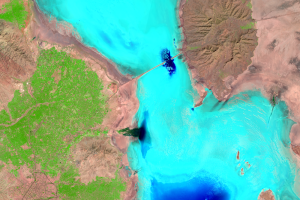
Lake Urmia is a hypersaline lake. Rivers carry sediments and minerals to the lake, and as the lake water evaporates, the minerals remain. As a result, the salts in the lake become more concentrated and the water becomes increasingly more saline.
As the lake’s water recedes, the salty lakebed is exposed. Light blue or pale shades fringe the lake’s shoreline in these images. These salt flats do not support agriculture, and this salty desert could cause windblown salt to damage nearby fields. A similar phenomenon is happening in the vicinity of the Aral Sea.
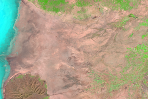
Crops are grown near rivers that flow into Lake Urmia. Green fields mark these river deltas, such as the ones shown southeast of the lake. With little precipitation in this region, farming depends on irrigation from the rivers. An increasing population is putting more pressure on water resources. Much of the streamflow from these rivers no longer reaches the lake.
Imagery

Downloads
Related Content
Lake Urmia, Iran
Lake Urmia in Iran is another closed basin lake that has been shrinkin...
Causes and Plans
The diversion of water from the rivers for agricultural use is probabl...
Populations
About 76 million people live within 500 kilometers (310 miles) of Lake...
Salt and Farming
Lake Urmia is a hypersaline lake. Rivers carry sediments and minerals ...