

San Cristóbal Volcano
Earth Resources Observation and Science (EROS) Center - Earthshots
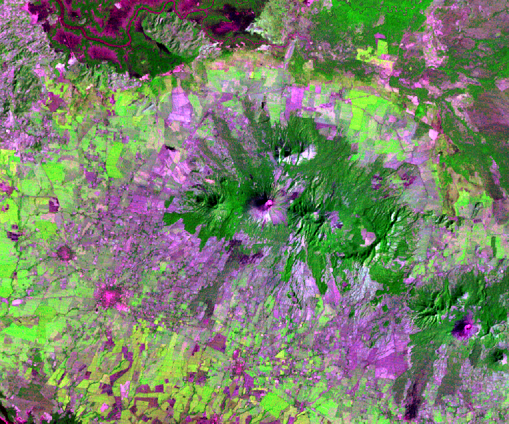
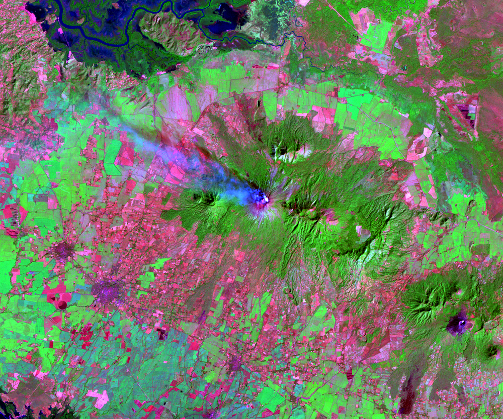
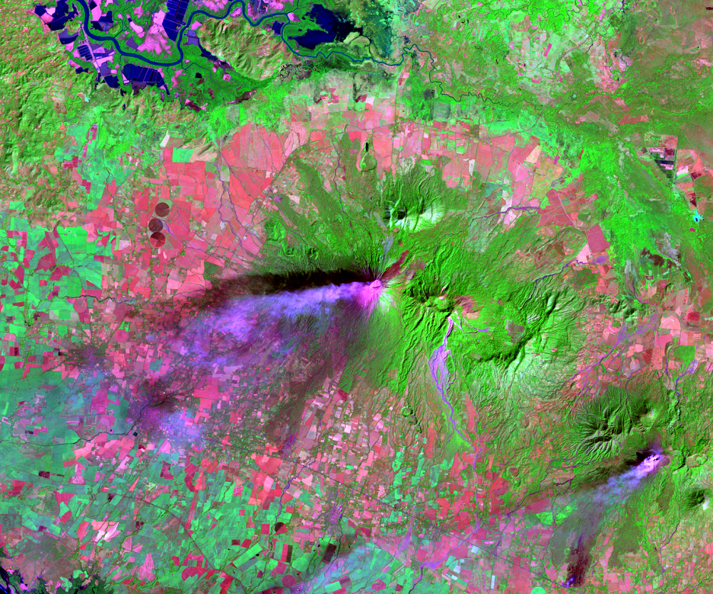
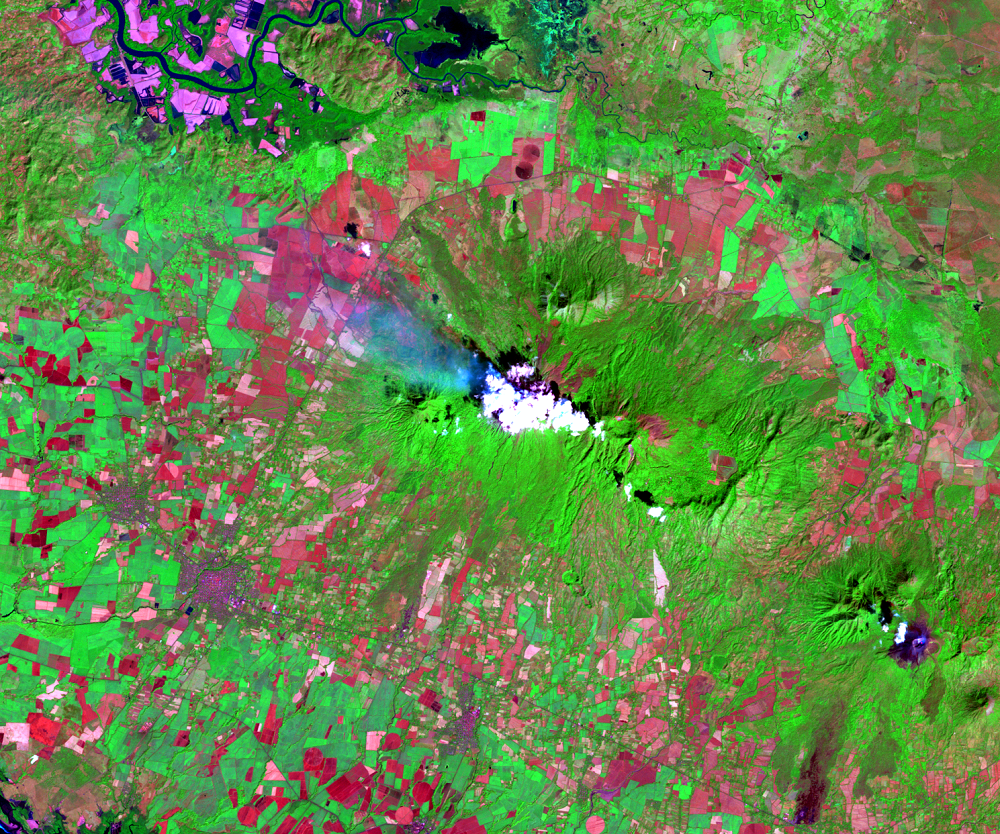
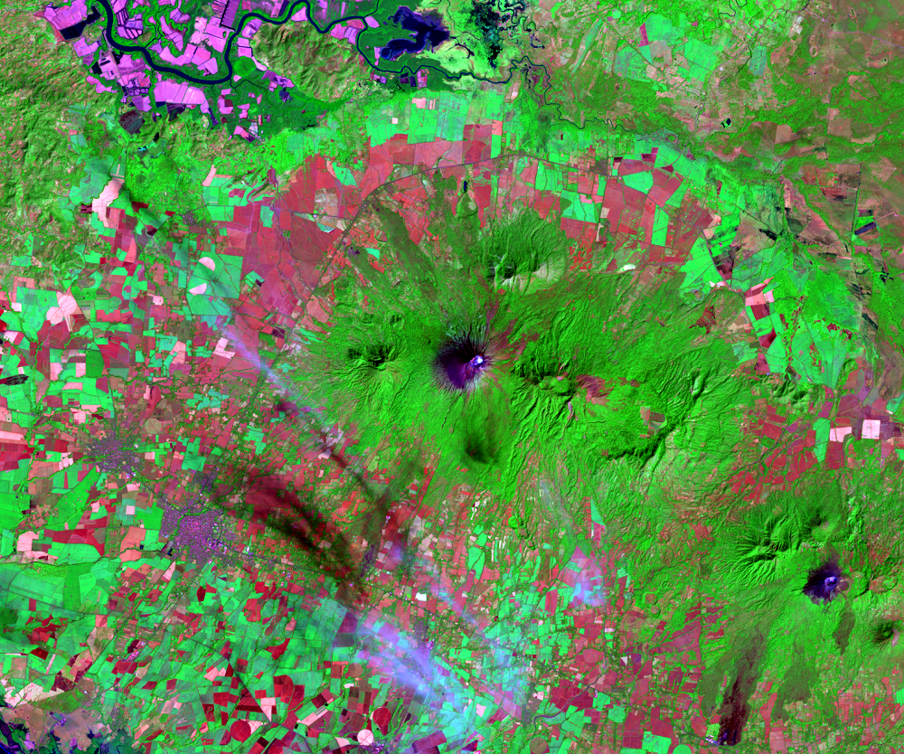
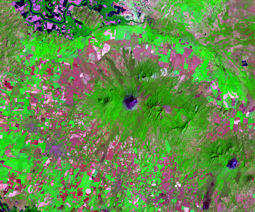
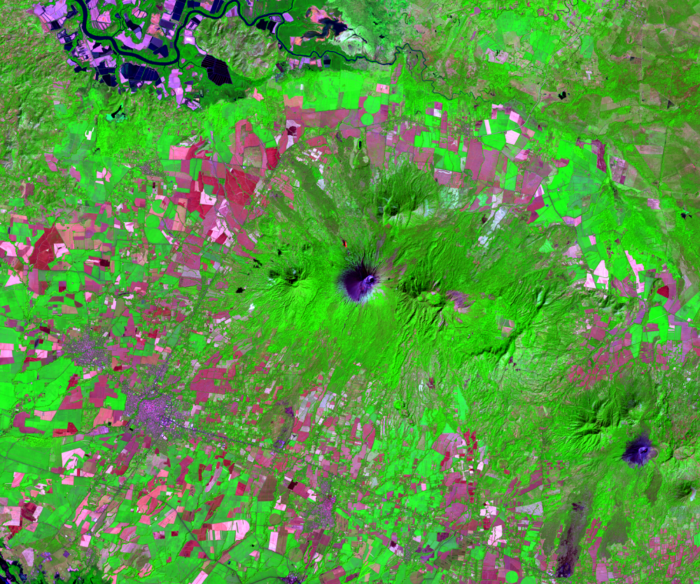
In the lower right corner of the main images, you can see Nicaragua’s San Cristóbal volcano, which shows some activity in two of the images. Ash can be seen in the 1987 and 2000 images thinly streaming from the summit. San Cristóbal is Nicaragua’s highest volcano—its summit is 1,745 meters above sea level. Small to moderate eruptions have been reported since the 16th century.
You might also notice in the 2000 image another active volcano. Telica is southeast of San Cristóbal. The ash streaming from its peak is evidence of its recent activity.
Imagery
Downloads
Related Content
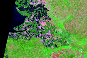
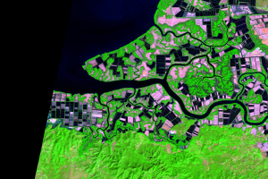
Gulf of Fonseca, Honduras and Nicaragua
Honduras is one of Latin America’s top producers of cultured shrimp. S...
Environmental Effects
The environmental implications of the shrimp farm expansion are potent...
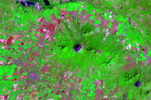
San Cristóbal Volcano
In the lower right corner of the main images, you can see Nicaragua’s ...
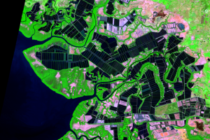
Shrimp Farming
The area around the Gulf of Fonseca is ideal for shrimp farming. Shrim...