

Seno Plain, Mali
Earth Resources Observation and Science (EROS) Center - Earthshots
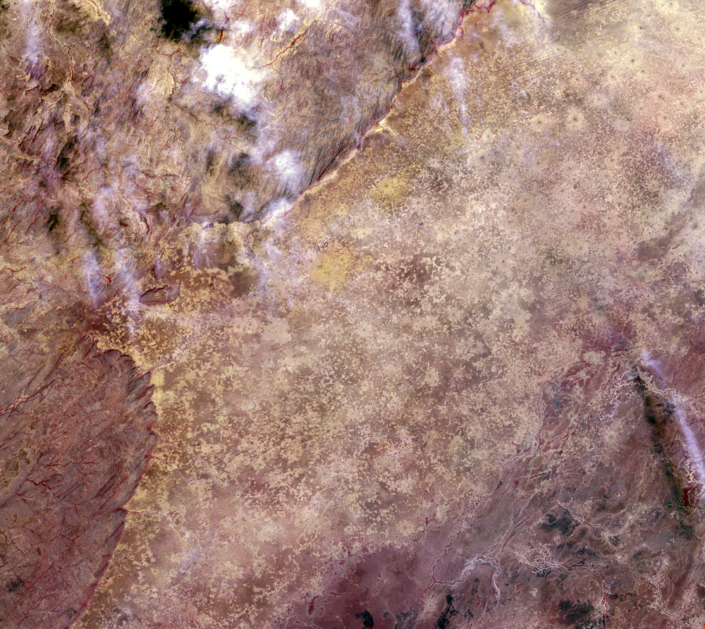
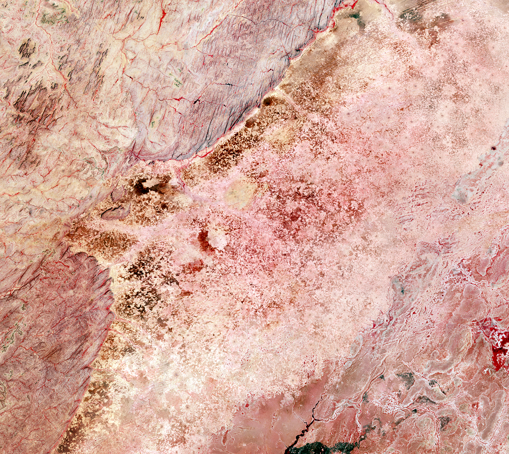
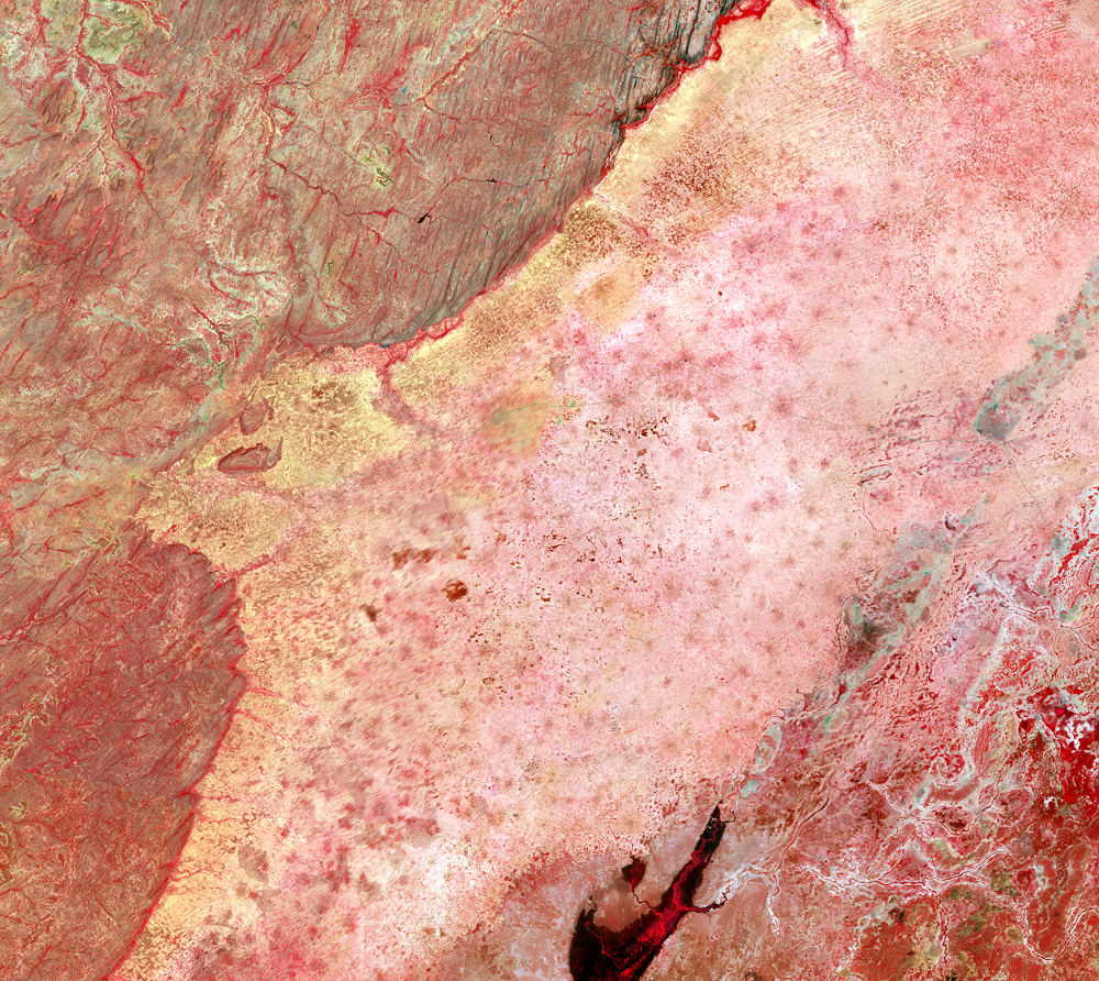
On the Seno Plain of Mali, the population has more than doubled since 1972. In this wide view of the region, the Seno Plain sweeps from lower left to upper right. The feature to the left is the Bandiagara escarpment, with a rocky plateau to the west. The rocky surface on this plateau is not suitable for agriculture. So the plain, which is 200 meters lower than the plateau, is where there is increasing demand for agricultural land as the population grows.
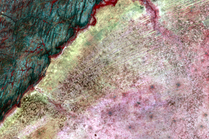
Growing vegetation is indicated by red tones in these Landsat images, which are visible and near-infrared composites. These images are from the dry season, so cropland is indicated by bright tones.
Villages are scattered throughout the Seno Plain. They increase in size throughout the series of images. In the 1972 and 1986 images, the villages are the dark spots surrounded by a light color. Those light areas are cropland surrounding each village. In the 2016 image, the light-colored areas merge, and the dark spots stand out as the location of the villages. The population of these villages ranges from a few hundred to several thousand.
Imagery
Downloads
CILSS, 2016, Landscapes of West Africa—A window on a changing world: Garretson, S. Dak., U.S. Geological Survey, EROS, 219 p., at https://eros.usgs.gov/westafrica/.
Satellite Imaging Corporation, 2017, WorldView-2 Satellite Sensor: Satellite Imaging Corporation, accessed July 14, 2017, at http://www.satimagingcorp.com/satellite-sensors/worldview-2/.
Spiekermann, R., Brandt, M., and Samimi, C., 2015, Woody vegetation and land cover changes in the Sahel of Mali (1967–2011): International Journal of Applied Earth Observation and Geoinformation, v. 34, p. 113–121. Available online at http://www.sciencedirect.com/science/article/pii/S0303243414001718.
Tappan, Gray, USGS Earth Resources Observation and Science (EROS) Center, 2018, personal communication.
USGS, 2015, Declassified Satellite Imagery—1: USGS Long Term Archive, accessed July 14, 2017, at https://lta.cr.usgs.gov/declass_1.
Related Content
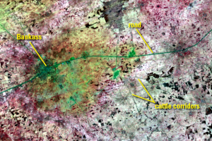
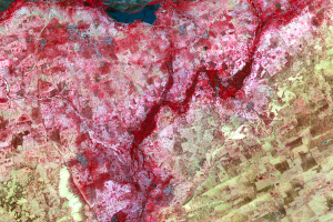
Cattle Corridors
Some of the dark lines in the images might look like roads. Those line...
Corona and WV-2
To get an even more detailed view of this region, we can actually go b...
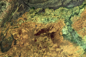
Cropland
These close-up images from Landsat show the Seno Plain in a bit more d...
WorldView-2 Detail
On the edge of the Seno Plain, up against the Bandiagara escarpment, a...