

The Water Returns
Earth Resources Observation and Science (EROS) Center - Earthshots
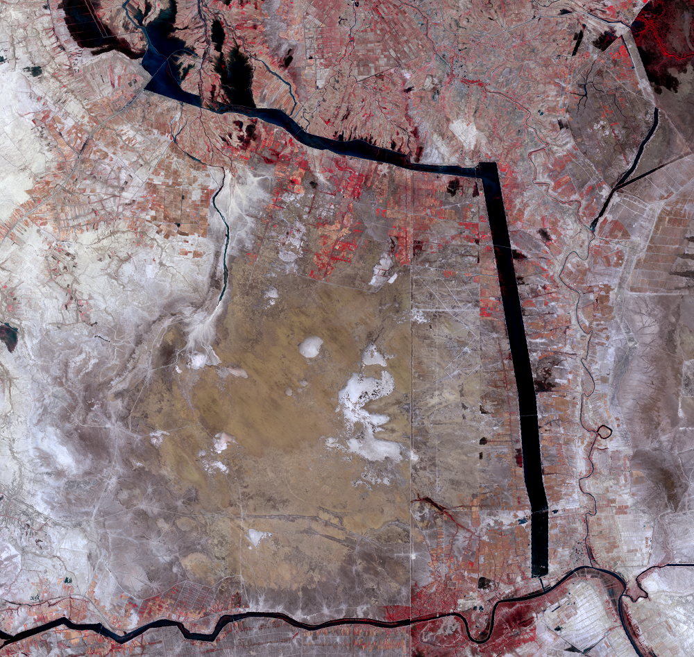
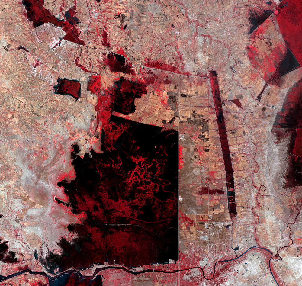
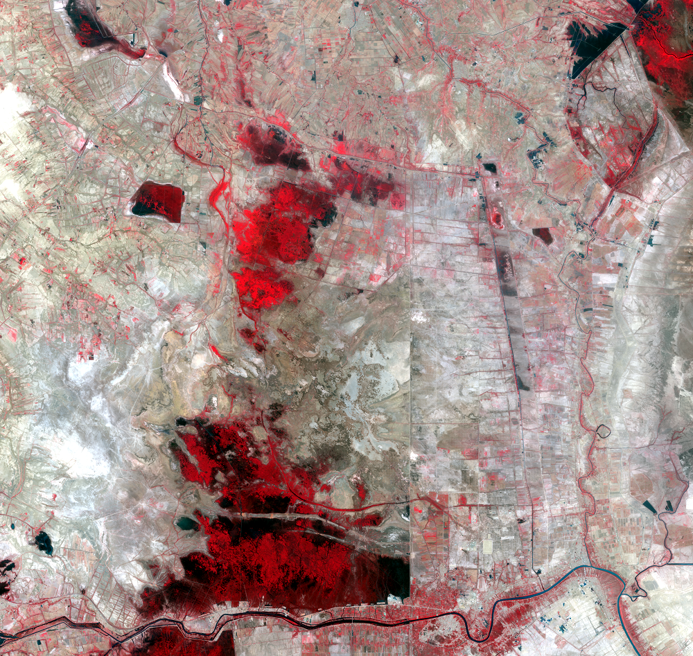
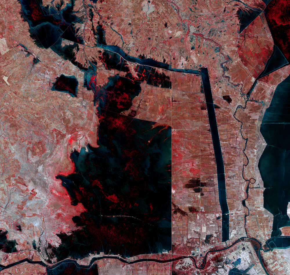
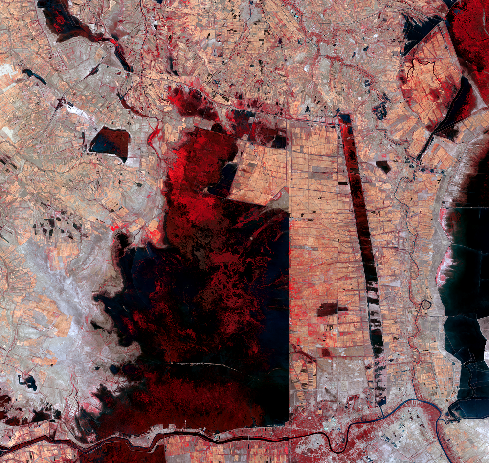
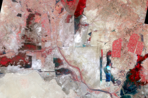
After the large-scale draining throughout the 1990s, the Mesopotamian Marshes went through another major change. After 2003, some Marsh Arabs returned to the wetlands, and the dams, dikes, and levees were demolished. Water flowed once again from the rivers into the marshlands.
It’s still unclear whether the area has achieved successful restoration. Although returning water to marshlands to restore them seems simple, the water releases were spontaneous and uncontrolled. There is still high soil and water salinity, stemming from the many years the land was dried out. The wetlands that exist now are disconnected, which affects species diversity. Water also now pours into the marshes from sewer pipes.
Sustained freshwater input is needed to maintain water extent. But that depends on how the water is used upstream. The Ataturk Dam in Turkey, on the Euphrates River, began filling in 1990. That and other dams in Turkey, Syria, and Iran have reduced the volume of the Tigris and Euphrates rivers. The reduced flow from the rivers leads to saltwater intrusion from the Gulf.
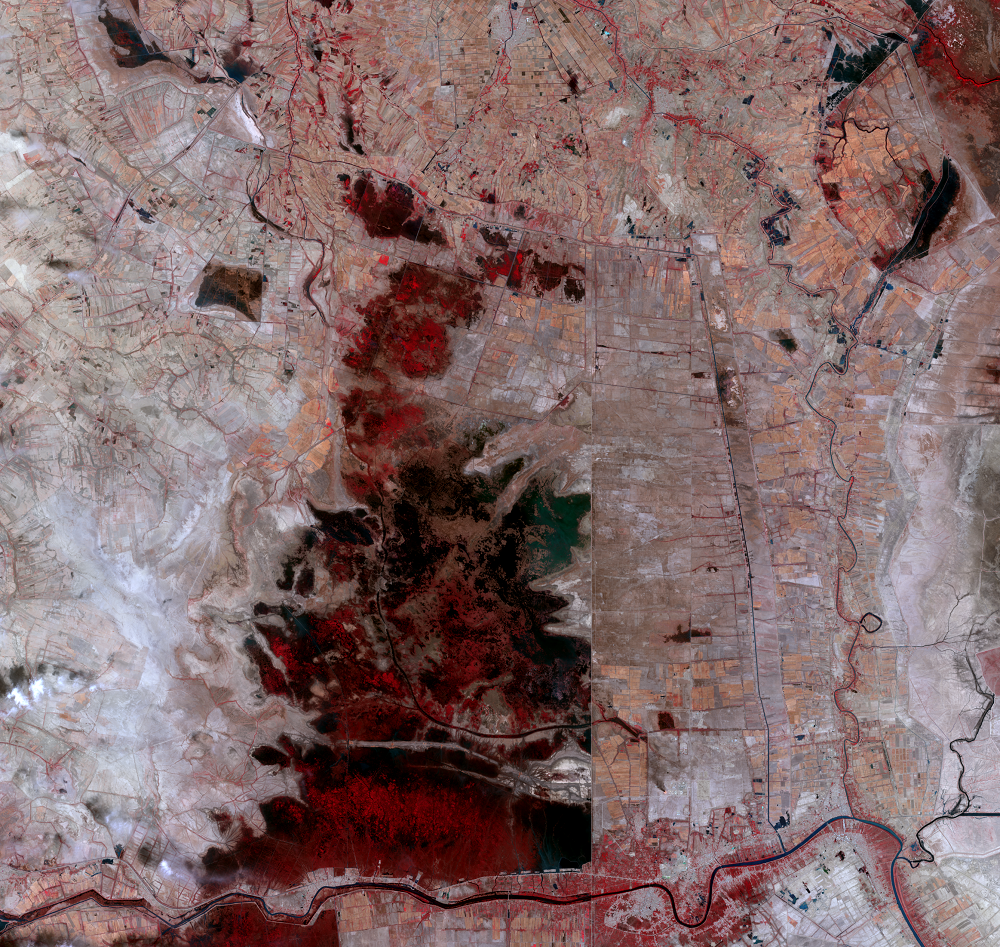
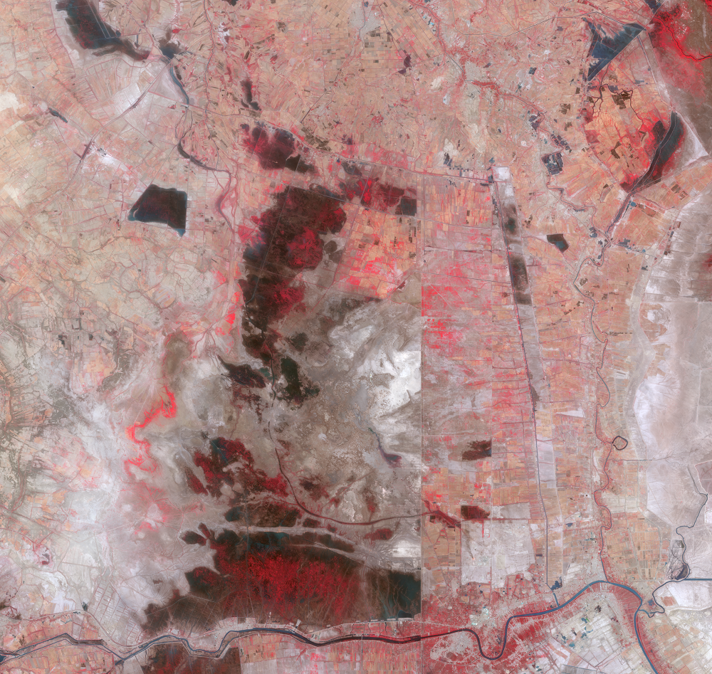
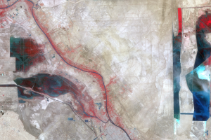
The marshland extent is still less than half of what it was in the time frame of the earliest images shown here. That reduced extent makes the area more vulnerable to year-to-year changes in precipitation. Interannual variation in the water levels is evident in the images. Drought in 2018 caused water levels to drop. But spring 2019 and 2020 had above average rainfall, and the marshes’ water coverage expanded. However, in the latest images shown here, a drying trend has returned. Regional drought is forcing many to abandon their farmland.
The marshes will likely never be the same as they once were, even as recently as the 1960s. It’s unclear how long re-inundated areas will stay that way, considering changing climate and upstream dam projects.
Imagery

Downloads
Related Content
Mesopotamian Marshes, Iraq
Fifty years of observing the Earth means Landsat has witnessed many la...
About the Marshes
All of the water that keeps the Mesopotamian Marshes alive comes from ...
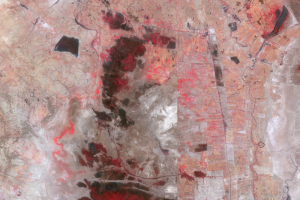
War Comes to the Marshes
The marsh wetlands supported the traditional lifestyles of an estimate...
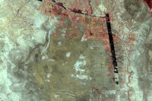
After the Gulf War
Large-scale draining of the marshes began in earnest after the Gulf Wa...
The Water Returns
After the large-scale draining throughout the 1990s, the Mesopotamian ...