

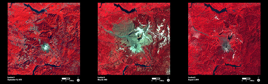
The violent eruption of Mount St. Helens 35 years ago permanently changed the mountain and surrounding forest. The volcanic blast on May 18, 1980, devastated more than 150 square miles of forest within a few minutes. In these Landsat false-color images, forest appears as bright red interspersed with patches of logging. Snow appears white, and ash is gray.
Before the eruption, Mount St. Helens towered about a mile above its base, but when the volcano erupted, its top slid away in an avalanche of rock and debris. When measured on July 1, 1980, the mountain’s height had been reduced from 9,677 feet to 8,364 feet—a difference of about 1,300 feet.
The 2014 Landsat image shows vegetation regrowth, as light red and pink, in the devastated area. However, the gray around the mountain is still evident, and the volcanic crater is still prominent as an “amphitheater,” where the peak of the mountain slid away.
Scientists are using this opportunity to witness the recovery process, both with satellites and on the ground. With its 40-plus years of consistent imagery, the Landsat archive is perfect for studying the landscape changes caused by natural disasters and the gradual recovery process.