

A magnitude 7.8 earthquake struck Nepal on April 25, 2015. Along with damage due to shaking, the earthquake and its aftershocks triggered many large and small landslides throughout the region. As of early May, over 3,000 individual landslides had been identified, based on analysis of hundreds of satellite images collected after the earthquake.
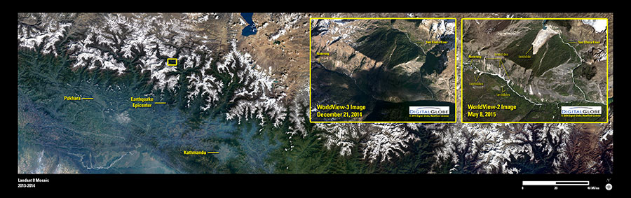
The background image above is a Landsat 8 mosaic of the entire region, produced by stitching together Landsat images acquired from 2013–2014.
The insets show an image pair acquired by WorldView-2 and WorldView-3 over one example location near the town of Namrung, Nepal. Comparing the image acquired shortly after the earthquake with an image from a previous date allows scientists to map the exact locations and extent of local changes caused by the landslides. Here, the post-event (May 8) WorldView-2 image shows one major landslide, as well as many smaller-scale slides that also occurred along the river valley after the earthquake. The image also shows a new lake that formed behind the largest landslide, as a result of damming of the Tom Khola River.
This inset image pair shows just one location, and these changes have occurred across the landscape, especially in the mountainous regions.
Scientists will continue to monitor the region with various satellite data. As post-event images become available, earthquake damage and landslide maps are being created and updated. For more information (including earthquake damage assessments and a landslide inventory map) see the International Charter ‘Space and Major Disasters’ home page: https://www.disasterscharter.org.