

Shuttle Radar Topography Mission (SRTM) data had previously only been available worldwide at 90-meter resolution. The National Geospatial-Intelligence Agency (NGA), NASA, and USGS are now releasing a newly processed, global SRTM 30-meter dataset.
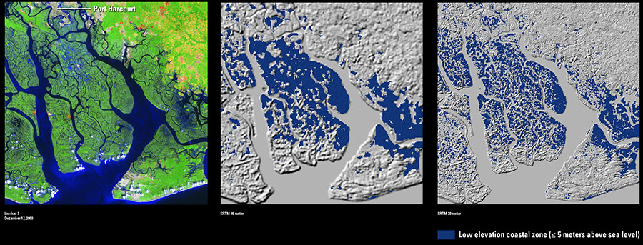
The above images show an example of the difference between the 90-meter and 30-meter data of the Niger River Delta in western Africa. The Landsat image, also at 30-meter resolution, of the same area shows the extensive coastal estuaries, tidal flats, mangrove forests, and lowland rainforests of this part of southern Nigeria. More detailed elevation data are especially critical in such coastal settings that have small elevation changes.
For more information on the new SRTM elevation product, see the USGS Top Story here.