

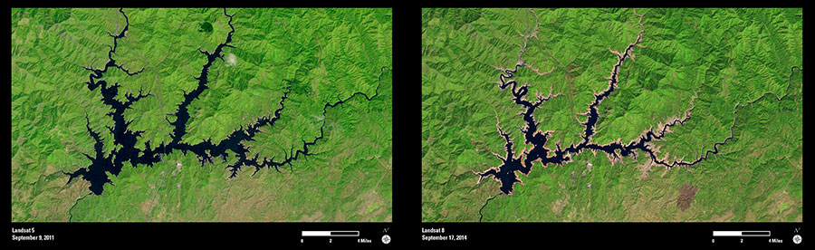
As a 3-year drought continues in the western United States, water levels have been dropping in many California reservoirs, leading to emergency water use restrictions across the state.
These two Landsat images show the changing shoreline of Shasta Lake reservoir in northern California over the past three years. The first image was collected in September 2011 and shows the shoreline when the reservoir’s water levels were at 77 percent of total capacity. The tan colors in the September 2014 image show the change in shoreline. Even though snowmelt slightly increased the lake level earlier in 2014, the reservoir was still at only 27 percent capacity when this more recent image was acquired.
The lower right portion of the second image also shows a recent burn scar from the Gulch Fire. This fire was officially contained one day before the September 17 image was collected.
The images collected by Landsat are an important tool for monitoring changes to the earth’s surface, and can help support analysis related to water resources and other environmental conditions for affected communities.