

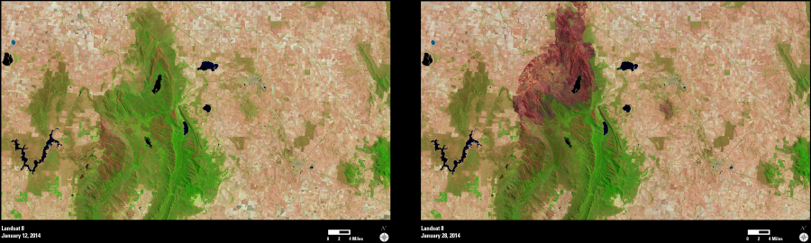
On January 15, 2014, lightning sparked a brushfire in Grampians National Park in the State of Victoria in southeastern Australia. The combination of dry, hot weather and strong winds contributed to a rapidly spreading complex. The fire became so intense it created a 12-km (7.5-mi) wide convection column that created its own weather, generated lightning strikes, and sparked many smaller spot fires.
Residents of the town of Halls Gap, just south of the burned area, were evacuated. The fire claimed at least one life and scorched over 53,000 hectares (131,000 acres) before it was contained on January 21.
These two Landsat 8 images show the area on January 12, 2014 (before the start of the fires) and again on January 28, 2014. The dark tones in the later image depict the burned areas.
The information contained in Landsat images is useful for mapping wildfires, along with many other types of land cover change.