

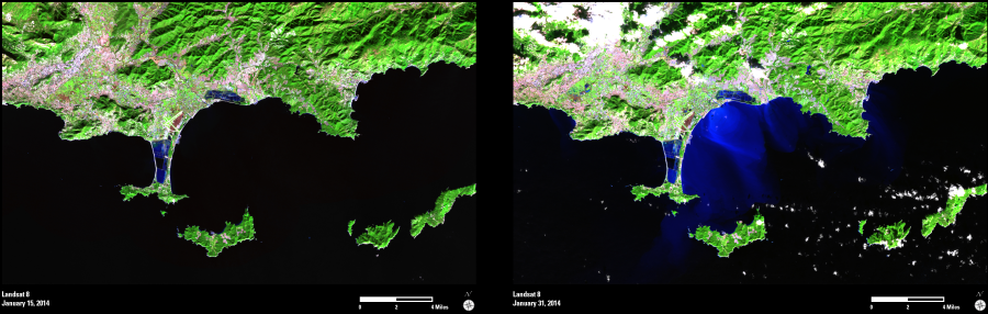
In mid-January 2014, unusually heavy rains in southeast France led to flooding, landslides, and evacuations. In some areas, up to 20 centimeters (8 inches) of rainfall occurred over three days, far exceeding the typical monthly totals.
These Landsat 8 images show the area around Hyères, along with the Giens Peninsula (Presqu’île de Giens) and nearby islands.
The two images were acquired on January 15, 2014 (one day before the rains began) and again on January 31, 2014. The bright blue colors in the right image show the flow of the sediment-rich floodwaters as they moved out into the Mediterranean Sea.