

A volcanic eruption that started on August 31 in Iceland shows no sign of weakening. This eruption is occurring at the Bardarbunga volcano, which lies north of the Vatnajökull glacier in south-central Iceland. Lava has been flowing spectacularly from the Holuhraun lava field, and the eruptive fissure has now spread lava across more than 70 square kilometers (27 square miles).
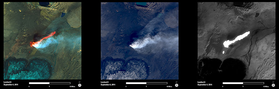
These Landsat 8 images show different spectral bands and band combinations acquired on September 6, 2014. These images provide examples of the type of information being used by scientists to monitor and map the eruption.
The first image is a false-color composite that combines information from the shortwave infrared, near-infrared, and green wavelengths of light. In this image, the recently erupted lava glows bright orange and red. The areas covered by snow and ice within the neighboring glacier can also be seen in shades of blue-green. The second image is a natural color representation, based on the visible wavelengths of light. In this image, the location of active volcanic fissures can be seen as small bright features, and the plumes and trajectory of ash and steam can also be clearly seen. The surface of the cooling lava flows (where visible) are black. The third image is a thermal infrared representation. This image shows relative surface temperature over the region, with the hottest areas (erupted lava) shown in bright hues and colder areas (glacial ice and water bodies) shown in dark tones.
The combined information available in Landsat images can provide an important complement to ground sensors. These images are important for scientists and decision makers engaged in mapping and monitoring the eruption.