

As 2014 comes to an end, so does the growing season in the northern U.S. heartland. Millions of acres of corn, soybeans, alfalfa, and small grains have been harvested from the land in recent weeks.
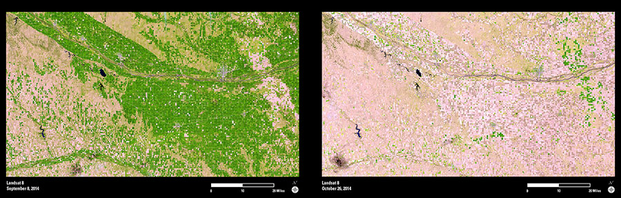
These two Landsat images show the harvest activity and seasonal vegetation changes along the Platte River in south-central Nebraska. The river flows from the northwest corner of the images and then to the east, and its associated basin provides an important corridor for agriculture. The first image was acquired in early September. This image shows many actively growing fields (green blocks) across the landscape, especially within the Platte River basin. The second image (late October) is dominated by shades of tan, pink, and gray. These colors indicate bare ground, and only a small number of green fields remain.
Landsat data are often used for agriculture monitoring and management. This imagery can help users monitor local and regional conditions of the world’s croplands—within a growing season, from year to year, and from one decade to another.