

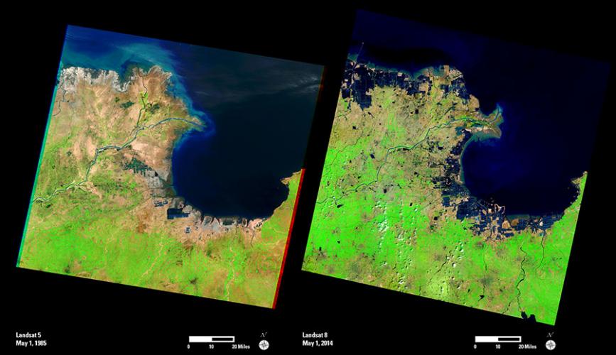
The Huang He (Yellow) River in China is the most sediment-filled river on Earth. It flows from the Bayan Har Mountains to the Bohai Sea. Along the way, it crosses a soft plateau that is covered with fine, wind-blown soil. The river carries away millions of tons of this delta-building material every year. Over time, the river carries its sediment load farther outward into the sea. These Landsat images provide a view of the dramatic changes to the shoreline.
Besides changes to the delta, aquaculture has significantly expanded along the coastline near the river delta, as well as farther south along Laizhou Bay. The dark geometric shapes along the coast were built on what were once tidal flats. These ponds hold shrimp and other types of seafood.
Landsat imagery is useful in providing historical records of the changes taking place on the Earth’s surface, and future acquisitions will allow scientists to help in protecting the delta’s natural wetlands, while meeting the demands of development along the shoreline.