

At the size of a grain of rice, the mountain pine beetle’s subtle assault on America’s forests isn’t always obvious to the naked eye. Yet over time, their armies of thousands can ravage entire mountainsides. That’s why the continuous monitoring abilities of Landsat satellites have become so important in fighting the insect hordes.
The U.S. Geological Survey’s (USGS) decision in 2008 to make what is now 44 years of archived satellite data free for distribution gave rise to time-series imagery that has become a powerful tool in revealing forest change. Landsat’s no-cost access gives forest managers an important and economical asset in discerning where outbreaks are happening as they occur. That knowledge in turn enables them to make more informed decisions on thinning tree stands affected by beetles, thus minimizing the potential fire threat they pose.
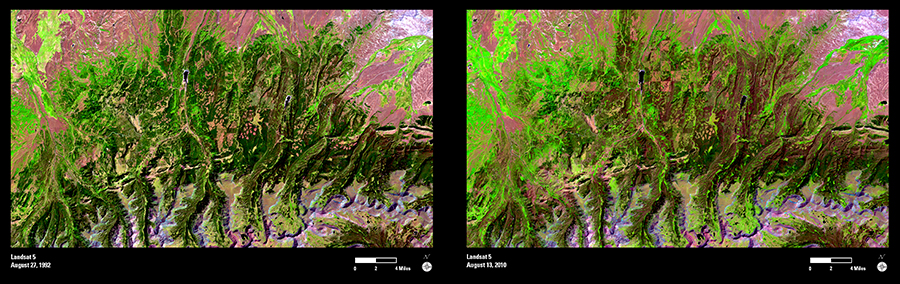
The value of continuous monitoring is readily apparent in these images. In August 1992, Landsat 5 focused on a swath of the Uinta Mountains just east of Salt Lake City, Utah. The shades of dark green indicate areas of healthier undisturbed forest. Almost exactly 18 years later, Landsat 5 found something much different—dark red stains readily visible throughout the image that tell a story of widespread pine beetle destruction.
Because they only measure field plots once a decade, Forest Service crews may have a harder time grasping the enormity of the assault. With Landsat’s continuous monitoring, the size and timing of infestations become much clearer.