

Throughout 2016, Indiana has been celebrating its 200th anniversary of statehood. Joining the Union on December 11, 1816, as the 19th state, Indiana was the second state admitted from what was once known as the Northwest Territory.
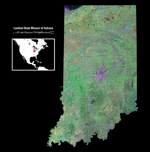
This satellite mosaic of the Hoosier State was created from several Landsat scenes stitched together to create one seamless image. Data from the National Elevation Dataset (NED) is also incorporated into the image. The names of major cities and county boundaries have been added.
The Landsat images used for this mosaic were from summer months, so it shows the state at the height of the growing season. Since farmland makes up about 70% of the state’s land, much of the state appears green. By contrast, urban areas appear in shades of lavender. The large spot in the middle of the state marks the location of Indiana’s capital and largest city, Indianapolis.
The Wabash River, the official state river, flows west across the northern part of the state and turns south to form part of the border with Illinois.
Poster-sized images of all 50 states, plus Puerto Rico, are available for download at no charge at http://eros.usgs.gov/imagegallery/landsat-state-mosaics.