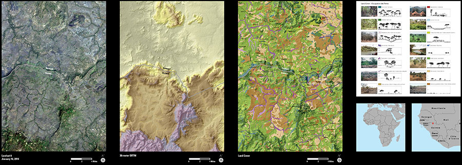
A team from the USGS Earth Resources Observation and Science (EROS) Center produced a detailed land use/land cover map using Landsat satellite and 30-meter elevation data from the Shuttle Radar Topography Mission (SRTM) of the highlands along the Senegal-Guinea border. The Dindefelo Nature Reserve was created to protect the high biodiversity of this area, including chimpanzee habitat, which is closely correlated with topography. The map helps scientists visualize the resources within the reserve and the mounting human pressure on the natural landscapes that surround it.
The Landsat 8 image (left) of the study area coupled with the SRTM 30-meter data (center) provides a specialized view of the topography. The land cover map (right) shows the diverse habitats, including the locations of gallery forests. These narrow ribbons of dense trees follow watercourses and are indicated as purple shades on the land cover map. Gallery forests provide critical refuge for many species of plants and animals during the long, hot dry season. The maps are being used in a proposal by the Jane Goodall Institute to Senegal and Guinea to extend the Dindefelo Nature Reserve south into the Guinea highlands.
Mapping these biodiverse highlands is one example that demonstrates the advantage of the more accurate elevation data from SRTM. For more information, see the USGS Top Story.

