

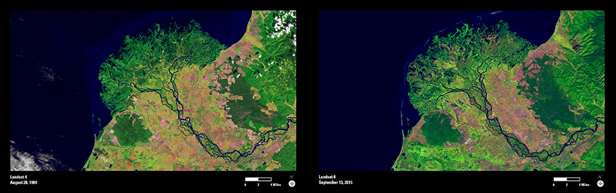
The Selenga River begins in Mongolia and flows north into Russia where it empties into Lake Baikal, the world’s deepest lake. The river slows as it approaches the lake, dropping large amounts of sediment in a wide alluvial plain. The braided river flows past farm fields—the blocky shapes in the images—and to the lake.
The river forms a unique delta as it carries sediment to Lake Baikal. These Landsat images show the delta in 1989 and 2015. While the overall shape of the delta has not changed significantly, a halo of sand bars surrounds the edge of the delta in the 2015 image. Varying lake levels and the river’s sediment load influence the changing shape of the delta and its sand bars.
Landsat data are freely available to anyone interested in researching and monitoring changes happening to the Earth’s surface.