

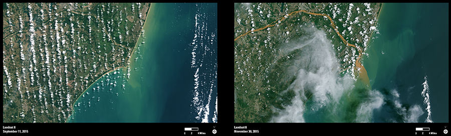
On November 5, 2015, a tailings pond dam failed at an iron mine in southeastern Brazil, sending contaminated water sediment through the nearby village of Bento Rodrigues and into tributaries of the Rio Doce (Sweet River). (See http://eros.usgs.gov/imagegallery/image-week-2#Brazil_Images) The sediment from that disaster has since moved downstream to the mouth of the Doce River.
The Landsat 8 image from September 11, 2015, shows what the mouth of the Doce River looks like under normal conditions. A Landsat 8 image acquired on November 30 shows a plume of sediment flowing into the Atlantic Ocean. This may be contaminated sediment from the dam breach. Advanced Landsat 8 capabilities, including the new coastal aerosol band and superior instrument performance, may improve monitoring the extent of sediment flow in the river.