

The afternoon of Sunday June 14, Alaskan authorities were notified of a 40-acre fire in Willow, AK. Named the Sockeye Fire for the street where the fire began, the fire moved quickly through the black spruce forested area due to flat topography and hot, dry, windy weather. In only 48 hours, the burned area grew to about 6,500–7,000 acres. Strong north winds are expected to drive the fires to the south, threatening populated areas. Smoke could affect Anchorage, 80 miles to the south.
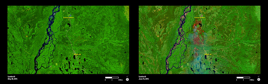
These two Landsat images were acquired by Landsat 8 on May 30, 2015 (left) and June 15, 2015 (right). Bright red indicates where the fire is burning. Burned areas are dark shades, and smoke from the fire forms a hazy trail toward the south. The Susitna River, to the west of the burned area, acts as a natural firebreak.
Landsat imagery assists with response planning and identification of areas at further burn risk. Future Landsat imagery will be useful for mapping and measuring burned areas and monitoring vegetation recovery.