

Heavy rains fell over Texas, Oklahoma, Arkansas, and Louisiana in late May 2015. Many lakes and rivers filled and overflowed their banks, causing widespread flooding in both urban and rural areas. These rains provided much-needed moisture for this area of the southern Plains, and may help to suspend a multiyear drought in the region. However, the rapid rate of the rainfall has been excessive for many areas.
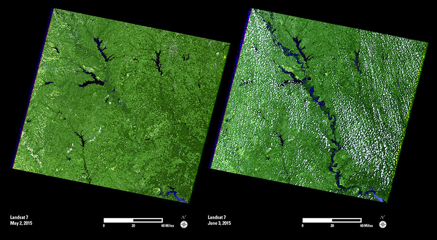
These images show the Trinity River southeast of Dallas, Texas. In the May image, the river can hardly be seen because of the vegetation along its banks. The June image shows Trinity River and flooded regions in bright blue and dark tones.
As the water moves downstream, continued flooding is affecting many homes, businesses, and cropland within Texas and its neighboring states. Future Landsat images will help with the monitoring and evaluation of impacts, as the waters crest and begin to recede.