

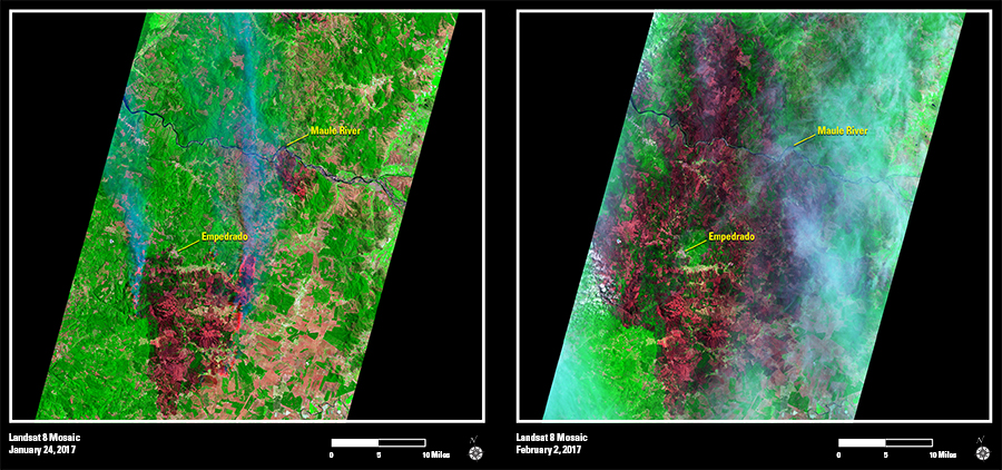
Wildfires fueled by dry conditions, high temperatures, and strong winds are scorching central Chile at a level Chilean officials say they haven’t seen in decades. Landsat 8 Operational Land Imager (OLI) mosaics on the left from January 24 and February 2 show multiple fire scars growing across the Chilean landscape.
The fires, which had consumed roughly 1,060 square miles as of late January, include a large burn area that threatened the city of Empedrado. The two images to the right capture the explosive growth of the fire around the city.
On January 24, the burned land can be seen primarily south of Empedrado, with blue smoke and orange flames visible from an active fire on the periphery of the scar. By February 2, the burn scar expanded to completely surround the city, and extends north all the way to and beyond the Maule River.
Satellite data have shown smoke from the Chile fires traveling hundreds of miles, reaching areas in the Central South Pacific. As of February 2, 123 active forest fires were registered in Chile by the National Forest Corporation (CONAF). In all, more than 20,000 people, including firefighters and experts from over a dozen countries, helped battle the wildfires, CONAF officials said.