

Degradation
Earth Resources Observation and Science (EROS) Center - Earthshots
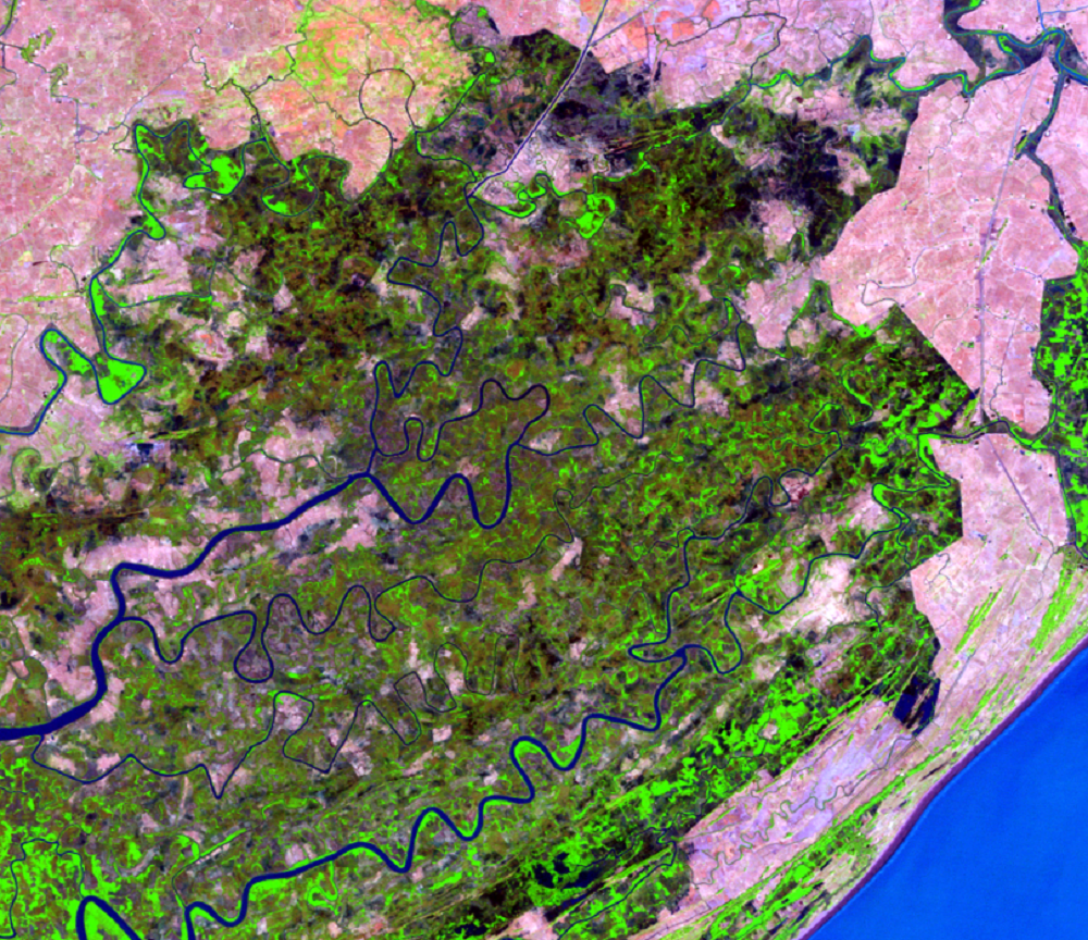
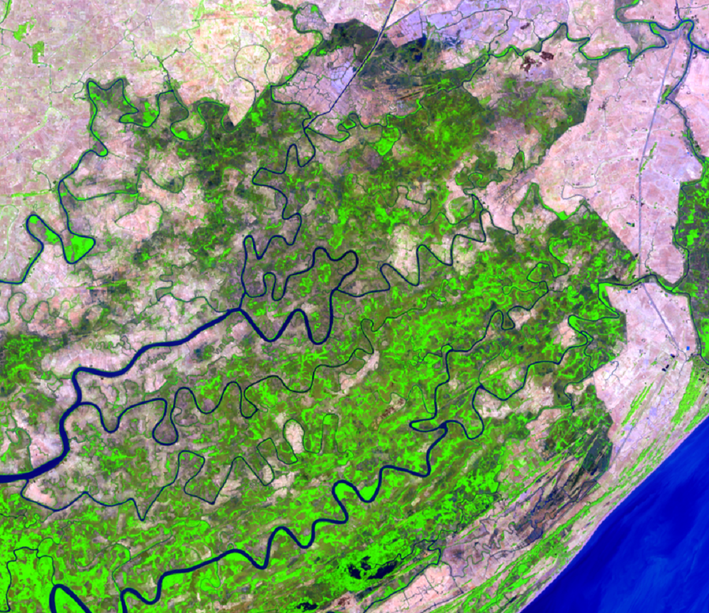
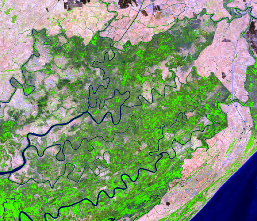
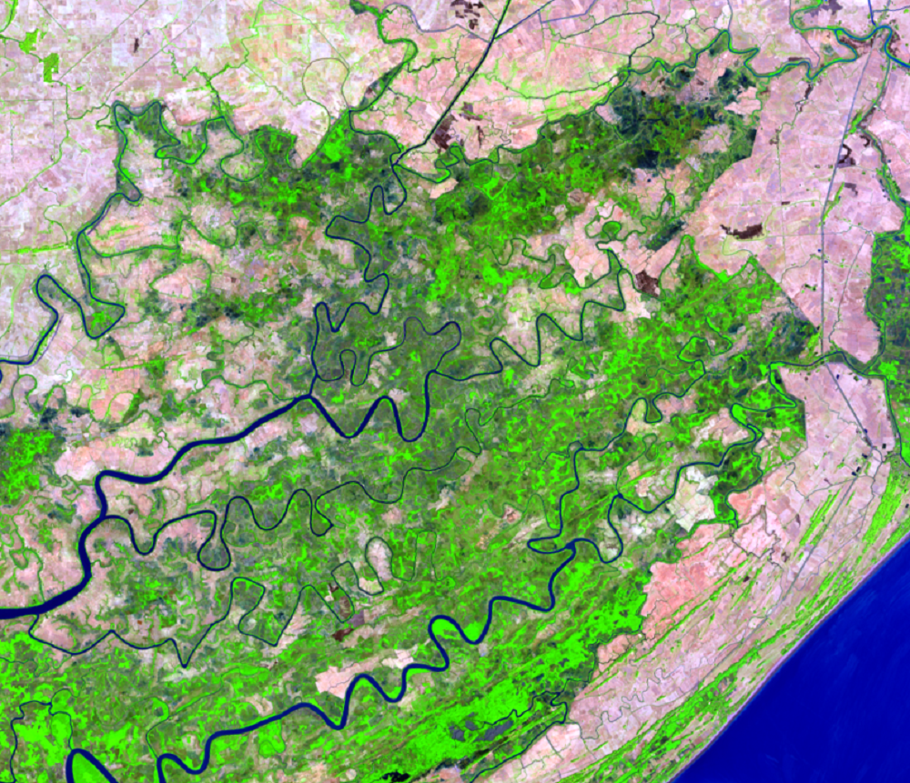
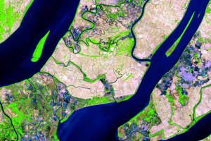
People are drawn to delta and coastal regions, and about 7.7 million people live on the Ayeyarwady Delta. Deltas can be productive agricultural areas because the soil is rich and the flat terrain and water provide easy access to water-based transportation. The Ayeyarwady Delta produces 35% of Myanmar’s rice. Cutting wood for fuel also contributes to mangrove loss, but most of the deforestation in this delta has been for rice fields.
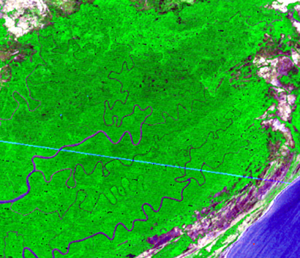
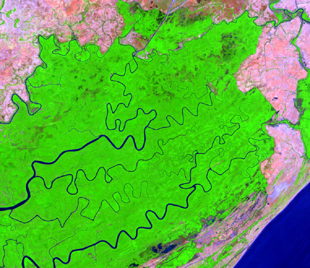
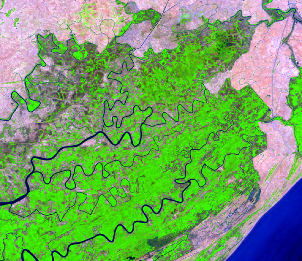
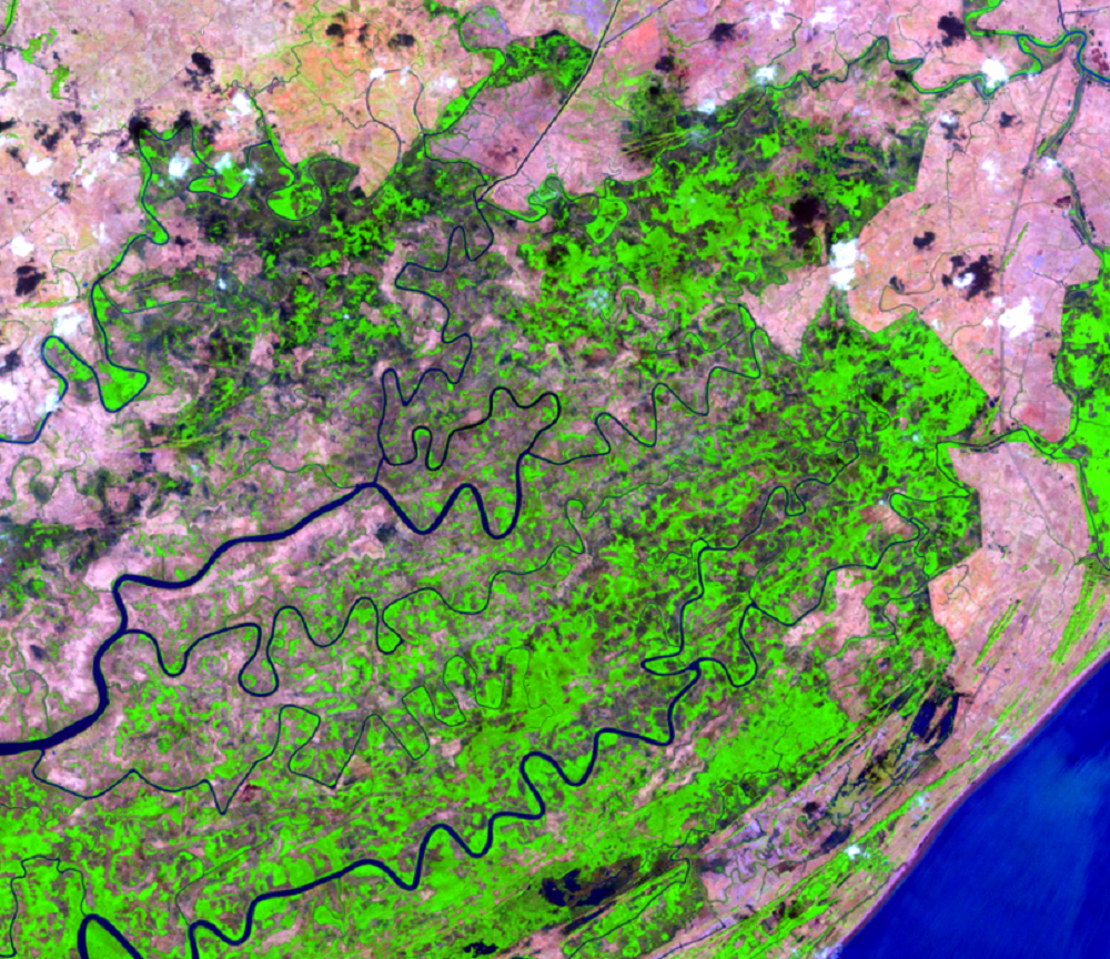
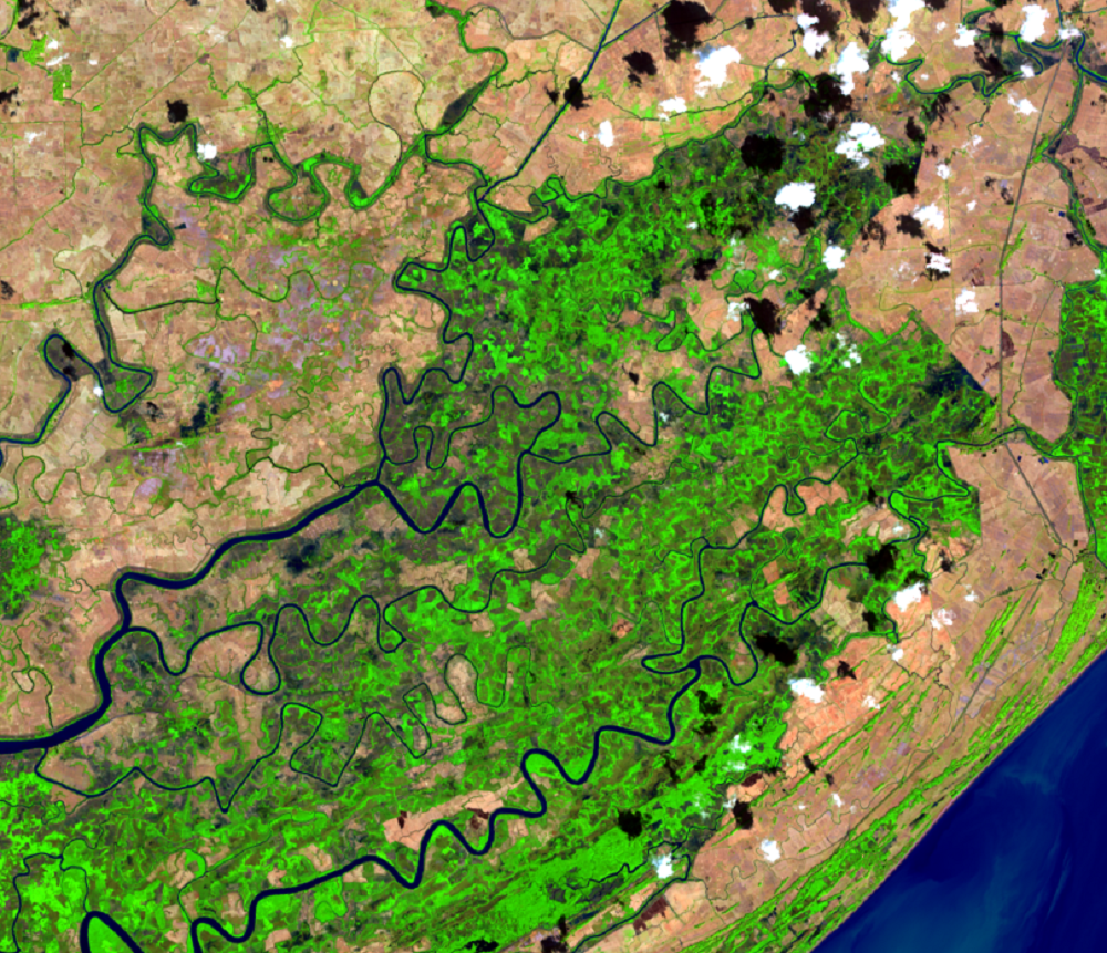
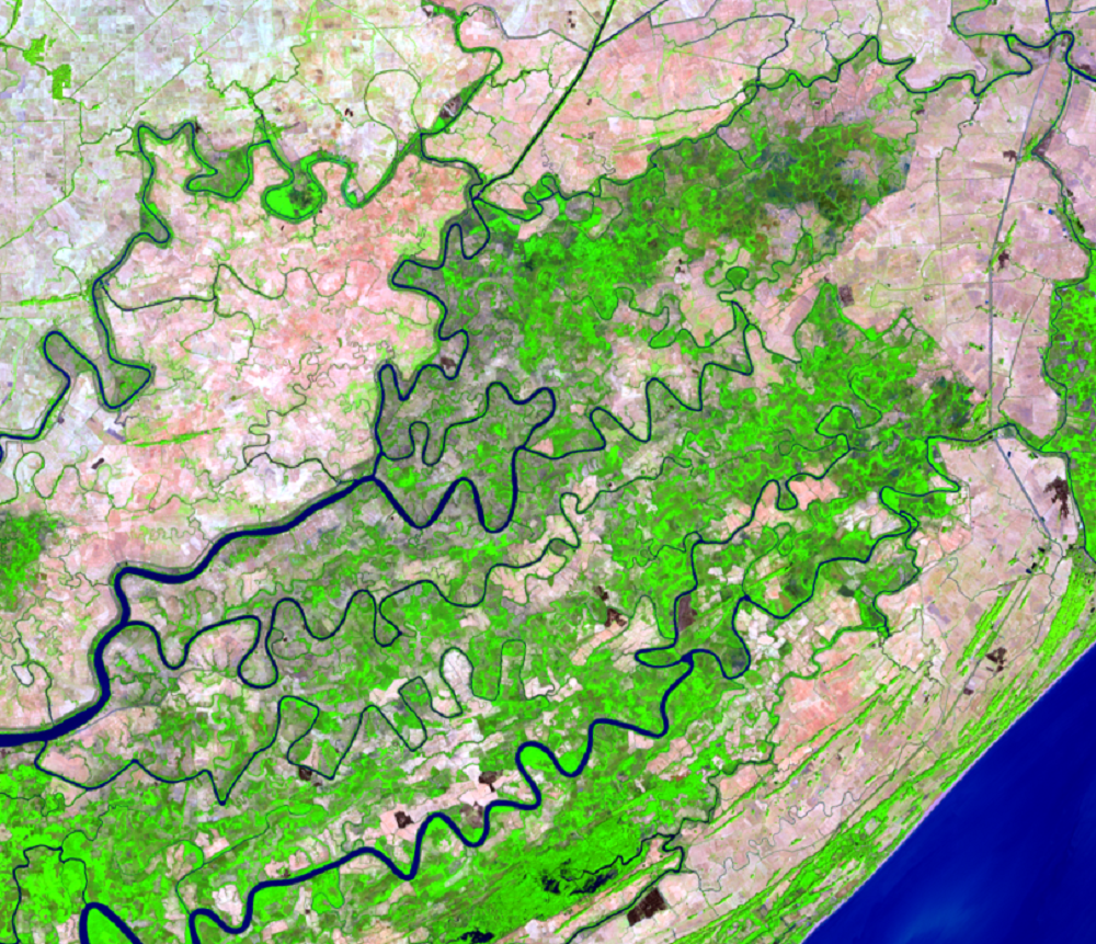
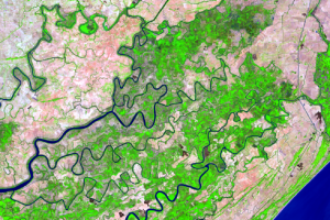
A more close-up look at the eastern portion of the delta shows this degradation in more detail. As the sequence of images progresses, the bright green of healthy mangrove changes into a mottled green of degraded mangrove.
This mangrove loss could have implications for protecting people on the delta. The delta’s low elevation and flat landscape make it vulnerable to flooding from storm surges, as with Cyclone Nargis in May 2008. The mangrove forests provide a buffer for storm surge.
Imagery
Downloads
Related Content
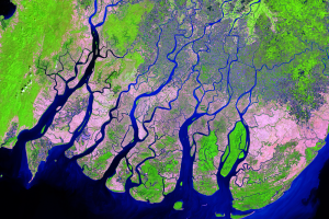
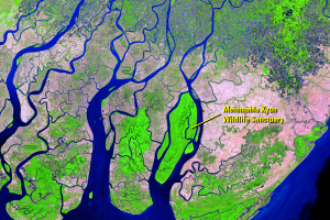
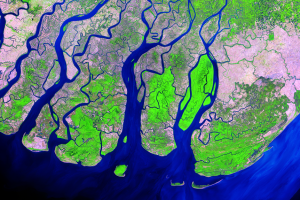
Ayeyarwady Delta, Myanmar
The Ayeyarwady Delta—also called the Irrawaddy Delta—is a vast alluvia...
Mangrove Benefits
Mangroves are sturdy species. They can recover from storm disturbances...
Missing Mangroves
Scientists have been tracking the distribution of the mangrove forests...
Degradation
People are drawn to delta and coastal regions, and about 7.7 million p...
Aquaculture
Mangroves in the Ayeyarwady Delta are also being replaced by aquacultu...