

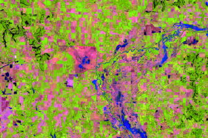
Lawrenceville and Vincennes
Earth Resources Observation and Science (EROS) Center - Earthshots
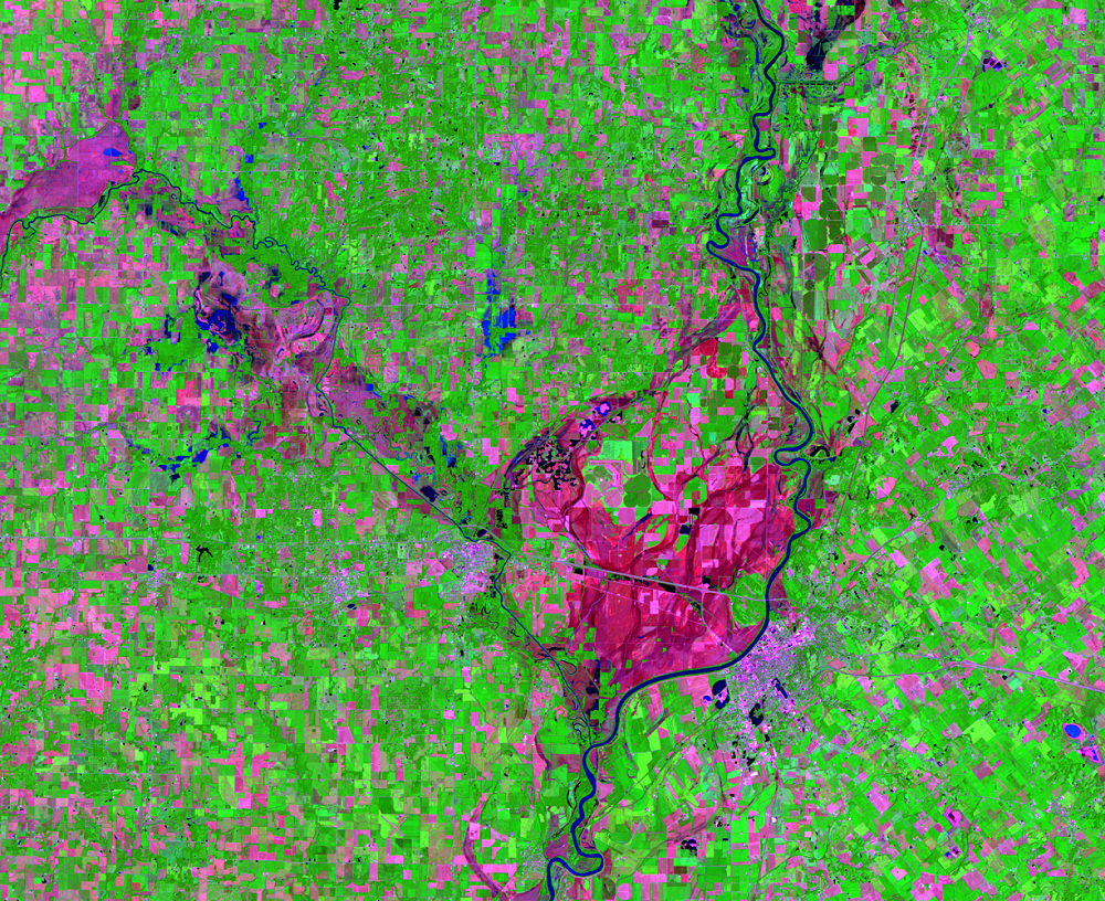
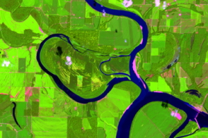
In this area at near Lawrenceville, Illinois, and Vincennes, Indiana, some fields are green, some are maroon, and others are pink. Why are these fields different colors?
In this band combination, bright green is healthy vegetation, so the crops are growing well in those fields. Some fields have a faint green color; crops are growing in those fields, but they are younger than the crops in the bright green fields. The pink and maroon fields are bare soil, probably planted but there is no growth yet. The bright pink fields have slightly less moisture in the soil. In the post-flood image, some of these fields near the river that were flooded are dark pink, indicating they still contain moisture.
Imagery
Downloads
Related Content
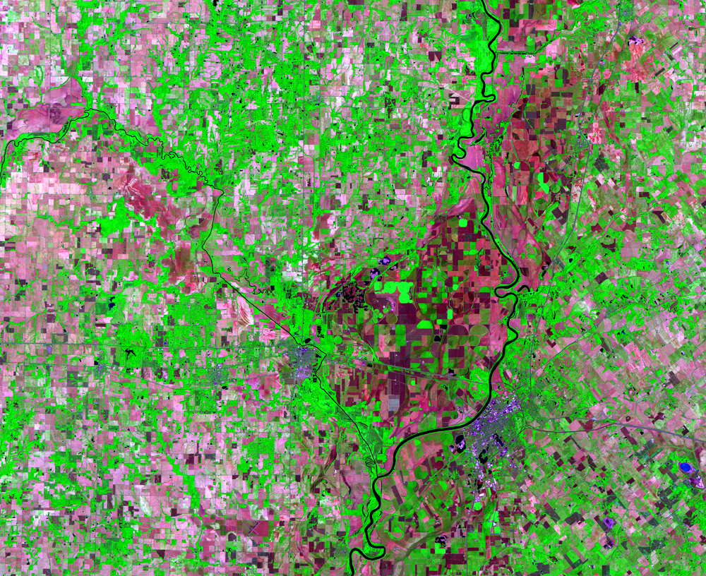
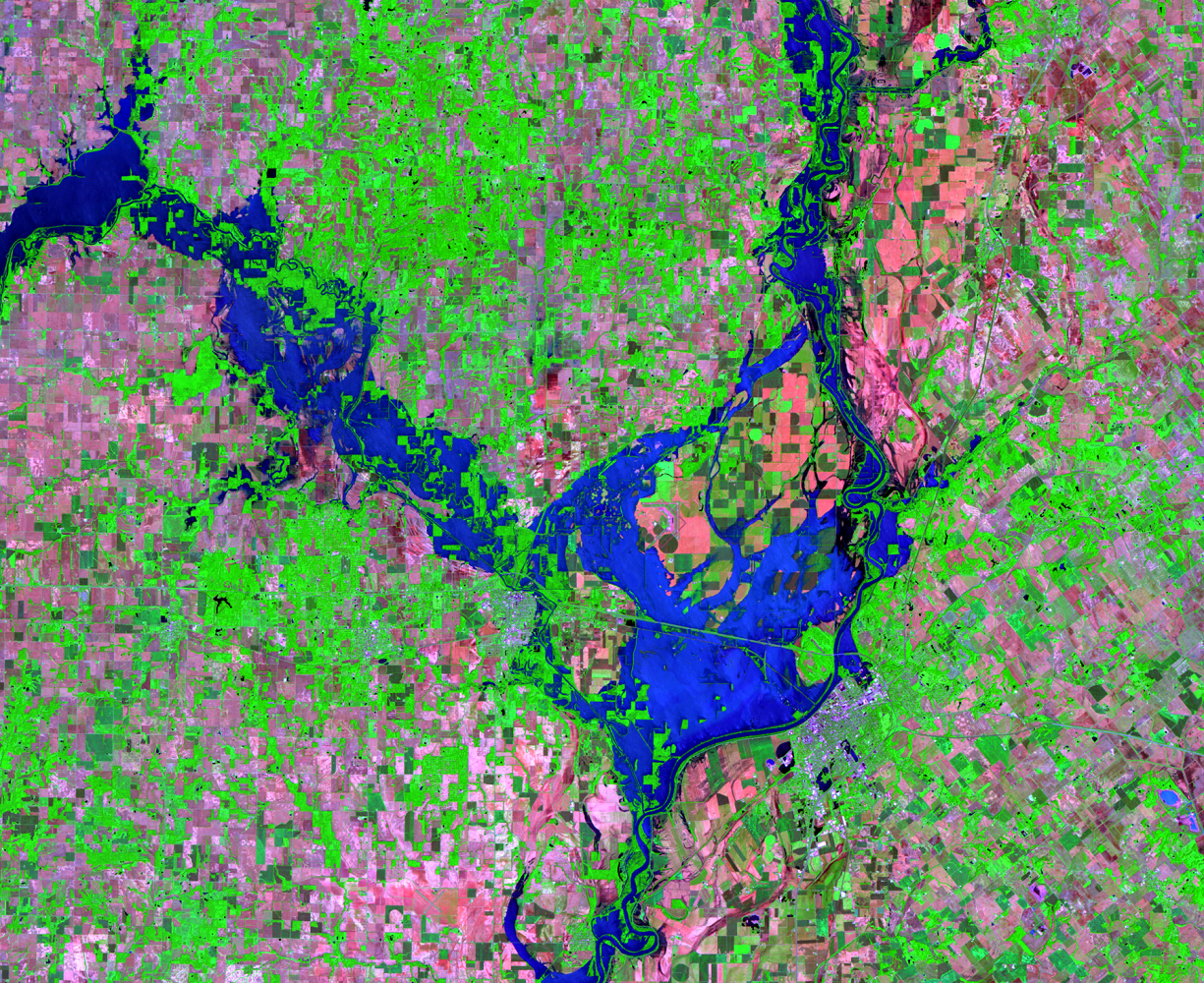
Illinois/Indiana, USA
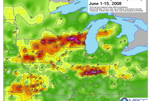
These three Landsat 5 images show several rivers in southern Illinois ...
More about This Flood
The flooding that happened in summer 2008 in Indiana and Illinois star...
Eel River
Just west of Clay City, there is a large, nearly square-shaped area of...
Lawrenceville and Vincennes
In this area at near Lawrenceville, Illinois, and Vincennes, Indiana, ...
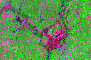
A New Cutoff
Floods are examples of short-term environmental change. They cause sub...
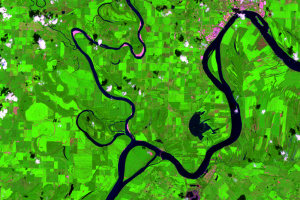
New Cutoff Close Up
Cutoffs are common on meandering rivers like the Wabash, but it’s rare...