

Sioux Falls, South Dakota, USA
Earth Resources Observation and Science (EROS) Center - Earthshots
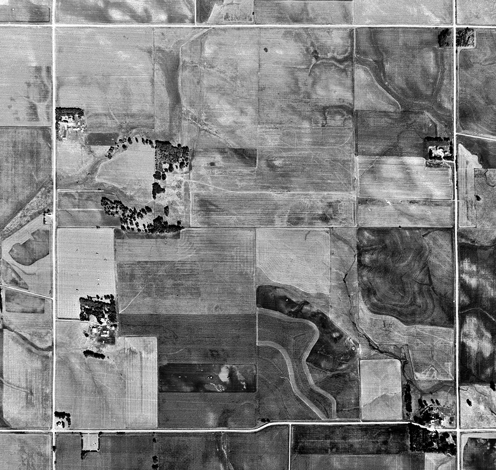
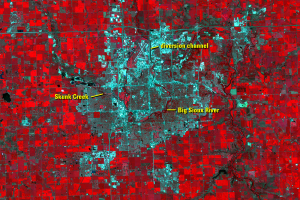
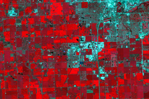
A half-section of land 10 miles north of Sioux Falls, South Dakota, surrounded by corn and soybean fields, is the home of the USGS Earth Resources Observation and Science (EROS) Center—and the Landsat archive. EROS has been archiving and distributing Landsat and other land data for 50 years. In that time, Landsat reveals a half-century of growth in Sioux Falls as it expands into agricultural areas.
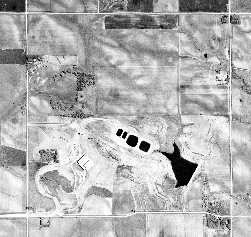
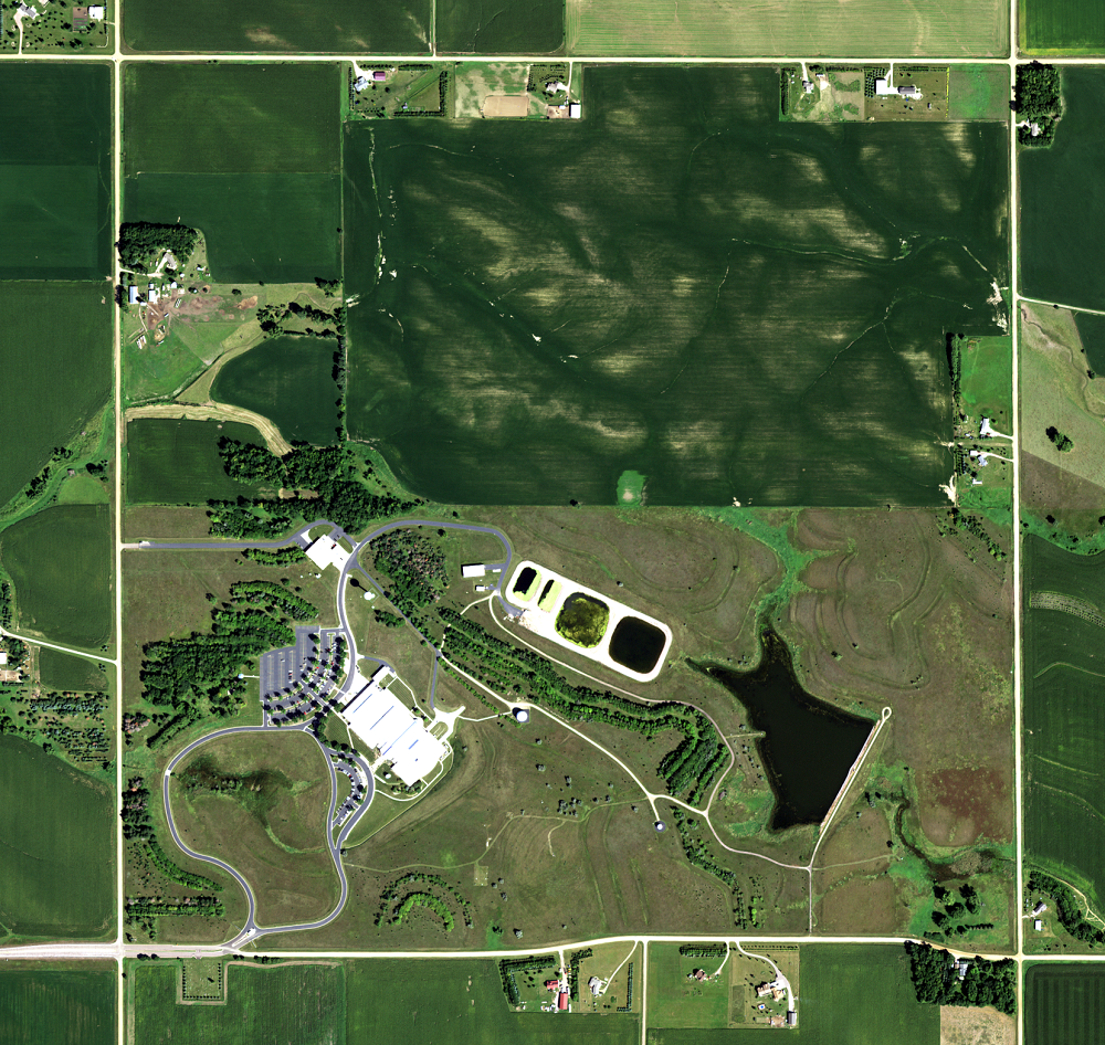
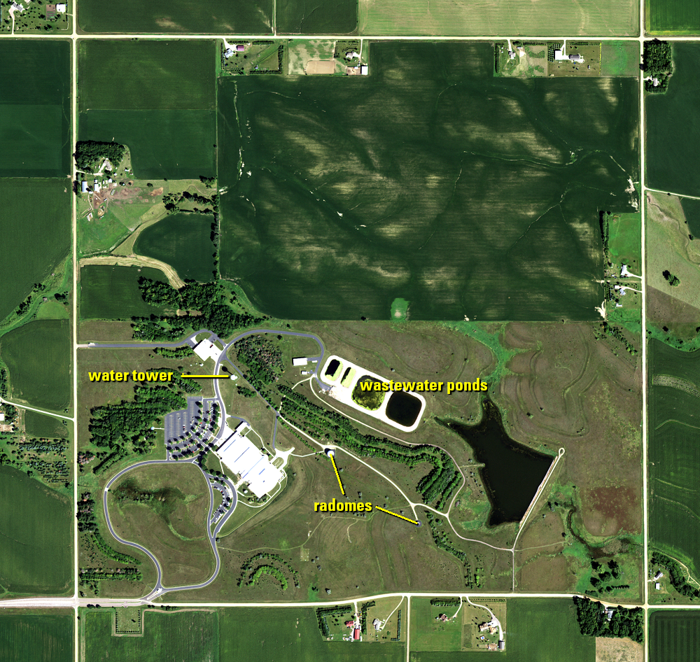
The vast EROS archive also includes historical and current aerial photography. A sample of those photos shows EROS’ location. The building opened in 1973, with an addition completed in 1996.
The ponds beside the building are wastewater ponds, originally for the large amount of photo and film processing that took place at EROS up until 2005. You can also see the water tower and its shadow. Two radomes, which protect the antennas that receive data from the Landsat satellites and send commands, also sit on the property.
Receiving data from the orbiting Landsat satellites is one of the main reasons EROS is located where it is. The Sioux Falls area is near the center of North America. The antennas inside the radomes can receive data from the Landsat satellites as they pass anywhere over the 48 conterminous states. With the recent launch of Landsat 9, and Landsat Next targeted for launch in 2030, EROS will remain the archive and distribution center for Landsat data for years to come.
Imagery
Downloads
Acevedo, W., Taylor, J.L., Hester, D.J., Mladinich, C.S., and Glavac, S., Eds., 2006, Rates, Trends, Causes, and Consequences of Urban Land-Use Change in the United States: U.S. Geological Survey Professional Paper 1726, 200 p. Available online at http://pubs.usgs.gov/pp/pp1726.
Brandon, South Dakota, [n.d.], City of Brandon, South Dakota: accessed May 25, 2023, at https://cityofbrandon.org/population.
Harrisburg, 2019, Comprehensive Plan: City of Harrisburg: accessed May 25, 2023, at https://harrisburgsd.gov/files/5315/5933/2346/Comprehensive_Plan_2019-2044.pdf.
Harrisburg School District, 2023, HSD Fast Facts: accessed May 25, 2023, at https://www.harrisburgdistrict41-2.org/page/fast-facts.
Lauck, J.K., Hicks, P., (eds.), 2022, City of Hustle—A Sioux Falls Anthology: Cleveland, Belt Publishing, 315 p.
U.S. Census Bureau, 2022, Metropolitan and Micropolitan Statistical Areas Population Totals and Components of Change—2020-2021: accessed May 24, 2023, at https://www.census.gov/data/tables/time-series/demo/popest/2020s-total-metro-and-micro-statistical-areas.html.
U.S. Census Bureau, 2022, QuickFacts—Brandon city, South Dakota: accessed May 25, 2023, at https://www.census.gov/quickfacts/brandoncitysouthdakota.
U.S. Census Bureau, 2022, QuickFacts—Harrisburg, city, South Dakota: accessed May 25, 2023, at https://www.census.gov/quickfacts/harrisburgcitysouthdakota.
USGS, 2023, EROS 50th History, 1966-1979—How Sioux Falls Ingenuity Secured the Center: USGS EROS website, accessed August 10, 2023, at https://www.usgs.gov/centers/eros/news/eros-50th-history-1966-1979-how-sioux-falls-ingenuity-secured-center.
Xian, G., Shi, H., Auch, R., Gallo, K., Zhou, Q., Wu, Z., 2021, The effects of urban land cover dynamics on urban heat Island intensity and temporal trends: GIScience & Remote Sensing, v. 58, no. 4, accessed May 25, 2023, at https://www.tandfonline.com/doi/full/10.1080/15481603.2021.1903282.
Related Content
Sioux Falls
The Big Sioux River flows through Sioux Falls, with Skunk Creek joinin...
Development Patterns
The building of roads and streets is a visible sign of urban expansion...
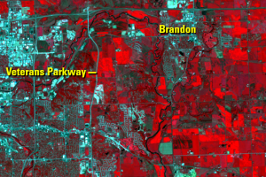
Eastward Expansion
On the east side of Sioux Falls, cropland continues to give way to dev...
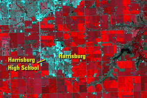
Southern Expansion
Since we’re comparing rate of change in population growth since 1970, ...