

Zabol
Earth Resources Observation and Science (EROS) Center - Earthshots
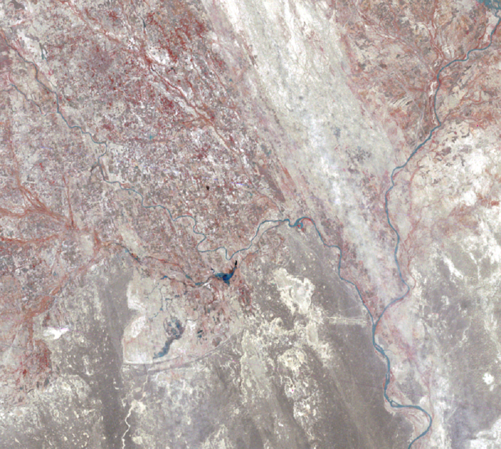
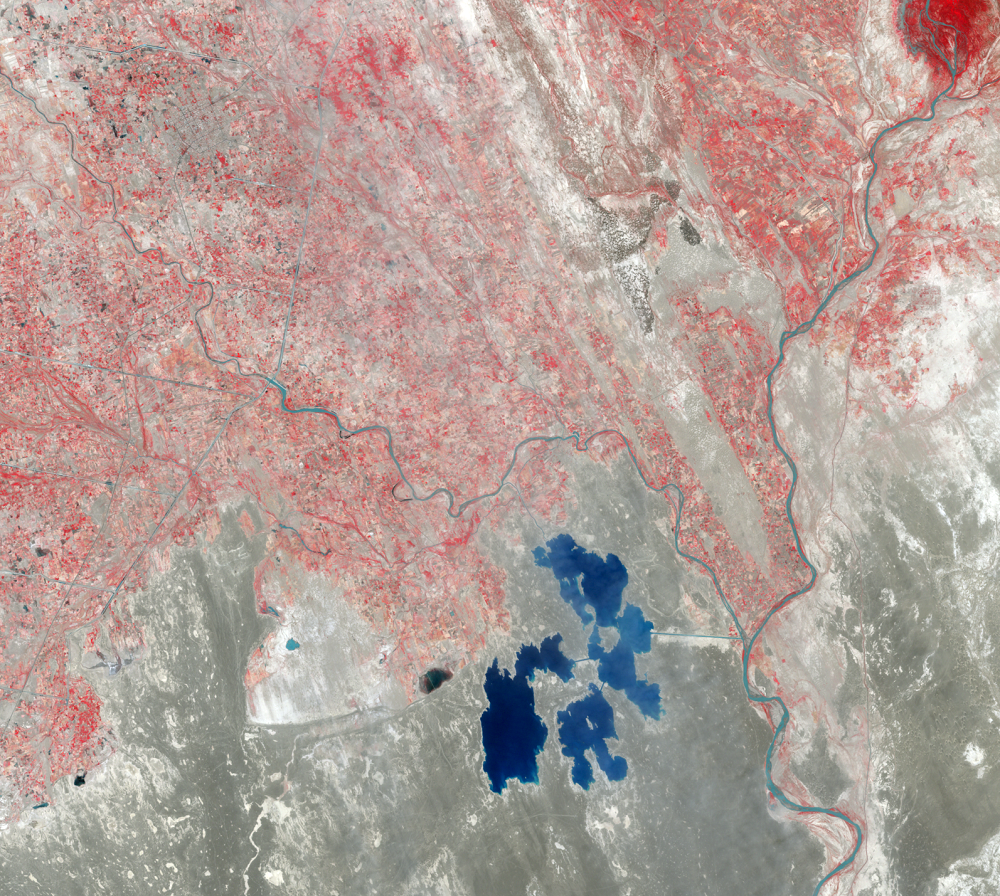
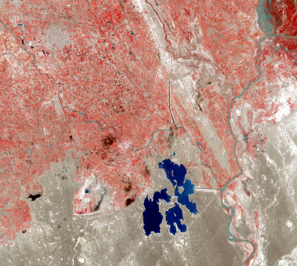
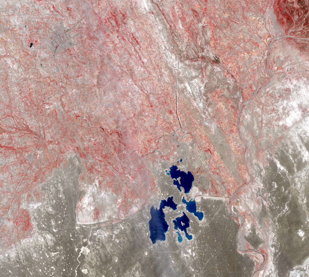
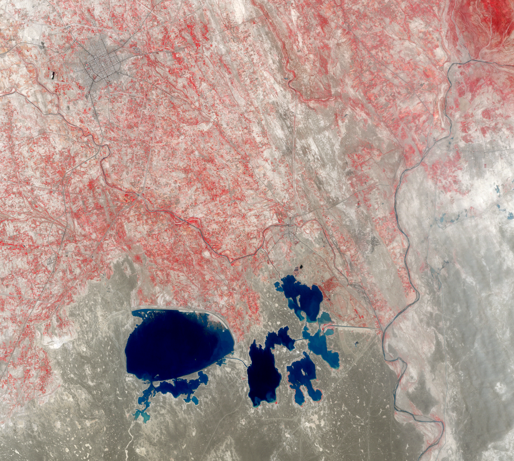
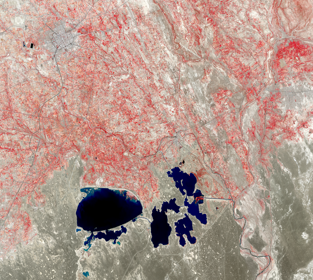
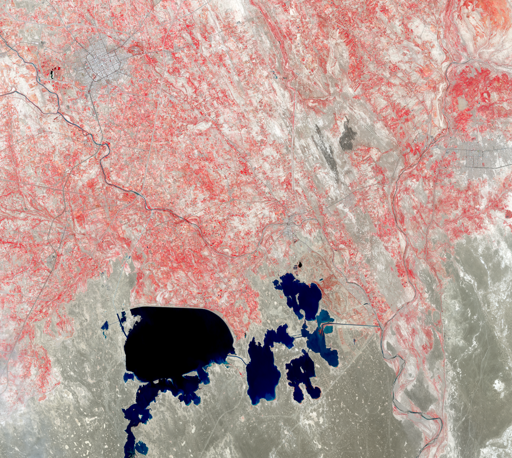
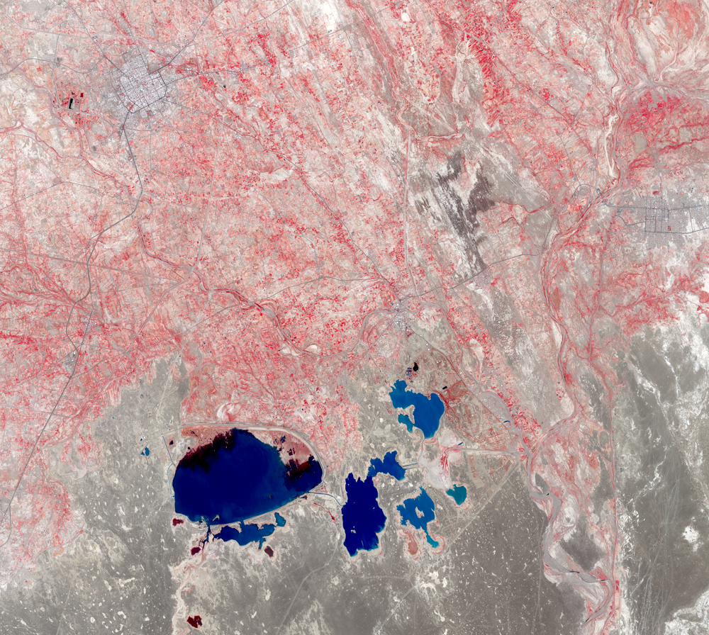
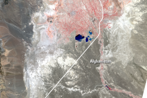
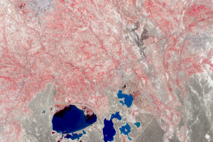
The lakes visible in these close-up images are the Chah-Nimeh reservoirs. These natural cavities in the southern Sistan plain are near Zabol, Iran, which is seen in the upper left of these images. The water in these reservoirs provides drinking water for Zabol, whose 2013 population was about 122,000. Canals connecting the reservoirs can be seen along with a canal that that branches off the Helmand River, on the right.
A field study conducted in December 2009 and January 2010 found a low level of water flow in the Helmand River, which failed to reach Lake Hamoun. Instead, the water was diverted to the Chah-Nimeh reservoirs.
Imagery
Downloads
Related Content
Lake Hamoun, Iran and Afghanistan
The Sistan Basin lies on the Iran-Afghanistan border. Melted snow from...
The Hamoun Wetlands
The Lake Hamoun area is classified as freshwater wetlands. Because Ham...
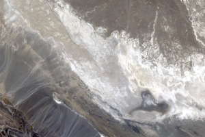
Lake Gowd-e-Zareh
Water from the Helmand River is used upstream for agriculture. The riv...
Zabol
The lakes visible in these close-up images are the Chah-Nimeh reservoi...
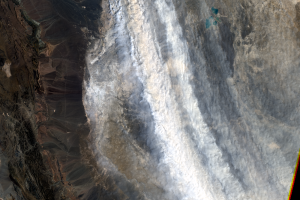
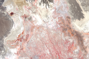
Dust Storms
Even with these reservoirs, dry lakebeds surrounding Zabol are problem...