

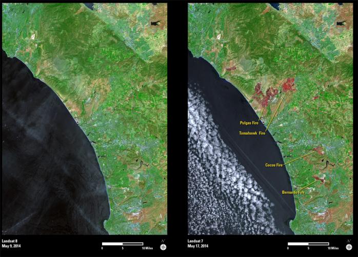
A series of wildfires erupted along the coastal region north of San Diego, California, in mid-May 2014. The first wildfire (Bernardo Fire) began on May 13, followed by several additional fires that occurred over the following days. At one point, firefighters were battling at least eight active wildfires and over 175,000 evacuation notices were issued.
The Landsat 8 image (left) was acquired on May 9, 2014, and shows the area before the fires began. The Landsat 7 image (right) was acquired eight days later. The red tones show numerous areas that were burned as of May 17, 2014.
The repetitive imagery provided by the Landsat satellites allows officials to evaluate the destructive impacts and monitor future recovery after disaster events such as these wildfires.