

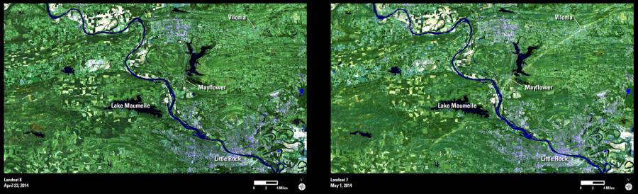
A tornado that touched down in central Arkansas on April 27, 2014, proved devastating and deadly.
These Landsat images show the area northwest of Little Rock, Arkansas, before and after the storm. The path of the tornado can be seen in the May 1, 2014 image. The tornado began southwest of Lake Maumelle, before crossing the Arkansas River and moving through the town of Mayflower. It then continued to the northeast through the town of Vilonia.
Landsat image acquisitions will be useful for monitoring the current impacts and future recovery of vegetation destroyed in the storm.