

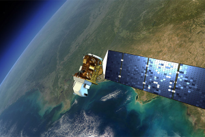
The Landsat Program
Earth Resources Observation and Science (EROS) Center - Earthshots
Since 1972, the Landsat satellites have been imaging Earth’s land areas. Landsat represents the world’s longest continuously acquired collection of space-based moderate resolution land remote sensing data. Landsat imagery provides a unique resource for those who work in agriculture, geology, forestry, regional planning, education, mapping, and global change research. Landsat images are also invaluable for emergency response and disaster relief.
Landsat satellites image the Earth’s surface along the satellite’s ground track in a 185-kilometer wide (115-mile wide) swath as the satellite moves in a descending orbit (moving from north to south) over the sunlit side of the Earth.
Landsats 8 and 9 are the two newest Landsat satellites. They are in a polar orbit 705 kilometers (438 miles) above the Earth’s surface. They complete one orbit every 99 minutes, for 14 ½ orbits per day. This means it takes 16 days for each satellite to obtain imagery over the entire globe. Together, these two Landsats image Earth's landmasses every 8 days.
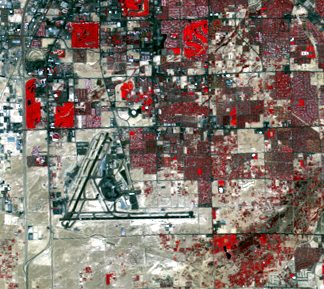
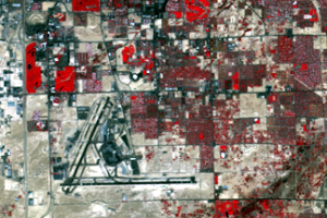
The images you see in Earthshots span the Landsat archive. The images from Landsats 1–3 used a sensor called the Multispectral Scanner (MSS). Its image resolution, the size of the smallest region on the Earth’s surface (known as a “pixel”) that can be observed by the instrument, was about 80 meters. On Landsats 4–5, the improved Thematic Mapper (TM) sensor provided a resolution of 30 meters. The Enhanced Thematic Mapper Plus (ETM+) onboard Landsat 7 and the Operational Land Imager (OLI) on Landsats 8 and 9 also provide 30-meter resolution. The images of Las Vegas, Nevada, show the difference between these two resolutions.
Landsat Program History
| Satellite | Launched | Decommissioned |
|---|---|---|
| Landsat 1 | July 23, 1972 | January 6, 1978 |
| Landsat 2 | January 22, 1975 | July 27, 1983 |
| Landsat 3 | March 5, 1978 | March 31, 1983 |
| Landsat 4 | July 16, 1982 | June 15, 2001 |
| Landsat 5 | March 1, 1984 | 2013 |
| Landsat 6 | October 5, 1993 | Did not achieve orbit |
| Landsat 7 | April 15, 1999 |
Primary science mission ended April 6, 2022 Extended science mission began May 4, 2022 |
| Landsat 8 | February 11, 2013 | Operational |
| Landsat 9 | September 27, 2021 | Operational |
Imagery

Downloads
Related Content
More Information
The surface of the Earth is always changing. Some changes like earthqu...

Contact Information
Customer Services U.S. Geological Survey Earth Resources Observation a...
Introduction to Remote Sensing
Remote sensing means observing something from a distance. Satelli...
The Landsat Program
Since 1972, the Landsat satellites have been imaging Earth’s land area...
What the Colors Mean
All of the colors in a satellite image, similar to images on a TV or c...