

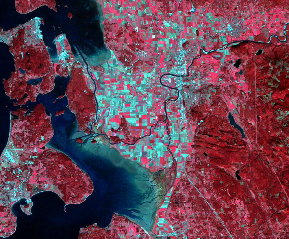
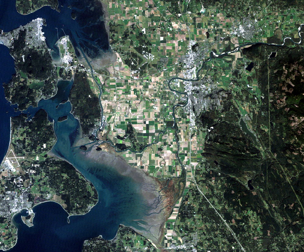
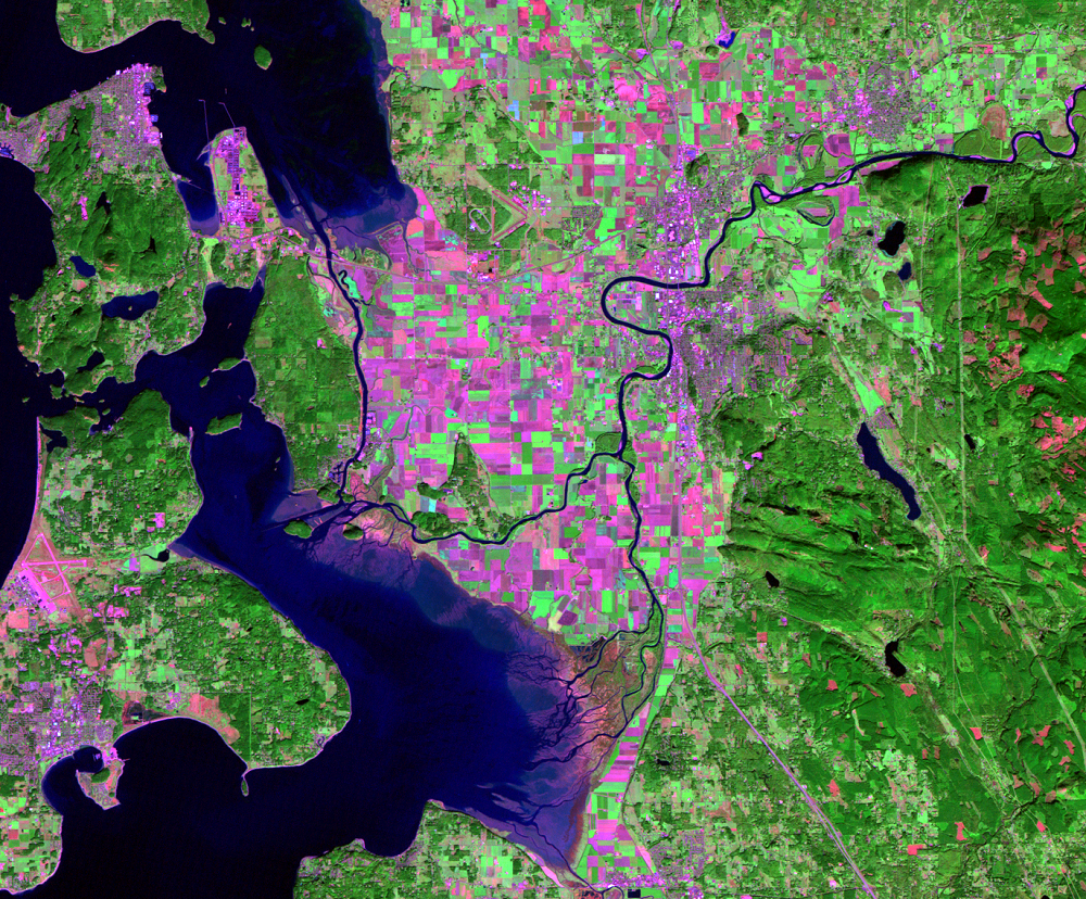
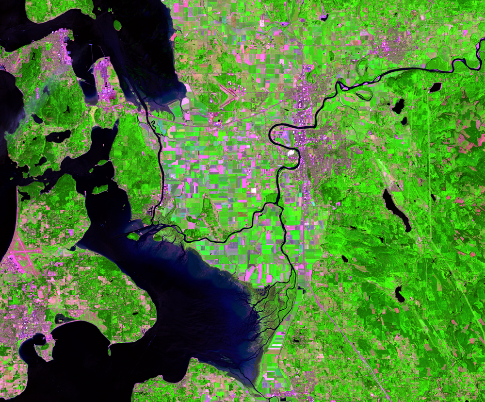
What the Colors Mean
Earth Resources Observation and Science (EROS) Center - Earthshots
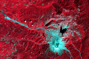
All of the colors in a satellite image, similar to images on a TV or computer monitor, are made up of a combination of red, green, and blue light, or RGB for short. The sensors capture these images in grayscale. These grayscale images are assigned the color red, green, or blue, which display the brightness of each of these colors. When we combine the three images, we get a false color image. With all of the possible combinations of red, green, and blue values, this provides for a display system capable of providing over a million different colors.
Each image shows a specific section of the electromagnetic spectrum, called a band. Landsats 1–3 collected data in four different bands. Landsat 5 collected seven different bands, and Landsat 7 collects eight different bands. Landsats 8 and 9 collect 11 different bands.
Three of the bands are combined to form an image, each band assigned as red, green, or blue (in that order) to produce natural color, false color, or color-infrared images as demonstrated in the Mt. Vernon, Washington, images.
Imagery

Downloads
Related Content
More Information
The surface of the Earth is always changing. Some changes like earthqu...

Contact Information
Customer Services U.S. Geological Survey Earth Resources Observation a...
Introduction to Remote Sensing
Remote sensing means observing something from a distance. Satelli...
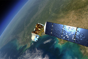
The Landsat Program
Since 1972, the Landsat satellites have been imaging Earth’s land area...
What the Colors Mean
All of the colors in a satellite image, similar to images on a TV or c...