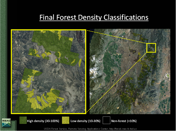
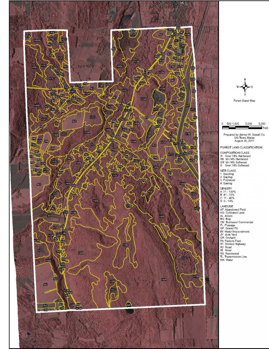
In FY2011, the BIA started integrating remote sensing into forest inventory and management planning efforts in remote, low timber value and inaccessible areas to meet a 2015 Forest Management Deadline. This deadline states that all Reservations with forested land must be under a management plan by the end of 2015. Some of these reservation lands are remote and have limited access to the forested areas, others are bordering Mexico and are dangerous places for field collection and others are not accessible for various reasons. Some of these lands do not have high value timber products and budgeting for inventory funding is difficult, thus, remote sensing potentially offers the BIA a low cost solution. In order to implement a management plan a forest inventory has to be conducted to attain volume data and calculate allowable cuts from the analysis of the volume data. The BIA turned to existing remote sensing sources such as NAIP imagery to gather data on general cover types and densities and, using resources on adjacent lands via biomass and Forest Inventory and Analysis (FIA) data, approximate timber volumes were estimated on those lands. In addition, airborne flights can collect the data needed and computer computations utilize those data to come up with a sample representation of timber volumes used for management plans. In the Western Region, in collaboration with the Forest Service Remote Sensing Applications Center, timber types were attained using eCognition software and NAIP imagery. In the Eastern Region, a contractor, Sewell, used elevation data to contrast with the imagery that they flew to attain a canopy height to derive the timber type. Both projects were successful and came in well below the cost of a ground based inventory.
Remote sensing pilot project in the Western Region (Pyramid Lake Nevada area) to inventory timber types
Remote sensing pilot project in the Eastern Region (Northwest New York State) to inventory timber types


