
The OSMRE GIS Branch has been providing imagery support to monitor mine reclamation activities. This support was more critical in 2020 due to travel restrictions caused by the pandemic. The GIS Branch has used Department of Defense (DOD) sources that provide access to the Maxar constellation (commercial imagery at 50-centimeter or better pixel resolution), the European Space Agency’s Sentinel systems (10 to 60-meter pixel resolution collected by a 22-country consortium), and most recently Planet imagery (commercial imagery at 3 to 5-meter pixel resolution data collected at up to daily intervals). Surface coal mine reclamation often occurs over decades. OSMRE staff work with State coal reclamation programs and mine operators to monitor reclamation and to adjust where necessary. Color imagery is often used to verify overall activity and to plan time spent on the ground. The OSMRE also develops multispectral products such as false color infrared, Normalized Difference Vegetation Index (NDVI), and others to target specific questions around the revegetation of reclaimed areas.
In response to the pandemic, OSMRE staff were restricted from traveling to many mines. Inspection oversite of reclamation activities continued because imagery from multiple sources was available to OSMRE staff. Sentinel imagery has provided a constant update of surface coal mines and reclamation for broad-area monitoring multiple times a month. To provide detail required to effectively monitor reclamation activities, the Sentinel imagery was augmented by higher resolution Maxar imagery that provides a more detailed and clearer picture of smaller areas that would normally be visited by the OSMRE. The daily imagery and weekly base maps from Planet are allowing more detailed temporal analysis of the reclamation process. These data sources have allowed OSMRE to meet the requirements of the Surface Mining Control and Reclamation Act (SMCRA) and continue to work with State partners and mine operators until in person inspections can resume.
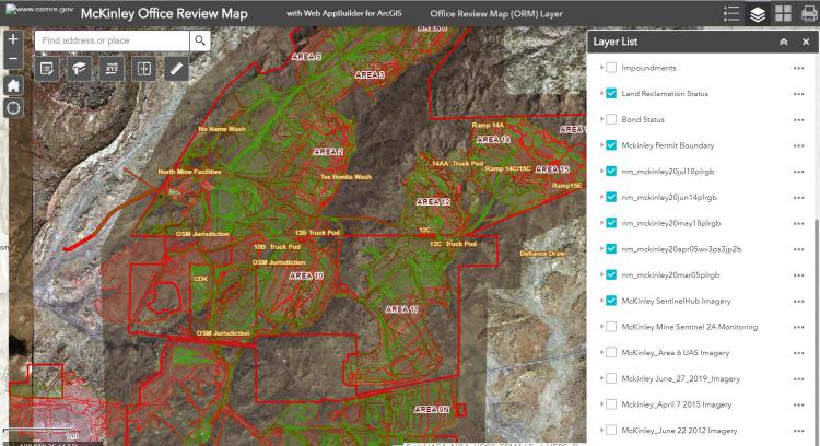
OSMRE staff view imagery using interactive web maps that have tools to compare images, measure areas, and make notes.