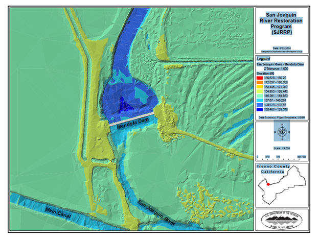
The San Joaquin River Restoration Program (SJRRP) is a comprehensive, long-term effort to revive the river’s self-sustaining Chinook salmon fishery by restoring water flows to the river from the Friant Dam to the confluence of Merced River, a distance of over 100 miles. A goal of the SJRRP is to mitigate or avoid adverse water supply impacts from the restoration releases. To satisfy this requirement, BOR’s Technical Service Center (TSC) has been tasked with completing the design of a compact bypass that provides fish passage around Mendota Pool as well as floodplain grading and revegetation over this reach of the river. In support of these efforts, TSC staff developed lidar-based terrain models to test the hydraulic behavior of the proposed designs.

Lidar-based terrain used for hydraulic modeling efforts associated with the San Joaquin River Restoration Program (SJRRP). Friant Dam is about 50 miles upstream (ENE) from Mendota Dam. For scale, the Mendota Dam is 430 feet long.

