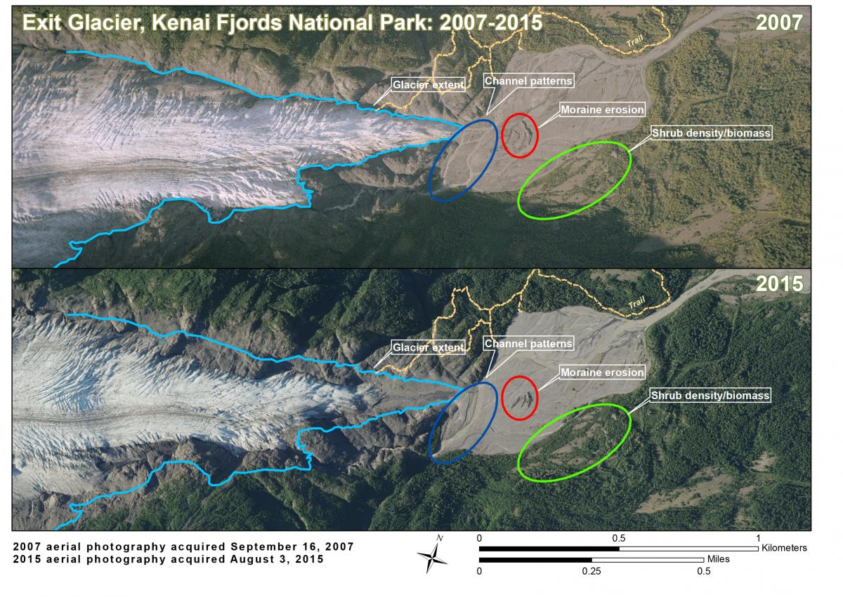
The current rapid retreat of glaciers in Kenai Fjords National Park (KEFJ) results in dramatic landscape change on a shorter time scale than is observed in many other parts of the country. Park scientists and managers monitor this change not only to understand shifts in ecosystem dynamics but also to address potential impacts to the visitor experience. Many visitors to Alaska plan their trip with the expectation of viewing a glacier, preferably through an up-close and personal experience. Exit Glacier is the only glacier in the park, and one of only a few in the State, that is accessible by a short walk on a maintained trail. This accessibility makes it one of the most popular destinations in KEFJ and for glacier visits in Alaska. In the past 5 years, the approach to Exit Glacier has changed substantially as the glacier has retreated at an average annual rate of 44 m (145 ft). KEFJ personnel have extended the trail system twice in the past decade to maintain a safe up-close glacier experience for visitors. However, as the glacier retreats into more confined terrain, trail development has become a challenge, limiting options for park managers working to provide visitors with a safe and satisfying experience.
Geographic Information Systems (GIS) and Global Positioning Systems (GPS) technologies are necessary tools for resource management at KEFJ. In-situ data collection using mapping-grade GPS units is employed for nearly all science and resource management projects, including glacier monitoring, exotic plant management, and wildlife monitoring. For larger scale projects and/or projects occurring in areas of the park that are less accessible, remotely sensed imagery acquired via satellite and low-altitude planes are utilized to learn about and to monitor the park’s resources, particularly the glacial ice that covers more than half of the land managed by KEFJ.
For example, in 2015, new aerial imagery of KEFJ was acquired that allows NPS personnel to identify changes in the Exit Glacier area including glacier retreat, increased shrub density, erosion, and changing hydrology. The comparison of the 2015 aerial photo and the previous image (taken in 2007, only 8 years apart) provides the opportunity for numerous studies in landscape change and illustrates the pace of change that park managers work with at KEFJ.

Eight years of change in a glacial environment.

