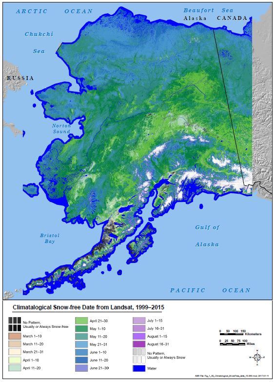
The NPS has partnered with Alaska Biological Research (ABR), Inc., to develop an Alaska-wide map that shows general patterns of snowmelt in the spring at a 30-m (Landsat) scale. This information can be used to study habitat use by mammals and climate change, and to help plan for field work and infrastructure development. As part of this project, ABR also tested satellite-based methods to map lichen abundance in Yukon-Charley Rivers National Preserve. Lichens are the main forage for the Fortymile Caribou Herd in winter. Developing strategies to map snowmelt and lichens using remotely sensed data allows for consistent regional monitoring.

Snow-free data from Landsat at 30-m resolution for Alaska for 1999–2015.

